Barrington Pit

Last updated
Barrington Pit
Site of Special Scientific Interest
Barrington Pit 1.jpg
Area of Search Cambridgeshire
Grid reference TL 383 491 [1]
Interest Geological
Area 3.8 hectares [1]
Notification 1989 [1]
Location map Magic Map

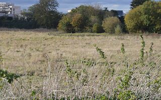
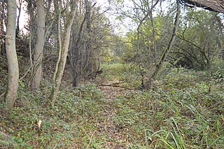
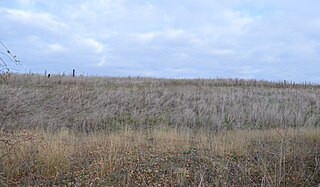
Barrington Pit is a 3.8 hectare geological Site of Special Scientific Interest near Barrington in Cambridgeshire. [1] [2] It is a Geological Conservation Review site. [3]

Site of Special Scientific Interest Conservation designation denoting a protected area in the United Kingdom

A Site of Special Scientific Interest (SSSI) in Great Britain or an Area of Special Scientific Interest (ASSI) in the Isle of Man and Northern Ireland is a conservation designation denoting a protected area in the United Kingdom and Isle of Man. SSSI/ASSIs are the basic building block of site-based nature conservation legislation and most other legal nature/geological conservation designations in the United Kingdom are based upon them, including national nature reserves, Ramsar sites, Special Protection Areas, and Special Areas of Conservation. The acronym "SSSI" is often pronounced "triple-S I".

Barrington, Cambridgeshire village and civil parish in the South West Cambridgeshire district of Cambridgeshire, England

Barrington is a village and civil parish in the South Cambridgeshire district of Cambridgeshire, England. The village is about 7 miles (11 km) south-west of Cambridge, between Haslingfield and Shepreth.

Cambridgeshire County of England

Cambridgeshire is a county in the East of England, bordering Lincolnshire to the north, Norfolk to the north-east, Suffolk to the east, Essex and Hertfordshire to the south, and Bedfordshire and Northamptonshire to the west. The city of Cambridge is the county town. Modern Cambridgeshire was formed in 1974 as an amalgamation of the counties of Cambridgeshire and Isle of Ely and Huntingdon and Peterborough, the former covering the historic county of Cambridgeshire and the latter covering the historic county of Huntingdonshire and the Soke of Peterborough, historically part of Northamptonshire. It contains most of the region known as Silicon Fen.

This site is described by Natural England as of national importance for its mammal fossils, most of which were found around 1900. Species include hippopotamuses, straight-tusked elephants, lions, aurochs and spotted hyenas. They probably date to the warm Eemian period, around 130,000 to 115,000 years ago. [4]

Natural England is a non-departmental public body in the United Kingdom sponsored by the Department for Environment, Food and Rural Affairs. It is responsible for ensuring that England's natural environment, including its land, flora and fauna, freshwater and marine environments, geology and soils, are protected and improved. It also has a responsibility to help people enjoy, understand and access the natural environment.

Hippopotamus A large, mostly herbivorous, semiaquatic mammal native to sub-Saharan Africa

The common hippopotamus, or hippo, is a large, mostly herbivorous, semiaquatic mammal native to sub-Saharan Africa. It is one of only two extant species in the family Hippopotamidae, the other being the pygmy hippopotamus. The name comes from the ancient Greek for "river horse" (ἱπποπόταμος). After the elephant and rhinoceros, the common hippopotamus is the third-largest type of land mammal and the heaviest extant artiodactyl. Despite their physical resemblance to pigs and other terrestrial even-toed ungulates, the closest living relatives of the Hippopotamidae are cetaceans from which they diverged about 55 million years ago.

Straight-tusked elephant species of mammal (fossil)

The straight-tusked elephant is an extinct species of elephant that inhabited Europe and Western Asia during the Middle and Late Pleistocene.

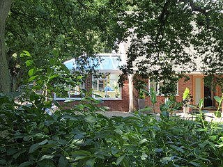
The site is private land, part of which is now covered by housing.

Related Research Articles

Travellers Rest Pit

Traveller's Rest Pit is a 2.2 hectare geological Site of Special Scientific Interest on the western outskirts of Cambridge. It is a Geological Conservation Review site.

Barrington Chalk Pit

Barrington Chalk Pit is a 97.1 hectare geological Site of Special Scientific Interest near Barrington in Cambridgeshire. It is a Geological Conservation Review site.

Upware Bridge Pit North

Upware Bridge Pit North is a 2.5 hectare geological Site of Special Scientific Interest north-west of Wicken in Cambridgeshire. It is a Geological Conservation Review site.

Upware South Pit

Upware South Pit is a 1.1 hectare geological Site of Special Scientific Interest (SSSI) north of Upware in Cambridgeshire. It is a Geological Conservation Review site.

Warboys Clay Pit

Warboys Clay Pit is a 12.6 hectare geological Site of Special Scientific Interest west of Warboys in Cambridgeshire. It is a Geological Conservation Review site.

Red House Farm Pit

Red House Farm Pit is a 0.5 hectare geological Site of Special Scientific Interest east of Wickham Market in Suffolk. It is a Geological Conservation Review site, and in the Suffolk Coast and Heaths Area of Outstanding Natural Beauty.

Breckland Forest

Breckland Forest is an 18,126 hectare biological and geological Site of Special Scientific Interest in many separate areas between Swaffham in Norfolk and Bury St Edmunds in Suffolk. It is part of the Breckland Special Protection Area under the European Union Directive on the Conservation of Wild Birds. It contains two Geological Conservation Review sites, Beeches Pit, Icklingham and High Lodge. Barton Mills Valley is a Local Nature Reserve in the south-west corner of the site.

Aldeburgh Hall Pit is a one hectare geological Site of Special Scientific Interest in Aldeburgh in Suffolk. It is a Geological Conservation Review site, and it is in the Suffolk Coast and Heaths Area of Outstanding Natural Beauty.

Crag Pit, Aldeburgh

Crag Pit, Aldeburgh is a 0.2 hectare geological Site of Special Scientific Interest in Aldeburgh in Suffolk. It is a Geological Conservation Review site, and within the Suffolk Coast and Heaths Area of Outstanding Natural Beauty.

Round Hill Pit, Aldeburgh

Round Hill Pit, Aldeburgh is a 0.5 hectare geological Site of Special Scientific Interest in Aldeburgh in Suffolk. It is a Geological Conservation Review site, and it is in the Suffolk Coast and Heaths Area of Outstanding Natural Beauty.

Sudbourne Park Pit is a 1.1 hectare geological Site of Special Scientific Interest between Orford and Chillesford in Suffolk. It is a Geological Conservation Review site, and it is in the Suffolk Coast and Heaths Area of Outstanding Natural Beauty.

Sandy Lane Pit, Barham

Sandy Lane Pit, Barham is an 11.1 hectare geological Site of Special Scientific Interest west of Barham in Suffolk. It is a Geological Conservation Review site.

Hoxne Brick Pit

Hoxne Brick Pit is a 1.3 hectare geological Site of Special Scientific Interest in Hoxne in Suffolk. It is a Geological Conservation Review site.

Waldringfield Pit

Waldringfield Pit is a 0.8 hectare geological Site of Special Scientific Interest between Martlesham Heath and Waldringfield in Suffolk. It is a Geological Conservation Review site.

Heacham Brick Pit

Heacham Brick Pit is a 0.8-hectare (2.0-acre) geological Site of Special Scientific Interest in Heacham, north of King's Lynn in Norfolk. It is a Geological Conservation Review site.

Grimston Warren Pit

Grimston Warren Pit is a 6.6-hectare (16-acre) geological Site of Special Scientific Interest east of King's Lynn in Norfolk. It is a Geological Conservation Review site.

Blackborough End Pit

Blackborough End Pit is a 13.2-hectare (33-acre) geological Site of Special Scientific Interest south-east of King's Lynn in Norfolk. It is a Geological Conservation Review site.

Holkham Brick Pit

Holkham Brick Pit is a 0.5-hectare (1.2-acre) geological Site of Special Scientific Interest west of Wells-next-the-Sea in Norfolk. It is a Geological Conservation Review site, and it is in the Norfolk Coast Area of Outstanding Natural Beauty.

Broome Heath Pit

Broome Heath Pit is a 1.2-hectare (3.0-acre) geological Site of Special Scientific Interest east of Ditchingham in Norfolk. It is a Geological Conservation Review site and part of Broome Heath Local Nature Reserve

Weybourne Town Pit

Weybourne Town Pit is a 0.7-hectare (1.7-acre) geological Site of Special Scientific Interest west of Sheringham in Norfolk. It is a Geological Conservation Review site and it is in the Norfolk Coast Area of Outstanding Natural Beauty.

References

  1. 1 2 3 4 "Designated Sites View: Barrington Pit". Sites of Special Scientific Interest. Natural England. Retrieved 29 September 2016.
  2. "Map of Barrington Pit". Sites of Special Scientific Interest. Natural England. Retrieved 29 September 2016.
  3. "Barrington Pit (Pleistocene Vertebrata)". Joint Nature Conservation Committee. Retrieved 29 September 2016.
  4. "Barrington Pit citation" (PDF). Sites of Special Scientific Interest. Natural England. Archived from the original (PDF) on 3 March 2016. Retrieved 29 September 2016.

Coordinates: 52°07′23″N0°01′08″E / 52.123°N 0.019°E / 52.123; 0.019

Geographic coordinate system Coordinate system

A geographic coordinate system is a coordinate system that enables every location on Earth to be specified by a set of numbers, letters or symbols. The coordinates are often chosen such that one of the numbers represents a vertical position and two or three of the numbers represent a horizontal position; alternatively, a geographic position may be expressed in a combined three-dimensional Cartesian vector. A common choice of coordinates is latitude, longitude and elevation. To specify a location on a plane requires a map projection.