Related Research Articles

Covington is an incorporated town in Wyoming County, New York. The population was 1,231 at the 2010 census. The town was named after General Leonard Covington.

Lime Ridge is a census-designated place (CDP) in Columbia County, Pennsylvania, United States. It is part of Northeastern Pennsylvania. The population was 890 at the 2010 census. It is part of the Bloomsburg-Berwick micropolitan area.


The Rappahannock River is a river in eastern Virginia, in the United States, approximately 195 miles (314 km) in length. It traverses the entire northern part of the state, from the Blue Ridge Mountains in the west where it rises, across the Piedmont to the Fall Line, and onward through the coastal plain to flow into the Chesapeake Bay, south of the Potomac River.

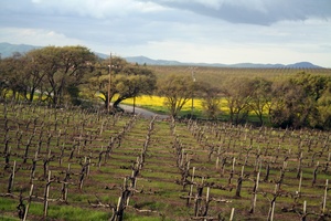
The Livermore Valley AVA is an American Viticultural Area in Alameda County, California, surrounding the city of Livermore in the Tri-Valley region. Both the AVA and the city are named after Robert Livermore, a landowner whose holdings encompassed the valley. The groundwater basin underlying the valley is the Livermore Basin, the largest sub-unit of which is the Mocho Subbasin. The Livermore Basin is one of five aquifers in the San Francisco Bay Area that supply most of the metropolitan Bay Area population. The entire Livermore Basin aquifer faces a concern over elevated total dissolved solids by the year 2020 due to an expanding human population leading to higher rates of return water flows to the aquifer containing certain salts.
The Ford Ranges are a grouping of mountain ranges standing east of Sulzberger Ice Shelf and Block Bay in the northwest part of Marie Byrd Land, Antarctica. Discovered by the Byrd Antarctic Expedition on December 5, 1929, they were named by Byrd for Edsel Ford of the Ford Motor Company, who helped finance the expedition.
Alton is a hamlet within the Town of Sodus, Wayne County, New York, United States. It is located six miles (10 km) southeast of the Village of Sodus and five miles (8 km) south of the Village of Sodus Point, at an elevation of 377 feet. The primary intersection in the hamlet is at N.Y. Route 14 and Ridge Road. N.Y. Route 104 passes just south of Alton.

Florida's 21st congressional district is a U.S. congressional district in the Treasure Coast. In the 2020 redistricting cycle, the district was drawn as a successor to the previous 18th district and contains all of St. Lucie County and Martin County as well as the northeastern part of Palm Beach County, and includes Port St. Lucie, Fort Pierce, Stuart, Jupiter, and Palm Beach Gardens, as well as Treasure Coast International Airport. The previous iteration of the 21st district, which extended from Delray Beach to Palm Beach, was instead renamed the 22nd district.

Rimer is an unincorporated community in western Sugar Creek Township, Putnam County, Ohio, United States. It lies along State Route 189 between Fort Jennings and Vaughnsville.

Degognia Township is one of 16 townships in Jackson County, in the U.S. state of Illinois. As of the 2010 census, its population was 153 and it contained 73 housing units. The township derives its name from Degognia Creek.

Murphysboro Township is one of sixteen townships in Jackson County, Illinois, USA. As of the 2010 census, its population was 10,563 and it contained 5,174 housing units.
Lafayette is a census-designated place (CDP) between the cities of Roanoke and Christiansburg in eastern Montgomery County, southwest Virginia, United States. The population as of the 2010 Census was 449. It is located adjacent to Elliston, at the confluence of the North and South Forks of the Roanoke River.
Alpine Creek is a small river in San Mateo County, California. It flows about 5 miles (8 km), from its source near West Alpine Road about a mile southwest of Skyline Boulevard (CA 35), to its confluence with La Honda Creek to form San Gregorio Creek in La Honda at California State Route 84.

Max is an unincorporated community in Jefferson Township, Boone County, in the U.S. state of Indiana.

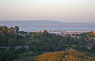
Pulgas Ridge Open Space Preserve is a public recreation area in the Santa Cruz Mountains, San Mateo County in northern California. It is managed by the Midpeninsula Regional Open Space District (MROSD).
Mobjack Bay is a bay on the western shore of Chesapeake Bay in Virginia in the United States. It lies between the Rappahannock River on the north and the York River on the south. The bay appears in early documents as "Mockjack Bay"; it was said that echoes on the bay would mock "Jack", a term for a sailor. Captain Thomas Todd of Toddsbury, Gloucester County, a mid seventeenth century emigrant, was recorded as "Thomas Todd of Mockjack Bay".
For the county seat of Upton County, Texas, see: Rankin, Texas.

Hurricane Mesa is a Utah landform near Hurricane, Utah, used for Cold War tests of rocket ejection seats for supersonic aircraft at the Hurricane Supersonic Research Site. The mesa is "flat bedrock of faultless Shinarump conglomerate" 1,500 ft (460 m) above the Virgin River valley, which allowed clearance for assessment of a longer flight trajectory up from the mesa and over the cliff for the test object.

Ogilvie Island is a patch of mud in San Francisco Bay. It is within the limits of the city of San Jose, in Santa Clara County, California, and named for county planner Arthur Ogilvie. Its coordinates are 37°27′55″N122°00′37″W, and the United States Geological Survey gave its elevation as 0 ft (0 m) in 2012. It appears on a 2012 USGS map of the area.
References
- ↑ "Bay Ridge". Geographic Names Information System . United States Geological Survey, United States Department of the Interior . Retrieved February 9, 2014.
37°12′41″N76°00′37″W / 37.21139°N 76.01028°W
