
Antoine is a town in Pike County, Arkansas, United States, along the Antoine River. The population was 117 according to the 2010 census.

Odenton is a census-designated place (CDP) in Anne Arundel County, Maryland, United States, located approximately 10–20 minutes from the state capital, Annapolis. The population was 37,132 at the 2010 census, up from 20,534 at the 2000 census. The town's population growth rate of 80.8% between 2000 and 2010 was the greatest of any town in western Anne Arundel County. Odenton is located west of Annapolis, south of Baltimore, and northeast of Washington.

Darnestown is a United States census-designated place (CDP) and an unincorporated area in Montgomery County, Maryland. The CDP is 17.70 square miles (45.8 km2) with the Potomac River as its southern border and the Muddy Branch as much of its eastern border. Seneca Creek borders portions of its north and west sides. The Travilah, North Potomac, and Germantown census-designated places are adjacent to it, as is the city of Gaithersburg. Land area for the CDP is 16.39 square miles (42.4 km2). As of the 2020 census, the Darnestown CDP had a population of 6,723, while the village of Darnestown is considerably smaller in size and population. Downtown Washington, D.C. is about 22 miles (35 km) to the southeast.

Travilah is a United States census-designated place and an unincorporated area in Montgomery County, Maryland. It is 17.28 square miles (44.8 km2) located along the north side of the Potomac River, and surrounded by the communities of Potomac, North Potomac, and Darnestown—all census-designated places. It had a population of 11,985 as of the 2020 census.

Tar Heel is a town located in Bladen County, North Carolina, United States. As of the 2010 census, the town population was 117.
Beulaville is a town located in Duplin County, North Carolina, United States. As of the 2020 census, the population was 1,116. At the previous census in 2010, the population was 1,296. The community lies within the Limestone Creek Township.

Ahoskie is a town in Hertford County, North Carolina, United States. The population was 5,039 at the 2010 census. Ahoskie is located in North Carolina's Inner Banks region. Its nickname is "The Only One" because no other town in the world is known by the same name. The etymology of the word Ahoskie, which was originally spelled "Ahotsky", was from the Wyanoke Indians, who entered the Hertford County area at the beginning of European settlement.

Danbury is a city located in Danbury Township, Stokes County, North Carolina, United States. As of the 2020 census, the city had a total population of 142. It is the county seat of Stokes County. Danbury is located on North Carolina Highway 8/89 approximately 20 miles (32 km) north of Winston-Salem and is the "Gateway to Hanging Rock". The Stokes County Government Center, Arts Council, school board, county jail, a public library, a post office, and other public services are found within the town limits. LifeBrite Community Hospital of Stokes is located about a half mile northwest of the town. North Stokes High School, a big part of town, is located 7.4 miles to the northwest.

Chapin, popularly known as the "Capital of Lake Murray", is a small lake town located at the northern tip of Lexington County, South Carolina, United States. Lake Murray separates Chapin from the rest of Lexington County. The population of Chapin was 1,445 according to the 2010 census, and an estimated 1,633 in 2019.

East Texas is a broadly defined cultural, geographic, and ecological region in the eastern part of the U.S. state of Texas that comprises most of 41 counties. It is primarily divided into Northeast and Southeast Texas. Most of the region consists of the Piney Woods ecoregion. East Texas can sometimes be defined only as the Piney Woods. At the fringes, towards Central Texas, the forests expand outward toward sparser trees and eventually into open plains.
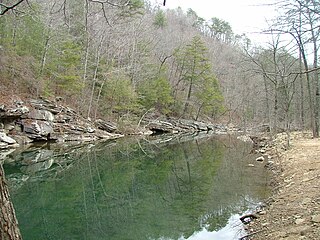
The Piney River is a 23.7-mile-long (38.1 km) tributary of the Duck River in Middle Tennessee in the United States. Via the Duck River, the Tennessee River, and the Ohio River, it is part of the Mississippi River watershed. The headwater tributaries of the Piney River rise in Dickson County, Tennessee, near the city of Dickson. Dickson is located on the "Tennessee Valley Divide", which corresponds for some distance with the downtown's Main Street. The western part of the town, the part in the Tennessee Valley, is drained by the East Piney River, a tributary to the Piney.

Star Valley is located in the United States between the Salt River Range in western Wyoming and the Webster Range of eastern Idaho. The altitude of the valley ranges from 5,600 feet (1,700 m) to 7,000 feet (2,100 m). Three major Wyoming rivers, the Salt River, the Greys River and the Snake River meet near Alpine Junction at Palisades Reservoir. Numerous towns are located in the valley, including Afton, Thayne, Bedford, Etna, Smoot, Fairview, Osmond, Freedom, Grover, Auburn, Alpine, Nordic, Turnerville and Star Valley Ranch. Star Valley was settled in the late 1870s by Mormon pioneers. Primary sources indicate Star Valley was proclaimed the "Star of All Valleys" for its natural beauty by a general authority of the Church of Jesus Christ of Latter-day Saints. The name was later shortened to Star Valley. Another less supported theory about the origin of the name comes from Starvation (Starve) Valley, a name the area gained during bitter winters in the late 1880s.

Piney Grove at Southall's Plantation is a property listed on the National Register of Historic Places in Holdcroft, Charles City County, Virginia. The scale and character of the collection of domestic architecture at this site recalls the vernacular architectural traditions of the eighteenth, nineteenth and twentieth centuries along the James River.
Binns Hall is an unincorporated community in eastern Charles City County, Virginia, United States. Binns Hall lies at the intersection of the Glebe Lane and Liberty Church Roads. A post office once occupied the Binns Hall Store. The community had two schools and a hall of the Order of St. Lukes. Liberty Baptist Church continues to operate in the community.

Piney Fork is an unincorporated community in central Smithfield Township, Jefferson County, Ohio, United States.1063420 The stream of Piney Fork flows southeast past the community; it meets Short Creek in far western Warren Township, and Short Creek in turn meets the Ohio River at Rayland.
Cape Fear is a coastal plain and Tidewater region of North Carolina centered about the city of Wilmington. The region takes its name from the adjacent Cape Fear headland, as does the Cape Fear River which flows through the region and empties into the Atlantic Ocean near the cape. Much of the region's populated areas are found along the Atlantic beaches and the Atlantic Intracoastal Waterway, while the rural areas are dominated by farms and swampland like that of the Green Swamp. The general area can be also identified by the titles "Lower Cape Fear", "Wilmington, NC Metropolitan Statistical Area", "Southeastern North Carolina", and "Azalea Coast". The latter name is derived from the North Carolina Azalea Festival held annually in Wilmington. Municipalities in the area belong to the Cape Fear Council of Governments.

Piney is a census-designated place (CDP) in Adair County, Oklahoma, United States. The population was 115 at the 2010 census. Piney was the "head town" of the first wave of relocated Cherokee people who relocated there from their ancestral homelands in the southeastern United States.
Halcyon is an unincorporated community located on the West Fork of Big Harts Creek in Logan and Lincoln counties, West Virginia, United States.
Piney Grove is an unincorporated community and census-designated place (CDP) in Harris County, Georgia, United States.

Turnersburg Township is a nonfunctioning administrative division in northeastern Iredell County, North Carolina, United States. Turnersburg township was established in 1868. The only major town in Turnersburg township is Harmony, which is also partially within Eagle Mills township.

