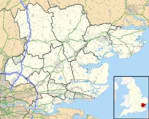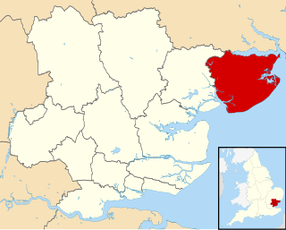
Tendring is a local government district in north east Essex, England. It extends from the River Stour in the north, to the coast and the River Colne in the south, with the coast to the east and the town of Colchester to the west. Its council is based in Clacton-on-Sea. Towns in the district include Frinton-on-Sea, Walton-on-the-Naze, Brightlingsea and Harwich. Large villages in the district include St Osyth and Great Bentley.

Thorpe-le-Soken is a village and civil parish in the Tendring district of Essex, England located west of Walton-on-the-Naze, Frinton-on-Sea and north of Clacton-on-Sea.

North Creake is a village and civil parish in the north west of the English county of Norfolk. It covers an area of 14.99 km2 (5.79 sq mi) and had a population of 414 in 184 households at the 2001 census, reducing to 386 at the 2011 Census. For the purposes of local government, it falls within the district of King's Lynn and West Norfolk. The parish shares boundaries with the adjacent parishes of Burnham Market, Burnham Thorpe, Holkham, Walsingham, South Creake, Barwick and Stanhoe.
Whitley is a village in the Selby district of North Yorkshire, England, close to the Aire and Calder Navigation and the M62 motorway. The population of the village at the 2001 census was recorded as being 574, which had risen to 1,021 by the time of the 2011 census. In 2015, North Yorkshire County Council estimated the population to have risen again to 1,110. It was historically part of the West Riding of Yorkshire until 1974.

Aldham is a village and civil parish in the Babergh district of Suffolk, England. Located around 8 miles (13 km) west of Ipswich, in 2005 it had a population of 200, reducing to 175 at the 2011 Census.

Barton-le-Street is a village and civil parish in the Ryedale district of North Yorkshire, England. According to the 2001 census the parish had a population of 186 reducing to 170 at the 2011 Census. It is located about five miles west of Malton, between Appleton-le-Street and Slingsby on the old Roman road which is now the B1257.
Booton is a village and civil parish in the Broadland district of Norfolk, England, just east of Reepham and seven miles west of Aylsham. According to the 2001 census, it had a population of 100, including Brandiston and increasing to 196 at the 2011 Census.
Camblesforth is a village and civil parish in the Selby district of North Yorkshire, England. According to the 2001 Census the civil parish had a population of 1,526, increasing to 1,568 at the 2011 Census. The village is 5 miles (8 km) south of Selby and 7 miles (11 km) west of Goole. It was historically part of the West Riding of Yorkshire until 1974.

Tushingham cum Grindley is a former civil parish, now in the parish of Tushingham-cum-Grindley, Macefen and Bradley, in the unitary authority of Cheshire West and Chester and the ceremonial county of Cheshire, England. The parish contained the village of Tushingham and the hamlet of Bell o' th' Hill. According to the 2001 UK census, the total population of the civil parish was 166, rising to 187 at the 2011 Census. The civil parish was abolished in 2015 to form Tushingham-cum-Grindley, Macefen and Bradley.

Haddiscoe is a village and civil parish in the South Norfolk district of Norfolk, England, about 16 miles (26 km) southeast of Norwich. The parish is on the county boundary with Suffolk, about 7 miles (11 km) west-northwest of Lowestoft. The parish includes the hamlet of Thorpe-next-Haddiscoe, about 1 mile (1.6 km) north of Haddiscoe village.

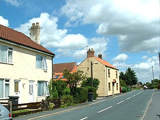
Wix is a village and civil parish in the Tendring district of north-east Essex, England. It lies in a small valley about 2 miles (3 km) south of the Stour Estuary. The valley drains east towards Harwich. Formerly an important crossroads on the route to Harwich, it has now been bypassed by the A120 road.
Culpho is a hamlet and civil parish in the East Suffolk district of Suffolk, about 4 miles (6.4 km) northeast of the centre of Ipswich and 3 1⁄2 miles (5.6 km) west of Woodbridge.

Rodney Stoke is a small village and civil parish, located at grid reference ST486501, 5 miles north-west of Wells, in the English county of Somerset. The village is on the A371 between Draycott and Westbury-sub-Mendip.

Wath is a village and civil parish 3.7 miles (6 km) north of Ripon in the Harrogate district of North Yorkshire, England. The population of the parish was estimated at 210 in 2015.

Swine is a village and civil parish in the East Riding of Yorkshire, England. It is situated approximately 5 miles (8 km) north-east of Hull city centre and 2 miles (3.2 km) south of Skirlaugh to the west of the A165 road.

Littledean is a village in the Forest of Dean, west Gloucestershire, England. The village has a long history and formerly had the status of a town. Littledean Hall was originally a Saxon hall, although it has been rebuilt and the current house dates back to 1612. The remains of a Roman temple are situated in the grounds. Neither the hall or Roman remains are open to the public.

Latchingdon is a village situated in the Dengie Peninsula in Essex, England, south of the city of Chelmsford. The parish was at one time called Latchingdon-cum-Snoreham, and Snoreham Hall still exists to the south of Latchingdon.

Roydon is a small village, civil parish and electoral ward east of King's Lynn in the English county of Norfolk. It covers an area of 4.62 km2 (1.78 sq mi) and had a population of 368 in 144 households at the 2001 census, the population of the village and ward being shown as 2,450 at the 2011 Census. For the purposes of local government, it falls within the district of King's Lynn and West Norfolk.

Hambleton is a small village and civil parish near to Selby in North Yorkshire, England. It is a ward of the Selby District and should not be confused with the Hambleton District, another district of North Yorkshire.

Friskney is a village and civil parish within the East Lindsey district of Lincolnshire, England.