Benns Church, Virginia | |
|---|---|
 Benns Church  Benns Church | |
| Coordinates: 36°56′15″N76°35′11″W / 36.93750°N 76.58639°W | |
| Country | United States |
| State | Virginia |
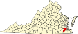
| County | Isle of Wight |
| Area | |
• Total | 4.2 sq mi (11 km2) |
| • Land | 4.1 sq mi (11 km2) |
| • Water | 0.08 sq mi (0.21 km2) |
| Elevation | 43 ft (13 m) |
| Population (2010) | |
• Total | 872 |
| • Density | 210/sq mi (82/km2) |
| Time zone | UTC−5 (Eastern (EST)) |
| • Summer (DST) | UTC−4 (EDT) |
| Area codes | 757, 948 |
| FIPS code | 51-06712 [1] |
| GNIS feature ID | 2584808 [2] |
Benns Church is a census-designated place (CDP) in Isle of Wight County, Virginia, United States. It is located at the junction of U.S. Route 258 and State Routes 10 and 32, southeast of Smithfield. The population as of the 2010 census was 872. [1]
Contents
The community is named for Benn's United Methodist Church, which lies at the intersection of Benn's Church Boulevard and Brewer's Neck Boulevard (US-258 with State Routes 10 and 32). The church was founded at that location by George Benn in 1789. Benn is buried in front of the church. The church bears a Virginia Historical Marker.
Benns Church is home to Benn's Grant, a 253-acre (102 ha) mixed-use development, which took almost a decade to be realized. [3]