Windsor, Virginia

Last updated

Windsor, Virginia
VAMap-doton-Windsor.PNG
Location in Virginia
Coordinates: 36°48′40″N76°44′37″W / 36.81111°N 76.74361°W / 36.81111; -76.74361
CountryUnited States
State Virginia
County Isle of Wight
Founded1902
Government
   Mayor Carita Richardson(I)
Area
[1]
  Total4.03 sq mi (10.44 km2)
  Land4.01 sq mi (10.39 km2)
  Water0.02 sq mi (0.04 km2)
Elevation
79 ft (24 m)
Population
 (2010)
  Total2,626
  Estimate 
(2019) [2]
2,758
  Density687.44/sq mi (265.39/km2)
Time zone UTC−5 (Eastern (EST))
  Summer (DST) UTC−4 (EDT)
ZIP code
23487
Area code(s) 757, 948
FIPS code 51-86784 [3]
GNIS feature ID1500328 [4]
Website www.windsor-va.gov

Windsor is an incorporated town in Isle of Wight County in the Hampton Roads region of southeastern Virginia in the United States. It is located near the crossroads of U.S. Route 460 and U.S. Route 258. The population was 2,626 at the 2010 census, [5] up from 916 at the 2000 census.

Contents

History

Windsor was established next to the Norfolk Southern Corporation's railroad. [6] The town of Windsor was chartered on March 15, 1902. Windsor established a volunteer fire department in 1947 and its police department in 1990. [7] [ non-primary source needed ] In 2001, the town annexed 2.8 square miles (7.3 km2) of Isle of Wight County, which nearly tripled its population. [6]

The Henry Saunders House and William Scott Farmstead are listed on the National Register of Historic Places. [8]

In 2021, it was reported that Windsor had developed a reputation for ticketing and fining passing motorists. Nearly 10 percent of the town's local revenue comes from traffic fines. [9] The town obtained national media coverage when a Windsor police officer stopped and pepper-sprayed Lt. Caron Nazario, a Black Hispanic male driving through Windsor. [9] [10] As a result of the Nazario incident, the Attorney General of Virginia filed suit against Windsor for its "pattern of unconstitutional and discriminatory policing" in December 2021. [11] On September 7, 2023, Windsor signed a settlement with the state that included independent reviews of misconduct allegations against its police force, additional training for its law enforcement officers, and a commitment to continue seeking Virginia Law Enforcement Professional Standards Commission accreditation. [12]

Geography

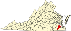
Windsor is located in southern Isle of Wight County at 36°48′40″N76°44′37″W / 36.81111°N 76.74361°W / 36.81111; -76.74361 (36.811175, 76.743658). [13] U.S. Route 460 passes through the center of town, leading southeast 11 miles (18 km) to Suffolk and northwest 47 miles (76 km) to Petersburg. Norfolk is 29 miles (47 km) east of Windsor via US-460 and U.S. Route 58. U.S. Route 258 crosses US-460 on the western side of Windsor, leading north 15 miles (24 km) to Smithfield and southwest the same distance to Franklin.

According to the United States Census Bureau, Windsor has a total area of 4.0 square miles (10.4 km2), of which 0.02 square miles (0.04 km2), or 0.41%, are water. [5]

Demographics

Historical population
CensusPop.Note
1880 266
1910 328
1920 326−0.6%
1930 37113.8%
1940 41110.8%
1950 4519.7%
1960 57928.4%
1970 68518.3%
1980 98543.8%
1990 1,0254.1%
2000 916−10.6%
2010 2,626186.7%
2019 (est.)2,758 [2] 5.0%
U.S. Decennial Census [14]

As of the census [3] of 2000, there were 916 people, 389 households, and 269 families residing in the town. The population density was 1,077.2 people per square mile (416.1/km2). There were 422 housing units at an average density of 496.3 per square mile (191.7/km2). The racial makeup of the town was 89.74% White, 9.06% African American, 0.44% Native American, and 0.76% from two or more races. Hispanic or Latino of any race were 0.98% of the population.

There were 389 households, out of which 30.6% had children under the age of 18 living with them, 52.4% were married couples living together, 12.6% had a female householder with no husband present, and 30.6% were non-families. 27.5% of all households were made up of individuals, and 11.3% had someone living alone who was 65 years of age or older. The average household size was 2.35 and the average family size was 2.87.

In the town, the population was spread out, with 23.8% under the age of 18, 7.4% from 18 to 24, 29.0% from 25 to 44, 27.3% from 45 to 64, and 12.4% who were 65 years of age or older. The median age was 38 years. For every 100 females, there were 88.5 males. For every 100 females aged 18 and over, there were 84.7 males.

The median income for a household in the town was $36,528, and the median income for a family was $44,167. Males had a median income of $34,205 versus $25,000 for females. The per capita income for the town was $20,999. About 5.9% of families and 8.8% of the population were below the poverty line, including 13.4% of those under age 18 and 8.2% of those age 65 or over.

Education

Windsor Elementary School serves students in grades of Pre-K through 5. The school mascot is the hornet, and for the 2010 – 2011 school year had a total enrollment of 613 students.[ citation needed ]

Georgie D. Tyler Middle School serves students in grades 6 through 8 and the Titan is the school mascot. The school colors are blue and silver. The school used to be called Windsor Middle School. During Windsor Middle School's 2010 – 2011 school year yielded a total enrollment of 328 students. Georgie D Tyler Middle School opened in late summer of 2014.[ citation needed ]

Windsor High School serves students in grades 9 through 12. The school colors are royal blue and gold, and the mascot is the Dukes. There were 501 students enrolled during the 2010 – 2011 school year. The school supports teams in baseball, basketball, cheerleading, football, marching band, golf, soccer, softball, track, tennis, wrestling and volleyball, theatre, forensics, and academic bowl. [15]

Related Research Articles

<span class="mw-page-title-main">Hartford County, Connecticut</span> County in Connecticut, United States

Hartford County is a county located in the north central part of the U.S. state of Connecticut. According to the 2020 census, the population was 899,498, making it the second-most populous county in Connecticut. Hartford County contains the city of Hartford, the state capital of Connecticut and the county's most populous city, with 121,054 residents at the 2020 census. Hartford County is included in the Hartford-East Hartford-Middletown metropolitan statistical area.

<span class="mw-page-title-main">Southampton County, Virginia</span> County in Virginia, United States

Southampton County is a county located on the southern border of the Commonwealth of Virginia. North Carolina is to the south. As of the 2020 census, the population was 17,996. Its county seat is Courtland.

<span class="mw-page-title-main">Isle of Wight County, Virginia</span> County in Virginia, United States

Isle of Wight County is a county located in the Hampton Roads region of the U.S. state of Virginia. It was named after the Isle of Wight, England, south of the Solent, from where many of its early colonists had come. As of the 2020 census, the population was 38,606. Its county seat is Isle of Wight, an unincorporated community.

<span class="mw-page-title-main">Lonsdale, Arkansas</span> Town in Arkansas, United States

Lonsdale is a town in Garland County, Arkansas, United States. It is part of the Hot Springs Metropolitan Statistical Area. The population was 103 at the 2020 census.

<span class="mw-page-title-main">Peru, Massachusetts</span> Town in Massachusetts, United States

Peru is a town in Berkshire County, Massachusetts, United States. The population was 814 at the 2020 census.

<span class="mw-page-title-main">Savoy, Massachusetts</span> Town in Massachusetts, United States

Savoy is a town in Berkshire County, Massachusetts, United States. It is part of the Pittsfield, Massachusetts Metropolitan Statistical Area. The population was 645 at the 2020 census.

<span class="mw-page-title-main">Windsor, Massachusetts</span> Town in Massachusetts, United States

Windsor is a town in Berkshire County, Massachusetts, United States. It is part of the Metropolitan Statistical Area of Pittsfield, Massachusetts. The population was 831 at the 2020 census.

<span class="mw-page-title-main">Cummington, Massachusetts</span> Town in Massachusetts, United States

Cummington is a town in Hampshire County, Massachusetts, United States. The population was 829 at the 2020 census, a decline from the figure of 872 tabulated in 2010. It is part of the Springfield, Massachusetts Metropolitan Statistical Area.

<span class="mw-page-title-main">Stockbridge, Vermont</span> Town in Vermont, United States

Stockbridge is a town in Windsor County, Vermont, United States, which contains the village of Gaysville. The population was 718 at the 2020 census. Stockbridge was one of thirteen Vermont towns isolated by flooding caused by Hurricane Irene in 2011.

<span class="mw-page-title-main">Glen Lyn, Virginia</span> Town in Virginia, United States

Glen Lyn is a town in Giles County, Virginia, United States, at the confluence of the East and New rivers. The population was 115 at the 2010 census, down from 151 at the 2000 census. It is part of the Blacksburg–Christiansburg Metropolitan Statistical Area.

<span class="mw-page-title-main">Rich Creek, Virginia</span> Town in Virginia, United States

Rich Creek is a town in Giles County, Virginia, United States. The population was 774 as per the 2010 census, up from 665 as per the 2000 census. It is part of the Blacksburg–Christiansburg Metropolitan Statistical Area.

<span class="mw-page-title-main">Rushmere, Virginia</span> Census-designated place in Virginia, United States

Rushmere is a census-designated place (CDP) in Isle of Wight County, Virginia, United States. The population was 1,018 at the 2010 census.

<span class="mw-page-title-main">Smithfield, Virginia</span> Town in Virginia, United States

Smithfield is a town in Isle of Wight County, in the South Hampton Roads subregion of the Hampton Roads region of Virginia in the United States. The population was 8,533 at the 2020 census.

<span class="mw-page-title-main">Burkeville, Virginia</span> Town in Virginia, United States

Burkeville is an incorporated town in Nottoway County, Virginia, United States. The population was 432 at the 2010 census. The source of the town name is disputed. The town is located at the crossroads of U.S. routes 360 and 460.

<span class="mw-page-title-main">Waverly, Virginia</span> Town in Virginia, United States

Waverly is an incorporated town in Sussex County, Virginia, United States. Per the 2020 census, the population was 1,955.

<span class="mw-page-title-main">Richlands, Virginia</span> Town in Virginia, United States

Richlands is a town in Tazewell County, Virginia, United States. The population was 5,261 at the 2020 census. It is part of the Bluefield, WV-VA micropolitan area which has a population of 107,578.

<span class="mw-page-title-main">Colonial Beach, Virginia</span> Town in Virginia, United States

Colonial Beach, Virginia (CBVA) is a river and beach town located in the northwestern part of Westmoreland County on Virginia's Northern Neck peninsula. It is bounded by the Potomac River, Monroe Bay and Monroe Creek. It is located 65 mi (105 km) from Washington, D.C.; 70 mi (110 km) from the state capital of Richmond; and 35 nautical miles from the Chesapeake Bay.

<span class="mw-page-title-main">Chapmanville, West Virginia</span> Town in West Virginia, United States

Chapmanville is a town in Logan County, West Virginia, United States. The population was 1,025 at the 2020 census. Chapmanville is named for Ned Chapman, an early settler who operated a store and post office. It was incorporated in 1947.

<span class="mw-page-title-main">Oakvale, West Virginia</span> Town in West Virginia, United States

Oakvale is a town in Mercer County, West Virginia, United States, along the East River. The population was 137 at the 2020 census. It is part of the Bluefield, WV-VA micropolitan area which has a population of 107,578.

<span class="mw-page-title-main">Surry County, Virginia</span> County in Virginia, United States

Surry County is a county in the southeastern part of the Commonwealth of Virginia. As of the 2020 census, the population was 6,561.

References

  1. "2019 U.S. Gazetteer Files". United States Census Bureau. Retrieved August 7, 2020.
  2. 1 2 "Population and Housing Unit Estimates". United States Census Bureau. May 24, 2020. Retrieved May 27, 2020.
  3. 1 2 "U.S. Census website". United States Census Bureau . Retrieved January 31, 2008.
  4. "US Board on Geographic Names". United States Geological Survey. October 25, 2007. Retrieved January 31, 2008.
  5. 1 2 "Geographic Identifiers: 2010 Census Summary File 1 (G001): Windsor town, Virginia". American Factfinder. U.S. Census Bureau. Archived from the original on February 13, 2020. Retrieved April 13, 2018.
  6. 1 2 Williams, Allison T. (March 15, 2013). "Tiny Windsor stands at a crossroads". McClatchy-Tribune Business News. ProQuest   1316899987.
  7. "History of Windsor Virginia". Town of Windsor Virginia. Retrieved May 21, 2021.
  8. "National Register Information System". National Register of Historic Places . National Park Service. July 9, 2010.
  9. 1 2 Oliver, Ned (April 16, 2021). "Windsor, site of viral traffic stop, leans heavily on ticketing to fund its budget". Virginia Mercury. Retrieved April 16, 2021.
  10. "The Demand for Money Behind Many Police Traffic Stops". The New York Times . October 31, 2021. Retrieved November 3, 2021.
  11. Rankin, Sarah (December 30, 2021). "Virginia AG sues town, alleging discriminatory policing". The Washington Post . Retrieved December 30, 2021.
  12. "Virginia lawsuit stemming from police pepper-spraying an Army officer will be settled". AP News. September 7, 2023. Retrieved September 8, 2023.
  13. "US Gazetteer files: 2010, 2000, and 1990". United States Census Bureau. February 12, 2011. Retrieved April 23, 2011.
  14. "Census of Population and Housing". Census.gov. Retrieved June 4, 2015.
  15. "IWCS Web Page" . Retrieved November 8, 2012.