Hillsville, Virginia

Last updated

Hillsville, Virginia
Hillsville-Main-businesses-va.jpg
Business along Main Street (US 52)
VAMap-doton-Hillsville.PNG
Location in Virginia
Coordinates: 36°45′32″N80°44′4″W / 36.75889°N 80.73444°W / 36.75889; -80.73444
CountryUnited States
State Virginia
County Carroll
Founded1842
Government
   Mayor Gregory N. Crowder
Area
[1]
  Total9.75 sq mi (25.25 km2)
  Land9.74 sq mi (25.22 km2)
  Water0.01 sq mi (0.03 km2)
Elevation
2,516 ft (767 m)
Population
 (2020) [2]
  Total2,897 Increase2.svg
  Estimate 
(2021) [2]
2,876
  Density273.26/sq mi (105.51/km2)
Time zone UTC−5 (Eastern (EST))
  Summer (DST) UTC−4 (EDT)
ZIP code
24343
Area code 276
FIPS code 51-37336 [3]
GNIS feature ID1498493 [4]
Website www.townofhillsville.com

Hillsville is a town in Carroll County, Virginia, United States. The population was 2,897 at the 2020 census. [2] It is the county seat of Carroll County. [5]

Contents

Geography

Hillsville is located in central Carroll County at 36°45′32″N80°44′04″W / 36.75889°N 80.73444°W / 36.75889; -80.73444 (36.758814, 80.734510). [6] U.S. Routes 52, 221 and 58 intersect in the center of town. US 52 leads northwest 28 miles (45 km) to Wytheville and south 22 miles (35 km) to Mount Airy, North Carolina, while US 221 leads northeast 70 miles (110 km) to Roanoke and southwest 13 miles (21 km) to Galax. US 58 leads east 63 miles (101 km) to Martinsville and west to Galax with US 221. The Hillsville town limits extend west along US 221 and 58 2.5 miles (4.0 km) to Interstate 77, which leads north 17 miles (27 km) to Interstate 81 east of Wytheville and south 20 miles (32 km) to Interstate 74 in North Carolina.

According to the United States Census Bureau, Hillsville has a total area of 8.9 square miles (23.0 km2), of which 0.01 square miles (0.03 km2), or 0.11%, is water. [7]

Carroll County is located within the Blue Ridge Mountain range of the Appalachian Mountains. The Blue Ridge Parkway runs through Carroll County 9 miles (14 km) south of Hillsville.

Climate

The climate in this area has mild differences between highs and lows, and there is adequate rainfall year-round. According to the Köppen Climate Classification system, Hillsville has a marine west coast climate, abbreviated "Cfb" on climate maps. [8]

Demographics

Historical population
CensusPop.Note
1850 181
1870 268
1930 485
1940 65635.3%
1950 76416.5%
1960 90518.5%
1970 1,14927.0%
1980 2,12384.8%
1990 2,008−5.4%
2000 2,60729.8%
2010 2,6812.8%
2020 2,8978.1%
2021 (est.)2,876 [2] −0.7%
U.S. Decennial Census [9]

As of the census [3] of 2000, there were 2,607 people, 1,207 households, and 731 families residing in the town. The population density was 457.6 people per square mile (176.6/km2). There were 1,352 housing units at an average density of 237.3 per square mile (91.6/km2). The racial makeup of the town was 96.39% White, 0.19% African American, 0.15% Native American, 0.42% Asian, 1.76% from other races, and 1.07% from two or more races. Hispanic or Latino of any race were 3.34% of the population.

There were 1,207 households, out of which 23.1% had children under the age of 18 living with them, 44.3% were married couples living together, 13.5% had a female householder with no husband present, and 39.4% were non-families. 35.5% of all households were made up of individuals, and 18.2% had someone living alone who was 65 years of age or older. The average household size was 2.11 and the average family size was 2.71.

In the town, the population was spread out, with 18.8% under the age of 18, 9.7% from 18 to 24, 23.8% from 25 to 44, 24.4% from 45 to 64, and 23.3% who were 65 years of age or older. The median age was 43 years. For every 100 females, there were 84.1 males. For every 100 females age 18 and over, there were 78.6 males.

The median income for a household in the town was $27,148, and the median income for a family was $36,117. Males had a median income of $26,625 versus $18,194 for females. The per capita income for the town was $16,633. About 12.9% of families and 16.4% of the population were below the poverty line, including 26.3% of those under age 18 and 11.4% of those age 65 or over.

According to the Modern Language Association, there are (in descending order) 2,372 English speakers, 55 Spanish speakers, 18 Vietnamese speakers, 5 German speakers, 4 Italian speakers, 3 Portuguese speakers, and 3 Russian speakers. Thus, less than 4% of the town of Hillsville speaks a non-English language at home.

Hillsville Flea Markets

Known for its events, the Hillsville Flea Markets are two of the largest. Held annually on Memorial Day weekend and Labor Day weekend, the latter has been called the largest American flea market to the east of the Mississippi River. In 2004, the Labor Day show attracted 650,000+ visitors, and the Memorial Day show attracted 250,000+ visitors. Vendors and customers have arrived from as far away as Germany, Africa, and South Korea.

Carroll County Courthouse shooting

On March 12, 1912, a gunfight broke out in the Carroll County Courthouse after the conviction of Floyd Allen, wealthy landowner and patriarch of the then-powerful Allen clan. [10] The story made national headlines until it was eclipsed by the sinking of the Titanic on April 12, 1912. Floyd Allen was on trial for illegal rescue of prisoners, assault and battery, and interfering with deputies. The charges stemmed from an altercation during which he freed his nephews—who had been arrested for brawling and disrupting a religious service, fled to North Carolina, but were recaptured and being taken to the Carroll county jail—and pistol-whipped a deputy sheriff with his own malfunctioning gun, leaving the officer unconscious.

Arrogant and short-tempered, Floyd had vowed he would never spend a day in jail. He had previously avoided jail time for other crimes, including killing a black man who was supposedly hunting on his property in North Carolina, nearly killing the successful purchaser of a farm he wanted, and even attempting to kill his own brother. Prosecutor William Foster (who had won his elective office by defeating another Allen clan member) received death threats but proceeded to trial beginning on March 12. However, the jury was deadlocked and therefore kept overnight in a local hotel. The next morning, after Floyd was convicted, Judge Thornton Massie refused to set aside the verdict (as had happened in an earlier case), and sentenced Floyd Allen to a year in jail and a $1000 fine, at which point Allen stood up and openly refused to go.

Gunfire erupted between lawmen and Floyd and several Allen family members present at the trial who came to his "aid". Researchers continue to disagree as to who fired the first shot. An estimated fifty shots were exchanged before more than 100 witnesses; Judge Massie, prosecutor Foster, Sheriff Lewis Webb, and the jury foreman were shot dead, and a witness died of her wounds the following day. Floyd, his brother Sidna, the court clerk, a deputy, another juror and two spectators were wounded.

Floyd and his family initially escaped. Because Virginia law at the time said deputies' law enforcement powers depended on their sheriff being alive, the assistant court clerk S. Floyd Landreth telegraphed Governor William Hodges Mann, who sent deputies employed by the Baldwin–Felts Detective Agency by train from Roanoke.

The wounded Floyd Allen and his son Victor had stayed in a Hillsville hotel overnight and were arrested the next morning. Other members of the Allen clan were soon captured. However, Sidna Allen and his cousin Wesley Edwards escaped, and were captured months later in Des Moines, Iowa.

For their parts in the fatal melee, Floyd and Claude Allen eventually received the death penalty, and were electrocuted in late March 1913. Victor Allen was later acquitted: Governor Elbert Lee Trinkle pardoned two Allen cousins in 1922, and Governor Harry F. Byrd pardoned Sidna Allen and Wesley Edwards in 1926. [11]

Points of Interest

Events

Notable people

Nearby Fancy Gap, Virginia shows its pride for Frank Beamer. Fancygap.jpg
Nearby Fancy Gap, Virginia shows its pride for Frank Beamer.

Further reading

Related Research Articles

<span class="mw-page-title-main">Grayson County, Virginia</span> County in Virginia, United States

Grayson County is a county located in the southwestern part of the Commonwealth of Virginia. As of the 2020 census, the population was 15,333. Its county seat is Independence. Mount Rogers, the state's highest peak at 5,729 feet (1,746 m), is in Grayson County.

<span class="mw-page-title-main">Floyd County, Virginia</span> County in Virginia, United States

Floyd County is a county located in the Commonwealth of Virginia. As of the 2020 census, the population was 15,476. Its county seat is the town of Floyd. Floyd County is included in the Blacksburg-Christiansburg, VA Metropolitan Statistical Area. Named after Virginia politician John Floyd, the county was established in 1831. The county is located on the high plateau of the Blue Ridge Mountains and surrounded by the Little River. In the 1960s and 1970s, Floyd proved popular with people in the era's counterculture, particularly those who wanted to live in closer contact with nature.

<span class="mw-page-title-main">Buena Vista, Virginia</span> Independent city in Virginia, United States

Buena Vista is an independent city located in the Blue Ridge Mountains region of Virginia in the United States. As of the 2020 census, the population was 6,641. The Bureau of Economic Analysis combines the independent cities of Buena Vista and Lexington, along with surrounding Rockbridge County, for statistical purposes.

<span class="mw-page-title-main">Carroll, Iowa</span> City in Iowa, United States

Carroll is a city in, and the county seat of, Carroll County, Iowa, United States, along the Middle Raccoon River. The population was 10,321 in the 2020 census.

<span class="mw-page-title-main">Ashland, Mississippi</span> Town in Mississippi, United States

Ashland is a town in Benton County, Mississippi, United States and the county seat. The population was 551 at the 2020 census, down from 569 at the 2010 census. Ashland was incorporated on March 8, 1871, and has a Mayor-Aldermen form of government. Mitch Carroll is the 28th mayor of Ashland.

<span class="mw-page-title-main">Carrollton, Mississippi</span> Town in Mississippi, United States

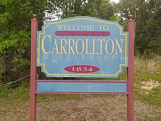
Carrollton is a town in and the second county seat of Carroll County, Mississippi, United States, which is within the Mississippi Delta. The population was 190 at the 2010 census, down from 408 in 2000. Centrally located in the county, the town is part of the Greenwood, Mississippi micropolitan area. The first county seat, Vaiden, was founded in the eastern part of the county during its early settlement.

<span class="mw-page-title-main">Lamesa, Texas</span> City in Texas, United States

Lamesa is a city in and the county seat of Dawson County, Texas, United States. The population was 8,674 at the 2020 census, down from 9,952 at the 2000 census. Located south of Lubbock on the Llano Estacado, Lamesa was founded in 1903. Most of its economy is based on cotton farming. The Preston E. Smith prison unit, named for the former governor of Texas, is located just outside Lamesa.

<span class="mw-page-title-main">Haskell, Texas</span> City in Texas, United States

Haskell is a city in central Haskell County, Texas, United States. As of the 2010 census, the city population was 3,322. It is the Haskell county seat.

<span class="mw-page-title-main">Newton, Texas</span> City in Texas, United States

Newton is a city in and the county seat of Newton County, Texas, United States. The population was 1,633 at the 2020 census.

<span class="mw-page-title-main">Accomac, Virginia</span> Town in Virginia, United States

Accomac is a town in and the county seat of Accomack County, Virginia, United States. The population was 526 at the 2020 census.

<span class="mw-page-title-main">The Plains, Virginia</span> Town in Virginia, United States

The Plains is a small incorporated town in Fauquier County, Virginia, United States. The population was 245 as of the 2020 census, up from 217 at the 2010 census. It is centered on the intersection of VA 55 and VA 245. The town of The Plains is situated off I-66. As of 2022, the mayor of The Plains is Lori Sisson.

<span class="mw-page-title-main">Floyd, Virginia</span> Town in Virginia, United States

Floyd is a town in Floyd County, Virginia, United States. The population was 448 at the 2020 census. It is the county seat of Floyd County. The Town of Floyd was originally named Jacksonville as the surrounding county was formed during the tenure of President Andrew Jackson. The name was subsequently changed to Floyd for Virginia governor John Floyd.

<span class="mw-page-title-main">Independence, Virginia</span> Town in Virginia, United States

Independence is a town located in and the county seat of Grayson County, Virginia. At the 2020 U.S. census, it had a population of 1,001. It is situated on Virginia's Crooked Road, a heritage trail celebrating the musical heritage of Southwest Virginia.

<span class="mw-page-title-main">Stuart, Virginia</span> Town in Virginia, United States

Stuart is a town in Patrick County, Virginia, United States, where it is the county seat. The population was 1,408 at the 2010 census. The town of Stuart was named after Confederate Gen. J.E.B. Stuart, of nearby Ararat, Virginia.

<span class="mw-page-title-main">Warsaw, Virginia</span> Town in Virginia, United States

Warsaw is an incorporated town in and the county seat of Richmond County, Virginia, United States. The population was 1,637 at the 2020 census and is estimated to be 2,281 as of 2022.

<span class="mw-page-title-main">Wise, Virginia</span> Town in Virginia, United States

Wise is a town in Wise County, Virginia. The population was 3,286 at the 2010 census. It is the county seat of Wise County. It was originally incorporated as the town of Gladeville in 1874. The town's name was changed to Wise in 1924, after Henry A. Wise, the last Virginia governor before the American Civil War and the first governor to hail from the Eastern Shore of Virginia.

<span class="mw-page-title-main">Wayne, West Virginia</span> Town in West Virginia, United States

Wayne is a town in and the county seat of Wayne County, West Virginia, United States. The population was 1,441 at the 2020 census. It is part of the Huntington–Ashland metropolitan area.

<span class="mw-page-title-main">Floyd Allen</span> American mass murderer

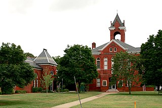
Floyd Allen was an American landowner and patriarch of the Allen clan of Carroll County, Virginia. He was convicted and executed for murder in 1913 after a sensational courthouse shootout the previous year that left a judge, prosecutor, sheriff, and two others dead, although the validity of the conviction has been a source of debate within Carroll County for decades. Allen, who was before the bar for sentencing after being convicted of taking a prisoner from a deputy sheriff, allegedly triggered the shooting at the Carroll County Courthouse in Hillsville on March 14, 1912.

<span class="mw-page-title-main">Carroll County, Virginia</span> County in Virginia, United States

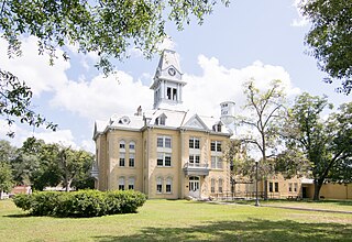
Carroll County is a United States county located in the southwestern part of the Commonwealth of Virginia. Roughly one fifth of the county lies in the Virginia Piedmont region, while the rest is part of the Appalachian Mountains. The county seat and largest town is Hillsville.

<span class="mw-page-title-main">Sidna Allen House</span> Historic house in Virginia, United States

The Sidna Allen House is a historic house located near the town of Fancy Gap, in Carroll County, Virginia. The house was built in 1911 for Sidna Allen, brother of Floyd Allen; however, he was arrested soon thereafter for complicity in the courthouse shooting of which his brother was accused, and never again lived there.

References

  1. "2019 U.S. Gazetteer Files". United States Census Bureau. Retrieved August 7, 2020.
  2. 1 2 3 4 "City and Town Population Totals: 2020—2021". Census.gov. US Census Bureau. Retrieved October 7, 2022.
  3. 1 2 "U.S. Census website". United States Census Bureau . Retrieved January 31, 2008.
  4. "US Board on Geographic Names". United States Geological Survey. October 25, 2007. Retrieved January 31, 2008.
  5. "Find a County". National Association of Counties. Archived from the original on May 31, 2011. Retrieved June 7, 2011.
  6. "US Gazetteer files: 2010, 2000, and 1990". United States Census Bureau. February 12, 2011. Retrieved April 23, 2011.
  7. "Geographic Identifiers: 2010 Demographic Profile Data (G001): Hillsville town, Virginia". U.S. Census Bureau, American Factfinder. Retrieved August 23, 2015.[ dead link ]
  8. "Hillsville, Virginia Köppen Climate Classification (Weatherbase)". Weatherbase. Retrieved April 16, 2018.
  9. "Census of Population and Housing". Census.gov. Retrieved June 4, 2015.
  10. "Hillsville Massacre". theroanoker.com. Retrieved April 16, 2018.
  11. "Hillsville History". Hillsville, Virginia. Retrieved August 21, 2016.