Chase City, Virginia

Last updated

Chase City, Virginia
Main at Walker, Chase City.jpg
Main Street downtown
Seal of Chase City, Virginia.png
VAMap-doton-ChaseCity.PNG
Location of Chase City, Virginia
Coordinates: 36°47′58″N78°27′40″W / 36.79944°N 78.46111°W / 36.79944; -78.46111
Country United States
State Virginia
County Mecklenburg
Government
  MayorAlden Fahringer
  Vice MayorJames Bohannon
  Town CouncilBrenda Hatcher
B.J. Mull
Marshall E. Whitaker
Michelle Wilson
Pauline Keeton
  Town ManagerC.F. “Dusty” Forbes
  Police ChiefJ. A. Jordon
Area
[1]
  Total2.19 sq mi (5.66 km2)
  Land2.19 sq mi (5.66 km2)
  Water0.00 sq mi (0.00 km2)
Elevation
571 ft (174 m)
Population
 (2010)
  Total2,351
  Estimate 
(2019) [2]
2,215
  Density1,012.80/sq mi (391.09/km2)
Time zone UTC-5 (Eastern (EST))
  Summer (DST) UTC-4 (EDT)
ZIP code
23924
Area code 434
FIPS code 51-14984 [3]
GNIS feature ID1464752 [4]
Website Official website

Chase City is a town in Mecklenburg County, Virginia, United States. Chase City was incorporated in 1873 and named for Salmon P. Chase, United States Chief Justice and Lincoln's Secretary of the Treasury. The population was 2,053 at the 2020 census. [5] Tobacco and other crops are grown nearby.

Contents

History

The Chase City High School, MacCallum More and Hudgins House Historic District, and Shadow Lawn are listed on the National Register of Historic Places. [6] [7]

Geography

Chase City is located at 36°47′58″N78°27′40″W / 36.79944°N 78.46111°W / 36.79944; -78.46111 (36.799312, -78.461019). [8]

According to the United States Census Bureau, the town has a total area of 2.2 square miles (5.7 km2), all of it land.

Climate

Climate data for Chase City, Virginia (1991–2020 normals, extremes 1947–present)
MonthJanFebMarAprMayJunJulAugSepOctNovDecYear
Record high °F (°C)81
(27)
80
(27)
88
(31)
95
(35)
105
(41)
103
(39)
107
(42)
105
(41)
106
(41)
98
(37)
89
(32)
81
(27)
107
(42)
Mean daily maximum °F (°C)49.4
(9.7)
52.7
(11.5)
60.3
(15.7)
70.6
(21.4)
77.6
(25.3)
85.2
(29.6)
88.9
(31.6)
87.1
(30.6)
81.0
(27.2)
71.0
(21.7)
61.0
(16.1)
52.3
(11.3)
69.8
(21.0)
Daily mean °F (°C)39.3
(4.1)
41.7
(5.4)
48.3
(9.1)
57.8
(14.3)
66.1
(18.9)
74.3
(23.5)
78.4
(25.8)
76.6
(24.8)
70.2
(21.2)
59.0
(15.0)
49.2
(9.6)
41.8
(5.4)
58.6
(14.8)
Mean daily minimum °F (°C)29.1
(−1.6)
30.8
(−0.7)
36.2
(2.3)
44.9
(7.2)
54.7
(12.6)
63.5
(17.5)
67.8
(19.9)
66.2
(19.0)
59.5
(15.3)
46.9
(8.3)
37.3
(2.9)
31.3
(−0.4)
47.3
(8.5)
Record low °F (°C)−3
(−19)
−1
(−18)
10
(−12)
15
(−9)
31
(−1)
40
(4)
49
(9)
46
(8)
35
(2)
22
(−6)
12
(−11)
0
(−18)
−3
(−19)
Average precipitation inches (mm)3.76
(96)
3.27
(83)
4.07
(103)
3.66
(93)
4.01
(102)
4.26
(108)
4.23
(107)
4.09
(104)
4.65
(118)
3.45
(88)
3.18
(81)
3.77
(96)
46.40
(1,179)
Average snowfall inches (cm)3.0
(7.6)
0.8
(2.0)
0.4
(1.0)
0.0
(0.0)
0.0
(0.0)
0.0
(0.0)
0.0
(0.0)
0.0
(0.0)
0.0
(0.0)
0.0
(0.0)
0.0
(0.0)
0.8
(2.0)
5.0
(13)
Average precipitation days (≥ 0.01 in)7.77.08.68.38.98.58.77.96.86.86.87.893.8
Average snowy days (≥ 0.1 in)1.10.80.10.00.00.00.00.00.00.00.00.62.6
Source: NOAA [9] [10]

Demographics

Historical population
CensusPop.Note
1880 251
1890 618146.2%
1900 542−12.3%
1910 1,662206.6%
1920 1,646−1.0%
1930 1,590−3.4%
1940 1,89619.2%
1950 2,51932.9%
1960 3,20727.3%
1970 2,909−9.3%
1980 2,749−5.5%
1990 2,442−11.2%
2000 2,4570.6%
2010 2,351−4.3%
2019 (est.)2,215 [2] −5.8%
U.S. Decennial Census [11]

As of the census [3] of 2000, there were 2,457 people, 1,099 households, and 658 families living in the town. The population density was 1,121.2 people per square mile (433.2/km2). There were 1,249 housing units at an average density of 570.0 per square mile (220.2/km2). The racial makeup of the town was 53.52% White, 44.65% African American, 0.20% Native American, 0.12% Asian,0.04% Pacific Islander, 0.49% from other races, and 0.98% from two or more races. Hispanic or Latino of any race were 1.34% of the population.

There were 1,099 households, out of which 26.1% had children under the age of 18 living with them, 36.6% were married couples living together, 18.7% had a female householder with no husband present, and 40.1% were non-families. 36.7% of all households were made up of individuals, and 21.7% had someone living alone who was 65 years of age or older. The average household size was 2.24 and the average family size was 2.93.

In the town, the population was spread out, with 25.4% under the age of 18, 6.8% from 18 to 24, 23.5% from 25 to 44, 22.5% from 45 to 64, and 21.8% who were 65 years of age or older. The median age was 40 years. For every 100 females there were 80.1 males. For every 100 females age 18 and over, there were 74.5 males.

The median income for a household in the town was $22,193, and the median income for a family was $32,700. Males had a median income of $26,712 versus $18,750 for females. The per capita income for the town was $13,559. About 15.9% of families and 22.7% of the population were below the poverty line, including 27.4% of those under age 18 and 20.3% of those age 65 or over.

Notable people

Related Research Articles

<span class="mw-page-title-main">Halifax County, Virginia</span> County in Virginia, United States

Halifax County is a county located in the Commonwealth of Virginia. As of the 2020 census, the population was 34,022. Its county seat is Halifax.

<span class="mw-page-title-main">Lockeford, California</span> Census-designated place in California, United States

Lockeford is an unincorporated community in San Joaquin County, California, United States. For statistical purposes, the United States Census Bureau has defined Lockeford as a census-designated place (CDP). The census definition of the area may not precisely correspond to local understanding of the area with the same name. The population was 3,521 at the 2020 census, up from 3,233 at the 2010 census.

<span class="mw-page-title-main">Cottonwood Falls, Kansas</span> City in Chase County, Kansas

Cottonwood Falls is the largest city and county seat of Chase County, Kansas, United States. As of the 2020 census, the population of the city was 851. It is located south of Strong City along the south side of the Cottonwood River.

<span class="mw-page-title-main">Troy, North Carolina</span> Town in North Carolina, United States

Troy is a town in Montgomery County, North Carolina, United States. The population was 3,188 at the 2010 census. It is the county seat of Montgomery County. A short story by Charles W. Chesnutt, The Sheriff's Children, is set in Troy.

<span class="mw-page-title-main">Central City, Pennsylvania</span> Borough in Pennsylvania, United States

Central City is a borough in Somerset County, Pennsylvania, United States. The population was 998 at the 2020 census. It is part of the Johnstown, Pennsylvania, Metropolitan Statistical Area. It is east-northeast of Stoystown and northeast of Somerset.

<span class="mw-page-title-main">Codorus Township, Pennsylvania</span> Township in Pennsylvania, United States

Codorus Township is a township in York County, Pennsylvania, United States. The population was 3,898 at the 2020 census.

<span class="mw-page-title-main">Tahoka, Texas</span> City in Texas, United States

Tahoka is a city in and the county seat of Lynn County, Texas, United States. The population was 2,673 at the 2010 census.

<span class="mw-page-title-main">Stanardsville, Virginia</span> Town in Virginia, United States

Stanardsville is a town in Greene County, Virginia, United States. The population was 349 at the 2020 census, down from 367 at the 2010 census. It is the county seat of Greene County. The name is from Robert Stanard, a benefactor who donated land for public use. It is part of the Charlottesville, Virginia metropolitan area.

<span class="mw-page-title-main">South Boston, Virginia</span> Town in Virginia, United States

South Boston, formerly Boyd's Ferry, is a town in Halifax County, Virginia, United States. The population was 8,142 at the 2010 census, down from 8,491 at the 2000 census. It is the most populous town in Halifax County.

<span class="mw-page-title-main">Virgilina, Virginia</span> Town in Virginia, United States

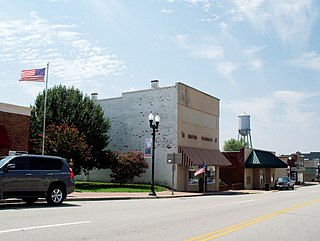
Virgilina is a town in Halifax County, Virginia, United States. The population was 154 at the 2010 census. Virgilina was once a copper mining town. It was a stop on the Atlantic and Danville Railway as recently as the 1950s. It is named "Virgilina" because it is located on the Virginia and North Carolina border.

<span class="mw-page-title-main">Kenbridge, Virginia</span> Town in Virginia, United States

Kenbridge is a town in Lunenburg County, Virginia, United States. The population was 1,257 at the 2010 census. It is in a tobacco farming area. The area is home to noted folk artist Eldridge Bagley. The town is home to the Lunenburg Girls’ Softball league, Lunenburg Lightning Football and Cheerleading league and the United Futbol Soccer league. There are many quaint shops and boutiques and many family-owned businesses. Home to Kenbridge Elementary School. Visit www.kenbridgeva.net for information.

<span class="mw-page-title-main">La Crosse, Virginia</span> Town in Virginia, United States

La Crosse is a town in Mecklenburg County, Virginia, United States. Its name is derived from the fact that it was a place where railroads once crossed, and there is still a caboose in the center of the town. La Crosse is adjacent to the neighboring town South Hill.

<span class="mw-page-title-main">Dungannon, Virginia</span> Town in Virginia, United States

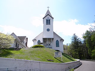
Dungannon is a town in Scott County, Virginia. The population was 257 at the 2020 census. It was named after the town of Dungannon in County Tyrone, Northern Ireland.

<span class="mw-page-title-main">Nickelsville, Virginia</span> Town in Virginia, United States

Nickelsville is a town in Scott County, Virginia. The population was 378 at the 2020 census. It is part of the Metropolitan Statistical Area, which is a component of the Johnson City-Kingsport-Bristol, TN-VA Combined Statistical Area – commonly known as the "Tri-Cities" region.

<span class="mw-page-title-main">Weber City, Virginia</span> Town in Virginia, United States

Weber City is an incorporated town in Scott County, Virginia, United States. The population was 1,327 at the 2010 census. It is part of the Kingsport–Bristol (TN)–Bristol (VA) Metropolitan Statistical Area, which is a component of the Johnson City–Kingsport–Bristol, TN-VA Combined Statistical Area – commonly known as the "Tri-Cities" region.

<span class="mw-page-title-main">Stony Creek, Virginia</span> Town in Virginia, United States

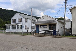
Stony Creek is a town in Sussex County, Virginia, United States. The population was 198 at the 2010 census.

<span class="mw-page-title-main">Pratt, West Virginia</span> Town in West Virginia, United States

Pratt is a town in Kanawha County, West Virginia, United States, along the Kanawha River. The population was 482 at the 2020 census.

<span class="mw-page-title-main">Gary, West Virginia</span> City in West Virginia, United States

Gary is a city located along the Tug Fork River in McDowell County, West Virginia, United States. According to the 2020 census, the city had a population of 762. It was named for Elbert Henry Gary, one of the founders of U.S. Steel. The former coal towns of Elbert, Filbert, Thorpe, and Wilcoe became part of Gary at the time of its incorporation in 1971.

<span class="mw-page-title-main">Pleasant Springs, Wisconsin</span> Town in Wisconsin, United States

The Town of Pleasant Springs is located in Dane County, Wisconsin, United States. The population was 3,053 at the 2000 census. The unincorporated community of Kegonsa is located in the town. The unincorporated community of Hoffman Corners is also located partially in the town.

<span class="mw-page-title-main">Clarksville, Virginia</span> Town in Virginia, United States

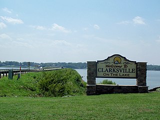
Clarksville is a town in Mecklenburg county in the U.S. state of Virginia, near the southern border of the commonwealth. The population was 1,139 at the 2010 census. Since the town has numerous buildings of the 18th-, 19th-, and early 20th-century architecture, the downtown area of Clarksville has been designated a Historic District on the National Register of Historic Places and Virginia's Historic Register. Clarksville claims the title of Virginia's only Lakeside town. Nearby the town of Clarksville is Occoneechee State Park.

References

  1. "2019 U.S. Gazetteer Files". United States Census Bureau. Retrieved August 7, 2020.
  2. 1 2 "Population and Housing Unit Estimates". United States Census Bureau. May 24, 2020. Retrieved May 27, 2020.
  3. 1 2 "U.S. Census website". United States Census Bureau . Retrieved January 31, 2008.
  4. "US Board on Geographic Names". United States Geological Survey. October 25, 2007. Retrieved January 31, 2008.
  5. "Explore Census Data". data.census.gov. Retrieved May 2, 2024.
  6. "National Register Information System". National Register of Historic Places . National Park Service. July 9, 2010.
  7. "National Register of Historic Places Listings". Weekly List of Actions Taken on Properties: 9/07/10 through 9/10/10. National Park Service. September 17, 2010.
  8. "US Gazetteer files: 2010, 2000, and 1990". United States Census Bureau. February 12, 2011. Retrieved April 23, 2011.
  9. "NowData – NOAA Online Weather Data". National Oceanic and Atmospheric Administration. Retrieved July 5, 2021.
  10. "Station: Chase City, VA". U.S. Climate Normals 2020: U.S. Monthly Climate Normals (1991–2020). National Oceanic and Atmospheric Administration. Retrieved July 5, 2021.
  11. "Census of Population and Housing". Census.gov. Retrieved June 4, 2015.