Wachapreague, Virginia

Last updated

Wachapreague, Virginia
WachapreagueSeaMarshFishingBoats.jpg
Sea marsh and fishing boats in Wachapreague
Accomack County Virginia incorporated and unincorporated areas Wachapreague highlighted.svg
Location in Accomack County and the state of Virginia.
Coordinates: 37°36′23″N75°41′26″W / 37.60639°N 75.69056°W / 37.60639; -75.69056
CountryUnited States
State Virginia
County Accomack
Area
[1]
  Total0.22 sq mi (0.58 km2)
  Land0.22 sq mi (0.58 km2)
  Water0.00 sq mi (0.00 km2)
Elevation
[2]
7 ft (2 m)
Population
 (2020)
  Total257
  Density1,000.00/sq mi (385.55/km2)
Time zone UTC−5 (Eastern (EST))
  Summer (DST) UTC−4 (EDT)
ZIP code
23480
Area code(s) 757, 948
FIPS code 51-82320 [3]
GNIS feature ID1500265 [2]
Website www.wachapreague.org

Wachapreague is a town in Accomack County, Virginia, United States. The population was 257 at the 2020 census. [4]

Contents

History

The name of the town came from the Wachapreague, an Algonquian people who resided in the area centuries ago. [5]

Bunting Place was added to the National Register of Historic Places in 2003. [6]

Geography

According to the United States Census Bureau, the town has a total area of 0.3 square miles (0.7 km2), all of it land.

The Wachapreague Channel winds from the town, through the seaside marsh, out to the barrier islands. Between Cedar and Parramore Islands it reaches the Atlantic Ocean. Easy access to the marsh and ocean makes this a popular place for fishermen.

Demographics

Historical population
CensusPop.Note
1910 485
1920 4982.7%
1930 58517.5%
1940 548−6.3%
1950 5510.5%
1960 507−8.0%
1970 399−21.3%
1980 4041.3%
1990 291−28.0%
2000 236−18.9%
2010 232−1.7%
2020 25710.8%
U.S. Decennial Census [7] [8]

At the 2000 census there were 236 people, 133 households, and 69 families living in the town. The population density was 922.9 people per square mile (350.5/km2). There were 225 housing units at an average density of 879.9 per square mile (334.1/km2). The racial makeup of the town was 93.22% White, 2.54% African American, 0.42% Native American, 1.69% from other races, and 2.12% from two or more races. Hispanic or Latino of any race were 1.69%. [3]

Of the 133 households 9.0% had children under the age of 18 living with them, 43.6% were married couples living together, 3.8% had a female householder with no husband present, and 48.1% were non-families. 42.9% of households were one person and 25.6% were one person aged 65 or older. The average household size was 1.77 and the average family size was 2.32.

The age distribution was 7.6% under the age of 18, 3.8% from 18 to 24, 20.3% from 25 to 44, 33.1% from 45 to 64, and 35.2% 65 or older. The median age was 56 years. For every 100 females, there were 87.3 males. For every 100 females aged 18 and over, there were 83.2 males.

The median household income was $36,625 and the median family income was $39,063. Males had a median income of $30,313 versus $21,563 for females. The per capita income for the town was $21,680. About 2.9% of families and 7.7% of the population were below the poverty line, including none of those under the age of eighteen and 7.0% of those sixty-five or over.

Notable people

Related Research Articles

<span class="mw-page-title-main">Vienna, Maine</span> Town in the state of Maine, United States

Vienna is a town in Kennebec County, Maine, United States. The population was 578 at the 2020 census.

<span class="mw-page-title-main">Madison, West Virginia</span> City in West Virginia, United States

Madison is a city and former coal town in Boone County, West Virginia, United States. The population was 2,911 at the 2020 census. It is the county seat of Boone County.

<span class="mw-page-title-main">Pax, West Virginia</span> Town in West Virginia, United States

Pax is a town in Fayette County, West Virginia, United States. The current mayor of Pax is William F. Hughes. The population was 167 at the 2010 census.

<span class="mw-page-title-main">Quinwood, West Virginia</span> Town in West Virginia, United States

Quinwood is a town and former coal town in Greenbrier County, West Virginia, United States. The population was 220 at the 2020 census.

<span class="mw-page-title-main">Fairview, West Virginia</span> Town in West Virginia, United States

Fairview is a town in Marion County, West Virginia, United States. The population was 374 at the 2020 census.

<span class="mw-page-title-main">Bradshaw, West Virginia</span> Town in West Virginia, United States

Bradshaw is a town in McDowell County, West Virginia, United States. The population was 337 at the 2010 census. Bradshaw was incorporated in December 1979 and named for a pioneer settler.

<span class="mw-page-title-main">Davy, West Virginia</span> Town in West Virginia, United States

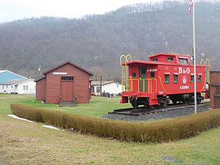
Davy is a town in McDowell County, West Virginia, United States. The population was 420 at the 2010 census. Founded in 1873, the town was originally called Hallsville but the name would change to Davy by 1901. Davy was officially incorporated in 1948. It is a mostly residential community in a coal mining district along the main line of the Norfolk Southern Railway.

<span class="mw-page-title-main">Blacksville, West Virginia</span> Town in West Virginia

Blacksville is an Incorporated Town in Monongalia County, West Virginia, United States. The population was 118 at the 2020 census. It is included in the Morgantown, West Virginia Metropolitan Statistical Area.

<span class="mw-page-title-main">Newburg, West Virginia</span> Town in West Virginia, United States

Newburg is a town in western Preston County, West Virginia, United States. The population was 275 at the 2020 census. It is part of the Morgantown metropolitan area.

<span class="mw-page-title-main">Reedsville, West Virginia</span> Town in West Virginia, United States

Reedsville is a town in western Preston County, West Virginia, United States. The population was 530 at the 2020 census. It is part of the Morgantown metropolitan area.

<span class="mw-page-title-main">Rowlesburg, West Virginia</span> Town in West Virginia, United States

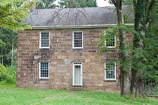
Rowlesburg is a town in southern Preston County, West Virginia, United States, along the Cheat River. The population was 438 at the 2020 census. It is part of the Morgantown metropolitan area. A former railroad town, it is home to the Downtown Rowlesburg Historic District, and was the site of action during the American Civil War.

<span class="mw-page-title-main">Terra Alta, West Virginia</span> Town in West Virginia, United States

Terra Alta is a town in eastern Preston County, West Virginia, United States. The population was 1,415 at the 2020 census. It is part of the Morgantown metropolitan area.

<span class="mw-page-title-main">Sophia, West Virginia</span> Town in West Virginia, United States

Sophia is a town in Raleigh County, West Virginia, United States. It was incorporated in 1912. The population was 1,124 at the 2020 census.

<span class="mw-page-title-main">Pullman, West Virginia</span> Town in West Virginia, United States

Pullman is a town in Ritchie County, West Virginia, United States. The population was 134 at the 2020 census.

<span class="mw-page-title-main">Hambleton, West Virginia</span> Town in West Virginia, United States

Hambleton is a town in Tucker County, West Virginia, United States. The population was 216 at the 2020 census. Hambleton was established in 1889, but not incorporated until 1905. It was named by then United States Senator Stephen B. Elkins in honor of a stockholder by this name in the West Virginia Central Railroad Company. The town was previously known as Hulings.

<span class="mw-page-title-main">Middlebourne, West Virginia</span> Town in West Virginia, United States

Middlebourne is a town and the county seat of Tyler County, West Virginia, United States. The population was 715 at the 2020 census.

<span class="mw-page-title-main">Hundred, West Virginia</span> Town in West Virginia, United States

Hundred is a town in Wetzel County, West Virginia, United States. The population was 257 at the 2020 census. It was named for the fact that local resident Henry "Old Hundred" Church was a centenarian. Hundred is the only place in the United States with this name.

<span class="mw-page-title-main">Pine Grove, West Virginia</span> Town in West Virginia, United States

Pine Grove is a town in Wetzel County, West Virginia, United States. The population was 363 at the 2020 census. The community was named for a grove of pine trees near the original town site.

<span class="mw-page-title-main">North Hills, West Virginia</span> Town in West Virginia, United States

North Hills is a town in Wood County, West Virginia, United States. It is a suburb of Parkersburg. The population was 837 at the 2020 census. North Hills was incorporated on February 15, 1979.

<span class="mw-page-title-main">Belle Haven, Accomack County, Virginia</span> Town in Virginia, United States

Belle Haven is a town in Accomack and Northampton counties in the U.S. state of Virginia. The population was 532 at the 2010 census.

References

  1. "2019 U.S. Gazetteer Files". United States Census Bureau. Retrieved August 7, 2020.
  2. 1 2 U.S. Geological Survey Geographic Names Information System: Wachapreague, Virginia
  3. 1 2 "U.S. Census website". United States Census Bureau . Retrieved January 31, 2008.
  4. "Profile of General Population and Housing Characteristics: 2010 Demographic Profile Data (DP-1): Wachapreague town, Virginia". United States Census Bureau . Retrieved April 5, 2012.
  5. Federal Writers' Project (1938). The Ocean Highway: New Brunswick, New Jersey to Jacksonville, Florida. Works Progress Administration. p. 73.
  6. "National Register Information System". National Register of Historic Places . National Park Service. July 9, 2010.
  7. "Census of Population and Housing". Census.gov. Retrieved June 4, 2015.
  8. "Explore Census Data". data.census.gov. Retrieved January 31, 2023.