Capron, Virginia

Last updated

Capron, Virginia
Capron town hall.jpg
Town hall
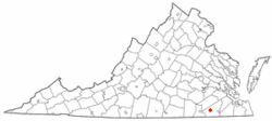
VAMap-doton-Capron.PNG
Location of Capronmap, Virginia
Coordinates: 36°42′39″N77°12′6″W / 36.71083°N 77.20167°W / 36.71083; -77.20167
Country United States
State Virginia
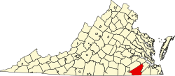
County Southampton
Area
[1]
  Total0.17 sq mi (0.43 km2)
  Land0.17 sq mi (0.43 km2)
  Water0.00 sq mi (0.00 km2)
Elevation
112 ft (34 m)
Population
 (2020) [1]
  Total141
  Density854.5/sq mi (329.9/km2)
Time zone UTC-5 (Eastern (EST))
  Summer (DST) UTC-4 (EDT)
ZIP code
23829
Area code 434
FIPS code 51-12904 [2]
GNIS feature ID1492710 [3]

Capron is a town in Southampton County, Virginia, United States. The population was 141 at the 2020 census. [1]

Contents

History

Belmont, Rose Hill, and the William H. Vincent House are listed on the National Register of Historic Places. [4]

Geography

Capron is located at 36°42′39″N77°12′6″W / 36.71083°N 77.20167°W / 36.71083; -77.20167 (36.710770, -77.201726). [5]

According to the United States Census Bureau, the town has a total area of 0.2 square miles (0.4 km2), all of it land.

Demographics

Historical population
CensusPop.Note
1930 337
1940 291−13.6%
1950 281−3.4%
1960 32716.4%
1970 314−4.0%
1980 238−24.2%
1990 144−39.5%
2000 16716.0%
2010 166−0.6%
2020 141−15.1%
U.S. Decennial Census [6]

As of the census [2] of 2000, there were 167 people, 72 households, and 45 families living in the town. The population density was 1,036.0 people per square mile (403.0/km2). There were 79 housing units at an average density of 490.1 per square mile (190.6/km2). The racial makeup of the town was 72.46% White and 27.54% African American.

There were 72 households, out of which 26.4% had children under the age of 18 living with them, 48.6% were married couples living together, 11.1% had a female householder with no husband present, and 37.5% were non-families. 36.1% of all households were made up of individuals, and 16.7% had someone living alone who was 65 years of age or older. The average household size was 2.32 and the average family size was 3.04.

In the town, the population was spread out, with 24.0% under the age of 18, 6.0% from 18 to 24, 30.5% from 25 to 44, 23.4% from 45 to 64, and 16.2% who were 65 years of age or older. The median age was 41 years. For every 100 females there were 103.7 males. For every 100 females age 18 and over, there were 95.4 males.

The median income for a household in the town was $45,000, and the median income for a family was $50,833. Males had a median income of $36,750 versus $25,417 for females. The per capita income for the town was $22,588. None of the population or families were below the poverty line.

Related Research Articles

<span class="mw-page-title-main">Capron, Illinois</span> Village in Illinois, United States

Capron is a village in Boone County, Illinois, United States. It is part of the Rockford, Illinois Metropolitan Statistical Area. The population was 1,395 at the 2020 census, up from 1,376 at the 2010 census.

<span class="mw-page-title-main">Preston, Maryland</span> Town in Maryland

Preston is a town in Caroline County, Maryland, United States. The population was 719 at the 2010 census.

<span class="mw-page-title-main">Covington Township, Tioga County, Pennsylvania</span> Township in Pennsylvania, United States

Covington Township is a township in Tioga County, Pennsylvania, United States. The population was 1,031 at the 2020 census.

<span class="mw-page-title-main">North Irwin, Pennsylvania</span> Borough in Pennsylvania, United States

North Irwin is a borough in Westmoreland County, Pennsylvania, United States. The population was 846 at the time of the 2010 census.

<span class="mw-page-title-main">Keller, Virginia</span> Town in Virginia, United States

Keller is a town in Accomack County, Virginia, United States. The population was 178 at the 2010 census.

<span class="mw-page-title-main">McKenney, Virginia</span> Town in Virginia, United States

McKenney is an incorporated town in Dinwiddie County, Virginia, United States. The population was 483 at the 2010 census.

<span class="mw-page-title-main">St. Charles, Virginia</span> Census-designated place in Virginia, United States

St. Charles is a census-designated place and former town in Lee County, Virginia, United States. The population was 72 at the 2020 census, down from 159 at the 2000 census.

<span class="mw-page-title-main">Burkeville, Virginia</span> Town in Virginia, United States

Burkeville is an incorporated town in Nottoway County, Virginia, United States. The population was 432 at the 2010 census. The source of the town name is disputed. The town is located at the crossroads of U.S. routes 360 and 460.

<span class="mw-page-title-main">Cleveland, Virginia</span> Town in Virginia, United States

Cleveland is a town in central Russell County, Virginia, United States. The population was 128 at the 2010 census.

<span class="mw-page-title-main">Nickelsville, Virginia</span> Town in Virginia, United States

Nickelsville is a town in Scott County, Virginia. The population was 378 at the 2020 census. It is part of the Metropolitan Statistical Area, which is a component of the Johnson City-Kingsport-Bristol, TN-VA Combined Statistical Area – commonly known as the "Tri-Cities" region.

<span class="mw-page-title-main">Branchville, Virginia</span> Town in Virginia, United States

Branchville is a town in Southampton County, Virginia, United States. The population was 123 at the 2000 census.

<span class="mw-page-title-main">Newsoms, Virginia</span> Town in Virginia, United States

Newsoms is a town in Southampton County, Virginia, United States. The population was 282 at the 2000 census.

<span class="mw-page-title-main">Stony Creek, Virginia</span> Town in Virginia, United States

Stony Creek is a town in Sussex County, Virginia, United States. The population was 198 at the 2010 census.

<span class="mw-page-title-main">Danville, West Virginia</span> Town in West Virginia, United States

Danville is a town in Boone County, West Virginia, United States. The population was 660 at the 2020 census. Danville was incorporated in 1911 and named for Dan Rock, the town's first postmaster. Danville was formerly known as Newport and Red House.

<span class="mw-page-title-main">Rupert, West Virginia</span> Town in West Virginia, United States

Rupert is a town in Greenbrier County, West Virginia, United States. The population was 881 at the 2020 census.

<span class="mw-page-title-main">Matoaka, West Virginia</span> Census-designated place in West Virginia, United States

Matoaka is a census-designated place in Mercer County, West Virginia, United States. The population was 173 at the 2020 census. It is part of the Bluefield, WV-VA micropolitan area which has a population of 100,093. This town is named for Chief Powhatan's daughter Matoaka who was better known by her nickname "Pocahontas". Matoaka became an unincorporated town when it voted to dissolve its charter in May 2018.

<span class="mw-page-title-main">Belmont, West Virginia</span> Town in West Virginia, United States

Belmont is a town in Pleasants County, West Virginia, United States. It is part of the Parkersburg–Vienna metropolitan area. The population was 872 at the 2020 census. Belmont was incorporated on April 19, 1946, by the Circuit Court of Pleasants County. The city was named for the beautiful hills in the area.

<span class="mw-page-title-main">Reedy, West Virginia</span> Town in West Virginia, United States

Reedy is a town in Roane County, West Virginia, United States. The population was 152 at the 2020 census.

<span class="mw-page-title-main">Flemington, West Virginia</span> Town in West Virginia, United States

Flemington is a town in Taylor County, West Virginia, United States. The population was 311 at the 2020 census. Flemington was incorporated in 1922 by the West Virginia Circuit Court, and named for James Fleming, an early settler in the area originally from Hampshire County.

<span class="mw-page-title-main">Smithfield, West Virginia</span> Town in West Virginia, United States

Smithfield is a town in Wetzel County, West Virginia, United States. The population was 103 at the 2020 census.

References

  1. 1 2 3 "Profile of General Population and Housing Characteristics: 2020 Demographic Profile Data (DP-1): Capron town, Virginia". United States Census Bureau . Retrieved March 19, 2024.
  2. 1 2 "U.S. Census website". United States Census Bureau . Retrieved January 31, 2008.
  3. "US Board on Geographic Names". United States Geological Survey. October 25, 2007. Retrieved January 31, 2008.
  4. "National Register Information System". National Register of Historic Places . National Park Service. July 9, 2010.
  5. "US Gazetteer files: 2010, 2000, and 1990". United States Census Bureau. February 12, 2011. Retrieved April 23, 2011.
  6. "Census of Population and Housing". Census.gov. Retrieved June 4, 2015.