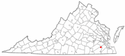
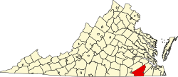
Ivor, Virginia

Last updated

Ivor, Virginia
Outskirts of Ivor, Virginia.jpg
Buildings along General Mahone Blvd. in Ivor
VAMap-doton-Ivor.PNG
Location of Ivor, Virginia
Coordinates: 36°54′24″N76°53′52″W / 36.90667°N 76.89778°W / 36.90667; -76.89778
CountryUnited States
State Virginia
County Southampton
Area
[1]
  Total1.09 sq mi (2.83 km2)
  Land1.09 sq mi (2.82 km2)
  Water0.00 sq mi (0.00 km2)
Elevation
89 ft (27 m)
Population
 (2010)
  Total339
  Estimate 
(2019) [2]
316
  Density289.91/sq mi (111.97/km2)
Time zone UTC−5 (Eastern (EST))
  Summer (DST) UTC−4 (EDT)
ZIP code
23866
Area code(s) 757, 948
FIPS code 51-40232 [3]
GNIS feature ID1495747 [4]

Ivor is an incorporated town in Southampton County, Virginia, United States. It is twenty-three miles northwest of Suffolk. The population was 320 at the 2000 census.

Contents

Geography

According to the United States Census Bureau, the town has a total area of 1.1 square miles (2.8 km2), all of it land.

Demographics

Historical population
CensusPop.Note
1910 297
1920 44349.2%
1930 309−30.2%
1940 3399.7%
1950 37711.2%
1960 3985.6%
1970 44411.6%
1980 403−9.2%
1990 324−19.6%
2000 320−1.2%
2010 3395.9%
2019 (est.)316 [2] −6.8%
U.S. Decennial Census [5]

At the 2000 census, [3] there were 320 people, 135 households and 100 families living in the town. The population density was 293.6 per square mile (113.4/km2). There were 152 housing units at an average density of 139.5 per square mile (53.8/km2). The racial makeup of the town was 76.25% White, 19.69% African American, 1.25% Native American, and 2.81% from two or more races.

There were 135 households, of which 25.9% had children under the age of 18 living with them, 62.2% were married couples living together, 10.4% had a female householder with no husband present, and 25.9% were non-families. 24.4% of all households were made up of individuals, and 17.0% had someone living alone who was 65 years of age or older. The average household size was 2.37 and the average family size was 2.78.

20.0% of the population were under the age of 18, 6.6% from 18 to 24, 24.4% from 25 to 44, 27.5% from 45 to 64, and 21.6% who were 65 years of age or older. The median age was 44 years. For every 100 females, there were 91.6 males. For every 100 females age 18 and over, there were 84.2 males.

The median household income was $34,583 and the median family income was $44,688. Males had a median income of $40,938 and females $18,750. The per capita income was $18,033. About 4.4% of families and 5.1% of the population were below the poverty line, including 5.7% of those under age 18 and 9.8% of those age 65 or over.

Notable people

Related Research Articles

<span class="mw-page-title-main">Littleton, Maine</span> Town in the state of Maine, United States

Littleton is a town in Aroostook County, Maine, United States. The population was 997 at the 2020 census.

<span class="mw-page-title-main">St. Francis, Maine</span> Town in the state of Maine, United States

St. Francis is a town in Aroostook County, Maine, United States on the Canada–United States border at the junction of the St. Francis River and the Saint John River. The population was 438 at the 2020 census. First settled by English speakers from southern Maine, the original population has been supplanted by French-speaking Acadians.

<span class="mw-page-title-main">Westfield, Maine</span> Town in the state of Maine, United States

Westfield is a town in Aroostook County, Maine, United States. The population was 455 at the 2020 census.

<span class="mw-page-title-main">Chesterville, Maine</span> Town in Maine, United States

Chesterville is a town in Franklin County, Maine, United States. The population was 1,328 at the 2020 census.

<span class="mw-page-title-main">West Gardiner, Maine</span> Town in the state of Maine, United States

West Gardiner is a town in Kennebec County, Maine, United States. The population was 3,671 at the 2020 census. West Gardiner is included in the Augusta, Maine micropolitan New England City and Town Area.

Greenwood is a town in Oxford County, Maine, United States. The population was 774 at the 2020 census. The town was named for surveyor Alexander Greenwood. The village of Locke Mills, on State Route 26 in the northern part of Greenwood, is the town's urban center and largest settlement.

Bradley is a town in Penobscot County, Maine, United States. It is part of the Bangor Metropolitan Statistical Area. The population was 1,532 at the 2020 census. The village of Bradley is in the northwestern corner of the town.

LaGrange is a town in Penobscot County, Maine, United States. The population was 635 at the 2020 census.

Plymouth is a town in Penobscot County, Maine, United States. The population was 1,325 at the 2020 census.

Detroit is a town in Somerset County, Maine, United States. The population was 885 at the 2020 census.

Ripley is a town in Somerset County, Maine, United States. The community was named after Brigadier General Eleazer Wheelock Ripley of the War of 1812. The population was 484 at the 2020 census.

<span class="mw-page-title-main">Smithfield, Maine</span> Town in the state of Maine, United States

Smithfield is a town in Somerset County, Maine, United States. The population was 925 at the 2020 census. The town was incorporated on February 29, 1840, making it the only town in Maine incorporated on Leap Day. The town was named after the Rev. Henry Smith, an early settler.

<span class="mw-page-title-main">Cutler, Maine</span> Town in the state of Maine, United States

Cutler is a town in Washington County, Maine, United States. The town was named after Joseph Cutler, an early settler, who hailed from Newburyport, Massachusetts. The population was 524 at the 2020 census.

Meddybemps is a town in Washington County, Maine, United States. The population was 139 at the 2020 census.

<span class="mw-page-title-main">Kelliher, Minnesota</span> Town in Minnesota, United States

Kelliher is a city in Beltrami County, Minnesota, United States. The population was 258 at the 2020 census. Minnesota State Highway 72 is the primary route through Kelliher.

<span class="mw-page-title-main">Urbank, Minnesota</span> City in Minnesota, United States

Urbank is a city in Otter Tail County, Minnesota, United States. The population was 52 at the 2020 census.

<span class="mw-page-title-main">Elmer City, Washington</span> Town in Washington, United States

Elmer City is a town in Okanogan County, Washington, United States. The population was 238 at the 2010 census.

<span class="mw-page-title-main">Worthington, West Virginia</span> Town in West Virginia, United States

Worthington is a town in Marion County, West Virginia, United States. The population was 158 at the 2010 census. Worthington was incorporated in 1893 and named for Colonel George Worthington, an early settler. U.S. Route 19 passes through the town.

<span class="mw-page-title-main">Albright, West Virginia</span> Town in West Virginia, United States

Albright is a town in central Preston County, West Virginia, United States, along the Cheat River. The population was 260 at the 2020 census. A former coal town, it is part of the Morgantown metropolitan area.

<span class="mw-page-title-main">Poca, West Virginia</span> Town in West Virginia, United States

Poca is a town in Putnam County, West Virginia, United States. The population was 875 at the 2020 census. It is part of the Huntington–Ashland metropolitan area. The town derives its name from the Pocatalico River.

References

  1. "2019 U.S. Gazetteer Files". United States Census Bureau. Retrieved August 7, 2020.
  2. 1 2 "Population and Housing Unit Estimates". United States Census Bureau. May 24, 2020. Retrieved May 27, 2020.
  3. 1 2 "U.S. Census website". United States Census Bureau . Retrieved January 31, 2008.
  4. "US Board on Geographic Names". United States Geological Survey. October 25, 2007. Retrieved January 31, 2008.
  5. "Census of Population and Housing". Census.gov. Retrieved June 4, 2015.