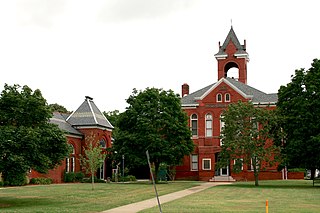
Hallwood, Virginia

Last updated

Hallwood, Virginia
Accomack County Virginia incorporated and unincorporated areas Hallwood highlighted.svg
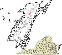
Location in Accomack County and the state of Virginia.
Coordinates: 37°52′39″N75°35′26″W / 37.87750°N 75.59056°W / 37.87750; -75.59056
CountryUnited States
State Virginia
County Accomack
Government
  MayorJ. Jackie Poulson, Jr. [1]
Area
[2]
  Total0.24 sq mi (0.61 km2)
  Land0.24 sq mi (0.61 km2)
  Water0.00 sq mi (0.00 km2)
Elevation
[3]
16 ft (5 m)
Population
 (2010)
  Total206
  Estimate 
(2019) [4]
200
  Density847.46/sq mi (326.87/km2)
Time zone UTC−5 (Eastern (EST))
  Summer (DST) UTC−4 (EDT)
ZIP code
23359
Area code(s) 757, 948
FIPS code 51-34176 [5]
GNIS feature ID1495643 [3]

Hallwood is a town in Accomack County, Virginia, in the United States. As of the 2010 census, the town population was 206. [6]

Contents

History

Wessells Root Cellar was added to the National Register of Historic Places in 1970. [7] Hallwood is the now-southern terminus of the Delmarva Central Railroad.

Geography

Hallwood is located at 37°52′39″N75°35′26″W / 37.877418°N 75.590589°W / 37.877418; -75.590589 (37.877418, 75.590589). [8]

According to the United States Census Bureau, the town has a total area of 0.2 square miles (0.6 km2), all of it land. It lies at an elevation of 16 feet. [3]

Demographics

Historical population
CensusPop.Note
1960 269
1970 254−5.6%
1980 243−4.3%
1990 228−6.2%
2000 29027.2%
2010 206−29.0%
2019 (est.)200 [4] −2.9%
U.S. Decennial Census [9]

At the 2000 census there were 290 people, 100 households, and 73 families living in the town. The population density was 1,184.8 people per square mile (466.5/km2). There were 121 housing units at an average density of 494.3 per square mile (194.7/km2). The racial makeup of the town was 84.14% White, 4.48% African American, 1.03% Native American, 8.97% from other races, and 1.38% from two or more races. Hispanic or Latino of any race were 12.76%. [5]

Of the 100 households 37.0% had children under the age of 18 living with them, 56.0% were married couples living together, 12.0% had a female householder with no husband present, and 27.0% were non-families. 22.0% of households were one person and 15.0% were one person aged 65 or older. The average household size was 2.90 and the average family size was 3.38.

The age distribution was 33.4% under the age of 18, 5.9% from 18 to 24, 26.6% from 25 to 44, 21.7% from 45 to 64, and 12.4% 65 or older. The median age was 32 years. For every 100 females, there were 101.4 males. For every 100 females aged 18 and over, there were 101.0 males.

The median household income was $29,861 and the median family income was $30,000. Males had a median income of $20,625 versus $19,773 for females. The per capita income for the town was $13,351. About 8.8% of families and 14.5% of the population were below the poverty line, including 21.4% of those under the age of eighteen and 3.9% of those sixty-five or over.

Climate

The climate in this area is characterized by hot, humid summers and generally mild to cool winters. According to the Köppen Climate Classification system, Hallwood has a humid subtropical climate, abbreviated "Cfa" on climate maps. [10]

Related Research Articles

<span class="mw-page-title-main">Accomac, Virginia</span> Town in Virginia, United States

Accomac is a town in and the county seat of Accomack County, Virginia, United States. The population was 526 at the 2020 census.

<span class="mw-page-title-main">Bloxom, Virginia</span> Town in Virginia, United States

Bloxom is a town in Accomack County, Virginia, United States. The population was 387 at the 2010 census.

<span class="mw-page-title-main">Chincoteague, Virginia</span> Town in Virginia, United States

Chincoteague is a town in Accomack County, Virginia, U.S. The town includes the whole of Chincoteague Island and an area of adjacent water. The population was 2,941 at the 2010 census. The town is a tourist gateway to the Chincoteague National Wildlife Refuge on adjacent Assateague Island, the location of a popular recreational beach and home of the Virginia herd of Chincoteague Ponies. These ponies and the annual Pony Swim are the subject of Marguerite Henry's 1947 children's book Misty of Chincoteague, which was made into the 1961 family film Misty, filmed on location.
<span class="mw-page-title-main">Keller, Virginia</span> Town in Virginia, United States

Keller is a town in Accomack County, Virginia, United States. The population was 178 at the 2010 census.
<span class="mw-page-title-main">Melfa, Virginia</span> Town in Virginia, United States

Melfa is a town in Accomack County on the Eastern Shore of Virginia in the United States. The population was 408 at the 2010 census.

<span class="mw-page-title-main">Onley, Virginia</span> Town in Virginia, United States

Onley is a town in Accomack County, Virginia, United States. The population was 516 at the 2010 census.

<span class="mw-page-title-main">Painter, Virginia</span> Town in Virginia, United States

Painter is a town in Accomack County, Virginia, United States. The population was recorded at 229 at the 2010 census.

<span class="mw-page-title-main">Parksley, Virginia</span> Town in Virginia, United States

Parksley is a town in Accomack County, Virginia, United States. The population was 842 at the 2010 census. It is home to the Eastern Shore Railway Museum.

<span class="mw-page-title-main">Urbanna, Virginia</span> Town in Virginia, United States

Urbanna is a town in Middlesex County, Virginia, United States. Urbanna means “City of Anne” and was named in honor of England's Queen Anne. The population was 476 at the 2010 census.

<span class="mw-page-title-main">Cheriton, Virginia</span> Town in Virginia, United States

Cheriton is a town in Northampton County, Virginia, United States. The population was 486 at the 2020 census.

<span class="mw-page-title-main">Nassawadox, Virginia</span> Town in Virginia, United States

Nassawadox is a town in Northampton County, Virginia, United States. Per the 2020 census, the population was 533. The town, with an area of 0.4 square miles (1.0 km2), is located on U.S. Route 13 on Virginia's Eastern Shore, approximately five miles south of Exmore and 25 miles (40 km) north of the Chesapeake Bay Bridge-Tunnel.

<span class="mw-page-title-main">Goshen, Virginia</span> Town in Virginia, United States

Goshen is a town in Rockbridge County, Virginia, United States. The population was 361 in the 2010 census.
<span class="mw-page-title-main">Toms Brook, Virginia</span> Town in Virginia, United States

Toms Brook is a town in Shenandoah County, Virginia, United States. The population was 258 at the 2010 census.

<span class="mw-page-title-main">Grantsville, West Virginia</span> Town in West Virginia, United States

Grantsville is a town in Calhoun County, West Virginia, United States. The population was 482 at the 2020 census. It is the county seat of Calhoun County. The town was established along the Little Kanawha River in 1865 and named for Ulysses S. Grant. Grantsville is home to Wayne Underwood Park, which includes a .25-mile-long (0.40 km) walking trail, and to the annual West Virginia Wood Festival.

<span class="mw-page-title-main">Iaeger, West Virginia</span> Town in West Virginia, United States

Iaeger is a town in McDowell County, West Virginia, United States. The population was 257 at the 2020 census.
<span class="mw-page-title-main">Smithfield, West Virginia</span> Town in West Virginia, United States

Smithfield is a town in Wetzel County, West Virginia, United States. The population was 103 at the 2020 census.

<span class="mw-page-title-main">Elizabeth, West Virginia</span> Town in West Virginia, United States

Elizabeth is a town in and the county seat of Wirt County, West Virginia, United States, situated along the Little Kanawha River. The population was 724 as of the 2020 census.

<span class="mw-page-title-main">Oceana, West Virginia</span> Town in West Virginia, United States

Oceana is a town in Wyoming County, West Virginia. The population was 1,462 at the time of the 2020 census. Oceana is the oldest city in Wyoming County and was the county seat until 1907.
<span class="mw-page-title-main">Millington, Maryland</span> Town in Maryland, United States

Millington is a town in Kent and Queen Anne's counties in the U.S. state of Maryland. The population was 642 at the 2010 census. Millington is the head of navigation for the Chester River.

<span class="mw-page-title-main">Belle Haven, Accomack County, Virginia</span> Town in Virginia, United States

Belle Haven is a town in Accomack and Northampton counties in the U.S. state of Virginia. The population was 532 at the 2010 census.
References

  1. "Mayors and Town Council Members". Accomack County, Virginia Official Website. Retrieved February 16, 2023.
  2. "2019 U.S. Gazetteer Files". United States Census Bureau. Retrieved August 7, 2020.
  3. 1 2 3 U.S. Geological Survey Geographic Names Information System: Hallwood, Virginia
  4. 1 2 "Population and Housing Unit Estimates". United States Census Bureau. May 24, 2020. Retrieved May 27, 2020.
  5. 1 2 "U.S. Census website". United States Census Bureau . Retrieved January 31, 2008.
  6. "Profile of General Population and Housing Characteristics: 2010 Demographic Profile Data (DP-1): Hallwood town, Virginia". United States Census Bureau . Retrieved April 5, 2012.
  7. "National Register Information System". National Register of Historic Places . National Park Service. July 9, 2010.
  8. "US Gazetteer files: 2010, 2000, and 1990". United States Census Bureau. February 12, 2011. Retrieved April 23, 2011.
  9. "Census of Population and Housing". Census.gov. Retrieved June 4, 2015.
  10. Climate Summary for Hallwood, Virginia