Toms Brook, Virginia

Last updated

Toms Brook, Virginia
StPetersLutheranTomsBrook.jpg
St. Peter's Lutheran Church (1904)
VAMap-doton-TomsBrook.PNG
Location of Toms Brook, Virginia
Coordinates: 38°56′50″N78°26′23″W / 38.94722°N 78.43972°W / 38.94722; -78.43972
CountryUnited States
State Virginia
County Shenandoah
Area
[1]
  Total0.13 sq mi (0.33 km2)
  Land0.13 sq mi (0.33 km2)
  Water0.00 sq mi (0.00 km2)
Elevation
702 ft (214 m)
Population
 (2010)
  Total258
  Estimate 
(2019) [2]
272
  Density2,158.73/sq mi (832.95/km2)
Time zone UTC−5 (Eastern (EST))
  Summer (DST) UTC−4 (EDT)
ZIP code
22660
Area code 540
FIPS code 51-79024 [3]
GNIS feature ID1500231 [4]

Toms Brook is a town in Shenandoah County, Virginia, United States. The population was 258 at the 2010 census.

Contents

History

Toms Brook School Toms Brook VA School Sept 2013.jpeg
Toms Brook School

During the American Civil War, the Battle of Tom's Brook was fought nearby, a Union victory that became dubbed "the Woodstock Races."

The Toms Brook School was listed on the National Register of Historic Places in 2011. [5]

Geography

Toms Brook is located at 38°56′50″N78°26′23″W / 38.94722°N 78.43972°W / 38.94722; -78.43972 (38.947214, 78.439657). [6]

According to the United States Census Bureau, the town has a total area of 0.2 square miles (0.4 km2), all of it land.

Climate

The climate in this area is characterized by hot, humid summers and generally mild to cool winters. According to the Köppen Climate Classification system, Toms Brook has a humid subtropical climate, abbreviated "Cfa" on climate maps. [7]

US 11 in Toms Brook 2018-10-12 12 14 18 View north along U.S. Route 11 (Main Street) just south of Toms Brook Drive in Toms Brook, Shenandoah County, Virginia.jpg
US 11 in Toms Brook

Transportation

U.S. Route 11 is the only significant highway directly serving Toms Brook. US 11 serves as a local service road for nearby Interstate 81. The closest interchange on I-81 is Exit 291, which connects to Toms Brook via US 11 and Mount Olive Road (SR 651).

Demographics

Historical population
CensusPop.Note
1860 598
1930 240
1940 219−8.7%
1950 25616.9%
1960 244−4.7%
1970 2585.7%
1980 226−12.4%
1990 2270.4%
2000 25512.3%
2010 2581.2%
2019 (est.)272 [2] 5.4%
U.S. Decennial Census [8]

At the 2000 census there were 255 people, 100 households, and 70 families living in the town. The population density was 1,652.4 people per square mile (656.4/km2). There were 103 housing units at an average density of 667.4 per square mile (265.1/km2). The racial makeup of the town was 94.90% White, 1.18% African American, 0.78% Native American, 0.39% from other races, and 2.75% from two or more races. Hispanic or Latino of any race were 0.78%. [3]

Of the 100 households 30.0% had children under the age of 18 living with them, 53.0% were married couples living together, 12.0% had a female householder with no husband present, and 30.0% were non-families. 24.0% of households were one person and 10.0% were one person aged 65 or older. The average household size was 2.55 and the average family size was 3.07.

The age distribution was 22.4% under the age of 18, 9.4% from 18 to 24, 32.5% from 25 to 44, 26.3% from 45 to 64, and 9.4% 65 or older. The median age was 37 years. For every 100 females, there were 90.3 males. For every 100 females aged 18 and over, there were 90.4 males.

The median household income was $38,214 and the median family income was $44,688. Males had a median income of $27,750 versus $20,972 for females. The per capita income for the town was $16,712. About 2.5% of families and 5.9% of the population were below the poverty line, including 3.4% of those under the age of eighteen and none of those sixty-five or over.

Related Research Articles

<span class="mw-page-title-main">Brooker, Florida</span> Town in Florida, United States

Brooker is a town in Bradford County, Florida, United States. The Town of Brooker is part of the North Florida region. The population was 322 at the 2020 census.

<span class="mw-page-title-main">Ocean City, Florida</span> CDP in Florida, United States

Ocean City is a census-designated place (CDP) in Okaloosa County, Florida, United States. The population was 5,594 at the 2000 census. It is part of the Fort Walton Beach–Crestview–Destin Metropolitan Statistical Area.

<span class="mw-page-title-main">Horton, Kansas</span> City in Brown County, Kansas

Horton is a city in Brown County, Kansas, United States. As of the 2020 census, the population of the city was 1,523.
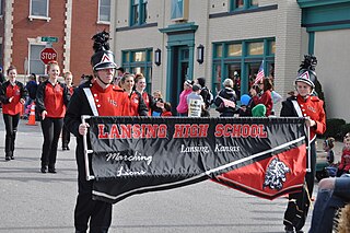
<span class="mw-page-title-main">Lansing, Kansas</span> City in Kansas, United States

Lansing is a city in Leavenworth County, Kansas, United States. It is situated along the west side of the Missouri River and Kansas-Missouri state border. As of the 2020 census, the population of the city was 11,239. It is the second most populous city of Leavenworth County and is a part of the Kansas City metropolitan area. The Lansing Correctional Facility, which includes the state's main maximum-security prison, is located in Lansing.

Cooper is a town in Washington County, Maine, United States. The community was named after General John Cooper, a landowner. The population was 168 at the 2020 census.

Jonesboro is a town in Washington County, Maine, United States. The town was named for John Coffin Jones, a landholder. The population was 587 at the 2020 census.

<span class="mw-page-title-main">Sutcliffe, Nevada</span> CDP in Nevada, United States

Sutcliffe is a census-designated place (CDP) in Washoe County, Nevada, United States. The population was 253 at the 2010 census. It is part of the Reno–Sparks Metropolitan Statistical Area.
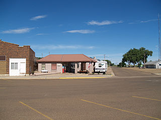
<span class="mw-page-title-main">Hettinger, North Dakota</span> City in North Dakota, United States

Hettinger is a city in and the county seat of Adams County, North Dakota, United States. The population was 1,074 at the 2020 census.

Parker is a census-designated place (CDP) in Greenville County, South Carolina, United States. The population was 11,431 at the 2010 census, up from 10,760 in 2000. It is part of the Greenville–Mauldin–Easley Metropolitan Statistical Area.
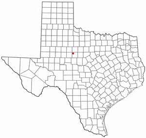
<span class="mw-page-title-main">Trent, Texas</span> Town in Texas, United States

Trent is a town in Taylor County, Texas, United States, that was established in 1881. The population was 337 at the 2010 census. It is part of the Abilene, Texas Metropolitan Statistical Area. Trent, Texas was named in honor of West Texas pioneer and cattleman, Isaac Riley Trent.

<span class="mw-page-title-main">Morristown, Vermont</span> Town in Vermont, United States

Morristown is a town in Lamoille County, Vermont, United States. As of the 2020 census, the population was 5,434. Morristown is the largest town by population in Lamoille County, and its central village of Morrisville serves as the county's main commercial center.

<span class="mw-page-title-main">Hallwood, Virginia</span> Town in Virginia, United States

Hallwood is a town in Accomack County, Virginia, in the United States. As of the 2010 census, the town population was 206.

<span class="mw-page-title-main">Broadway, Virginia</span> Town in Virginia, United States

Broadway is a town in Rockingham County, Virginia, United States. The population was 3,691 at the 2010 census. It is included in the Harrisonburg Metropolitan Statistical Area.

<span class="mw-page-title-main">New Market, Virginia</span> Town in Virginia, United States

New Market is a town in Shenandoah County, Virginia, United States. Founded as a small crossroads trading town in the Shenandoah Valley, it has a population of 2,155 as of the most recent 2020 U.S. census. The north–south U.S. 11 and the east–west U.S. 211 pass near it and cross Massanutten Mountain at the town's titular gap.

<span class="mw-page-title-main">Petersburg, West Virginia</span> City in West Virginia, United States

Petersburg is a city in Grant County, West Virginia, United States. The population was 2,251 at the 2020 census. It is the county seat of Grant County.
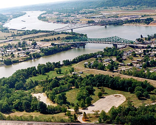
<span class="mw-page-title-main">Henderson, West Virginia</span> Unincorporated Town in West Virginia, United States

Henderson is an unincorporated community and former town in Mason County, West Virginia, United States, at the confluence of the Ohio and Kanawha Rivers. The population was 231 at the 2020 census. It is part of the Point Pleasant, WV–OH Micropolitan Statistical Area. The town was incorporated in 1893 and named for Samuel Bruce Henderson, who owned the townsite at the time. The town was unincorporated following a public hearing on August 11, 2022.

<span class="mw-page-title-main">Huttonsville, West Virginia</span> Town in West Virginia, United States

Huttonsville is a town in Randolph County, West Virginia, United States, along the Tygart Valley River. The population was 163 at the 2020 census.
<span class="mw-page-title-main">Smithfield, West Virginia</span> Town in West Virginia, United States

Smithfield is a town in Wetzel County, West Virginia, United States. The population was 103 at the 2020 census.

<span class="mw-page-title-main">Okauchee Lake, Wisconsin</span> CDP in Wisconsin, United States

Okauchee Lake is a census-designated place (CDP) in Waukesha County, Wisconsin, United States. The population was 5,094 at the 2020 census. Okauchee Lake is located in the town of Oconomowoc.

<span class="mw-page-title-main">Black Creek (town), Wisconsin</span> Town in Wisconsin, United States

Black Creek is a town in Outagamie County, Wisconsin, United States. The population was 1,251 at the 2020 census. The Village of Black Creek and the unincorporated community of Binghamton are located in the town. The unincorporated community of Five Corners is also located partially in the town.

References

  1. "2019 U.S. Gazetteer Files". United States Census Bureau. Retrieved August 7, 2020.
  2. 1 2 "Population and Housing Unit Estimates". United States Census Bureau. May 24, 2020. Retrieved May 27, 2020.
  3. 1 2 "U.S. Census website". United States Census Bureau . Retrieved January 31, 2008.
  4. "US Board on Geographic Names". United States Geological Survey. October 25, 2007. Retrieved January 31, 2008.
  5. "National Register of Historic Places Listings". Weekly List of Actions Taken on Properties: 8/15/11 through 8/19/11. National Park Service. August 26, 2011.
  6. "US Gazetteer files: 2010, 2000, and 1990". United States Census Bureau. February 12, 2011. Retrieved April 23, 2011.
  7. Climate Summary for Toms Brook, Virginia
  8. "Census of Population and Housing". Census.gov. Retrieved June 4, 2015.