Jarratt, Virginia

Last updated

Jarratt, Virginia
Town of Jarratt (VA) Welcome Sign; VA 139 & Henry Road.jpg
Welcome sign at VA 139 and Henry Road in Jarratt.
VAMap-doton-Jarratt.PNG
Location of Jarratt in Virginia
Coordinates: 36°48′57″N77°28′11″W / 36.81583°N 77.46972°W / 36.81583; -77.46972
Country United States
State Virginia
Counties Greensville, Sussex
Area
[1]
  Total1.26 sq mi (3.26 km2)
  Land1.26 sq mi (3.26 km2)
  Water0.00 sq mi (0.00 km2)
Elevation
151 ft (46 m)
Population
 (2020)
  Total652
  Density520/sq mi (200/km2)
Time zone UTC-5 (Eastern (EST))
  Summer (DST) UTC-4 (EDT)
ZIP codes
23867, 23870
Area code 434
FIPS code 51-40536
GNIS feature ID 1495754
Website www.jarrattva.com

Jarratt is a town in Greensville and Sussex counties in the U.S. state of Virginia. The population was 652 at the 2020 census. [2] In 1848, Jarratt was a stop on the Petersburg Railroad. Jaratt was incorporated in 1938. [3]

Contents

Geography

Jarratt is located on the border of Greensville and Sussex counties, just west of Interstate 95, which provides access from Exit 20 (Henry Road). It is 10 miles (16 km) north of Emporia and 33 miles (53 km) south of Petersburg via I-95.

The former Petersburg Railroad line within the town was acquired by the Atlantic Coast Line Railroad of Virginia, which is today part of the CSX North End Subdivision. It also contained a junction with the main line of the Virginian Railway, which was acquired by the Norfolk and Western Railway, and later abandoned, with the exception of a short spur west from the North End Subdivision to the Georgia-Pacific Jarratt Sheathing Plant.

According to the United States Census Bureau, the town has a total area of 1.3 square miles (3.3 km2), all land. [4]

Government and infrastructure

The post office on VA 139 on the Sussex-Greensville County Line. USPS, Jarratt, VA; 23867.jpg
The post office on VA 139 on the Sussex-Greensville County Line.

The United States Postal Service operates the Jarratt Post Office, [5] which is directly on the Sussex-Greensville County Line.

The Virginia Department of Corrections operates the Greensville Correctional Center in unincorporated Greensville County, near Jarratt. [6] Greensville houses the Commonwealth of Virginia execution chamber, which has been obsolete since the abolishment of capital punishment in 2021. [7] [8]

Demographics

Historical population
CensusPop.Note
1940 458
1950 57425.3%
1960 6085.9%
1970 591−2.8%
1980 6143.9%
1990 556−9.4%
2000 5895.9%
2010 6388.3%
2020 6522.2%
U.S. Decennial Census [9]
2010-2020 [10]

2020 census

Jarratt town, Virginia - Demographic Profile
(NH = Non-Hispanic)
Note: the US Census treats Hispanic/Latino as an ethnic category. This table excludes Latinos from the racial categories and assigns them to a separate category. Hispanics/Latinos may be of any race.
Race / EthnicityPop 2010 [11] Pop 2020 [10] % 2010% 2020
White alone (NH)30326147.49%40.03%
Black or African American alone (NH)31335649.06%54.60%
Native American or Alaska Native alone (NH)530.78%0.46%
Asian alone (NH)000.00%0.00%
Pacific Islander alone (NH)000.00%0.00%
Some Other Race alone (NH)030.00%0.46%
Mixed Race/Multi-Racial (NH)3150.47%2.30%
Hispanic or Latino (any race)14142.19%2.15%
Total638652100.00%100.00%

2010 census

As of the census [12] of 2000, there were 589 people, 271 households, and 175 families residing in the town. The population density was 464.8 people per square mile (179.1/km2). There were 293 housing units at an average density of 231.2 per square mile (89.1/km2). The racial makeup of the town was 63.16% White, 35.99% African American, 0.17% Asian, 0.34% from other races, and 0.34% from two or more races.

There were 271 households, out of which 30.3% had children under the age of 18 living with them, 44.6% were married couples living together, 15.5% had a female householder with no husband present, and 35.1% were non-families. 32.5% of all households were made up of individuals, and 16.6% had someone living alone who was 65 years of age or older. The average household size was 2.17 and the average family size was 2.71.

In the town, the population was spread out, with 22.4% under the age of 18, 7.3% from 18 to 24, 27.0% from 25 to 44, 25.6% from 45 to 64, and 17.7% who were 65 years of age or older. The median age was 41 years. For every 100 females, there were 86.4 males. For every 100 females aged 18 and over, there were 75.8 males.

The median income for a household in the town was $32,125, and the median income for a family was $38,942. Males had a median income of $31,319 versus $30,417 for females. The per capita income for the town was $24,291. About 11.4% of families and 13.0% of the population were below the poverty line, including 13.3% of those under age 18 and 8.5% of those age 65 or over.

Related Research Articles

<span class="mw-page-title-main">Southampton County, Virginia</span> County in Virginia, United States

Southampton County is a county located on the southern border of the Commonwealth of Virginia. North Carolina is to the south. As of the 2020 census, the population was 17,996. Its county seat is Courtland.

<span class="mw-page-title-main">Prince George County, Virginia</span> County in Virginia, United States

Prince George County is a county located in the Commonwealth of Virginia. As of the 2020 census, the population was 43,010. Its county seat is Prince George.

<span class="mw-page-title-main">Nottoway County, Virginia</span> County in Virginia, United States

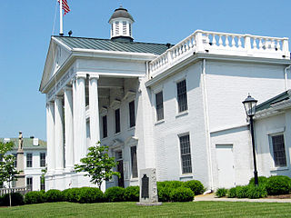
Nottoway County is a county located in the Commonwealth of Virginia. As of the 2020 census, the population was 15,642. Its county seat is Nottoway. It is situated south of the James River, thus making it a part of the Southside Virginia Region.

<span class="mw-page-title-main">Greensville County, Virginia</span> County in Virginia, United States

Greensville County is a county located in the Commonwealth of Virginia. As of the 2020 census, the population was 11,391. Its county seat is Emporia.

<span class="mw-page-title-main">Emporia, Virginia</span> Independent city in Virginia, United States

Emporia is an independent city in the Commonwealth of Virginia, surrounded by Greensville County, United States. Emporia and a predecessor town have been the county seat of Greensville County since 1791. As of the 2020 census, the population was 5,766, making it the third-least populous city in Virginia. The Bureau of Economic Analysis combines the city of Emporia with surrounding Greensville County for statistical purposes.

<span class="mw-page-title-main">Dinwiddie County, Virginia</span> County in Virginia, United States

Dinwiddie County is a county located in the Commonwealth of Virginia. As of the 2020 census, the population was 27,947. Its county seat is Dinwiddie.

<span class="mw-page-title-main">Hardeman County, Tennessee</span> County in Tennessee, United States

Hardeman County is a county located in the U.S. state of Tennessee. As of the 2020 census, the population was 25,462. Its county seat is Bolivar.
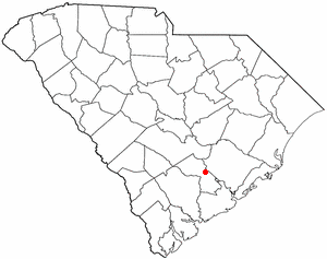
<span class="mw-page-title-main">Alberta, Virginia</span> Town in Virginia, United States

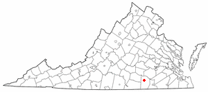
Alberta is a town in Brunswick County, Virginia, United States. The population was 302 at the 2020 census. It is home to the Christanna Campus of Southside Virginia Community College.

<span class="mw-page-title-main">Chester, Virginia</span> CDP in Virginia, United States

Chester is a census-designated place (CDP) in Chesterfield County, Virginia, United States. Per the 2020 census, the population was 23,414.

<span class="mw-page-title-main">McKenney, Virginia</span> Town in Virginia, United States

McKenney is an incorporated town in Dinwiddie County, Virginia, United States. The population was 483 at the 2010 census.

<span class="mw-page-title-main">Boydton, Virginia</span> Town in Virginia, United States

Boydton is a town in Mecklenburg County, Virginia, United States. The population was 302 at the 2020 census. It is the county seat of Mecklenburg County, and it is near Kerr Lake.

<span class="mw-page-title-main">Crewe, Virginia</span> Town in Virginia, United States

Crewe is a town in Nottoway County, Virginia, United States. The population was 2,262 at the 2020 census.

<span class="mw-page-title-main">Dendron, Virginia</span> Town in Virginia, United States

Dendron is a town in Surry County, Virginia, United States. The population was 251 at the 2020 census. Sculptor Leslie Garland Bolling was born in Dendron, as was mayor of Hopewell, Virginia, Curtis W. Harris.

<span class="mw-page-title-main">Wakefield, Virginia</span> Town in Virginia, United States

Wakefield is an incorporated town in Sussex County, Virginia, United States. Per the 2020 census, the population was 729.

<span class="mw-page-title-main">Waverly, Virginia</span> Town in Virginia, United States

Waverly is an incorporated town in Sussex County, Virginia, United States. Per the 2020 census, the population was 1,955.

<span class="mw-page-title-main">Flatwoods, West Virginia</span> Town in West Virginia, United States

Flatwoods is a town in Braxton County, West Virginia, United States, located approximately one mile from exit 67 of Interstate 79.

<span class="mw-page-title-main">Petersburg, West Virginia</span> City in West Virginia, United States

Petersburg is a city in Grant County, West Virginia, United States. The population was 2,251 at the 2020 census. It is the county seat of Grant County.

<span class="mw-page-title-main">Northfork, West Virginia</span> Town in West Virginia, United States

Northfork is a town in McDowell County, West Virginia, United States, located on U.S. Route 52 between Welch and Bluefield.

<span class="mw-page-title-main">Newburg, West Virginia</span> Town in West Virginia, United States

Newburg is a town in western Preston County, West Virginia, United States. The population was 275 at the 2020 census. It is part of the Morgantown metropolitan area.

<span class="mw-page-title-main">Sussex County, Virginia</span> County in Virginia, United States

Sussex County is a rural county located in the southeast of the Commonwealth of Virginia. As of the 2020 census, the population was 10,829. Its county seat is Sussex. It was formed in 1754 from Surry County. The county is named after the county of Sussex, England.

References

  1. "2019 U.S. Gazetteer Files". United States Census Bureau. Retrieved August 7, 2020.
  2. "Jarratt town, Virginia". United States Census Bureau . Retrieved January 30, 2022.
  3. "Home : Town of Jarratt, Greensville County Virginia". Archived from the original on August 1, 2015. Retrieved September 1, 2015. "Incorporated by Order of the Circuit Court of Sussex County, June 20, 1938"
  4. "Geographic Identifiers: 2010 Demographic Profile Data (G001): Jarratt town, Virginia". American Factfinder. U.S. Census Bureau. Retrieved March 29, 2017.[ dead link ]
  5. "Post Office Location - JARRATT Archived 2012-06-14 at the Wayback Machine ." United States Postal Service. Retrieved on August 22, 2010.
  6. "Greensville Correctional Center/Greensville Work Center (major male institution) Archived 2010-08-19 at the Wayback Machine ." Virginia Department of Corrections. Retrieved on August 22, 2010.
  7. "Virginia Death Row/Execution Facts ." My FOX DC. Tuesday November 10, 2009. Retrieved on August 22, 2010.
  8. "Northam signs ban on death penalty, making Virginia the first of the old Confederate states to do so - The Washington Post". The Washington Post . March 24, 2021. Archived from the original on March 24, 2021. Retrieved February 9, 2022.
  9. "Census of Population and Housing from 1790". US Census Bureau . Retrieved January 24, 2022.
  10. 1 2 "P2 HISPANIC OR LATINO, AND NOT HISPANIC OR LATINO BY RACE - 2020: DEC Redistricting Data (PL 94-171) - Jarratt town, Virginia". United States Census Bureau .
  11. "P2 HISPANIC OR LATINO, AND NOT HISPANIC OR LATINO BY RACE - 2010: DEC Redistricting Data (PL 94-171) - Jarratt town, Virginia". United States Census Bureau .
  12. "U.S. Census website". United States Census Bureau . Retrieved January 31, 2008.