Burkeville, Virginia

Last updated

Burkeville, Virginia
Burkeville, Virginia - panoramio (1).jpg
Central Burkeville
VAMap-doton-Burkeville.PNG
Location of Burkeville, Virginia
Coordinates: 37°11′14″N78°12′6″W / 37.18722°N 78.20167°W / 37.18722; -78.20167
Country United States
State Virginia
County Nottoway
Area
[1]
  Total1.01 sq mi (2.61 km2)
  Land1.00 sq mi (2.59 km2)
  Water0.01 sq mi (0.02 km2)
Elevation
548 ft (167 m)
Population
 (2010)
  Total432
  Estimate 
(2019) [2]
399
  Density398.60/sq mi (153.92/km2)
Time zone UTC-5 (Eastern (EST))
  Summer (DST) UTC-4 (EDT)
ZIP code
23922
Area code 434
FIPS code 51-11560 [3]
GNIS feature ID1464115 [4]

Burkeville is an incorporated town in Nottoway County, Virginia, United States. The population was 432 at the 2010 census. The source of the town name is disputed. The town is located at the crossroads of U.S. routes 360 and 460.

Contents

Major employers

History

The Town of Burkeville, Virginia was established in 1877.

Burksville and Jennings Ordinary area of Nottoway County, Virginia, 1864 Map of Burksville and Jennings Ordinary Area of Nottoway County, Virginia, from 1864.jpg
Burksville and Jennings Ordinary area of Nottoway County, Virginia, 1864

Burkeville was named either for a tavern or for a Samuel Burke, and was formerly called "Burke's Junction". It was founded at the junction of the Richmond and Danville Railroad and the Southside Railroad in the mid-nineteenth century. [5] The Southside became the Atlantic, Mississippi and Ohio Railroad in 1870, then a line in the Norfolk and Western Railway, and finally a line in the Norfolk Southern Railway.

The rail line from Burkeville to Pamplin City, after being abandoned, was converted by the Virginia Department of Parks and Recreation into High Bridge Trail State Park. The state of Virginia has still yet to complete the portion from approximately 1 mile out into the town of Burkeville as of July 1, 2023.

The last major Civil War battle in the Appomattox campaign was fought nearby at Sayler's Creek on April 6, 1865. Here were unconditionally surrendered more men than in any other battle on American soil. General Robert E. Lee's depleted forces lost over 7,000 men killed, wounded, or taken prisoner either at Sayler's Creek or at General John B. Gordon's engagement the same day, a few miles west. Lee surrendered at Appomattox three days later.

Ella Graham Agnew was appointed in 1910 by the United States Department of Agriculture to be the first State Agent for women, and was the first woman to be appointed by the Department to represent it in the field. She had moved to the town as a baby and was later buried in the community's Sunset Cemetery.

Burke's Tavern, Hyde Park, and Inverness are listed on the National Register of Historic Places. [6]

Geography

Burkeville is located at 37°11′14″N78°12′6″W / 37.18722°N 78.20167°W / 37.18722; -78.20167 (37.187, -78.202). [7] According to the United States Census Bureau, the town has a total area of 1.0 square miles (2.6 km2), of which 1.0 square miles (2.6 km2) is land and 0.99% is water.

Twin Lakes State Park (formerly Prince Edward–Goodwin Lake State Park) is to the west of town.

Demographics

Historical population
CensusPop.Note
1880 237
1890 40470.5%
1900 51026.2%
1910 65328.0%
1920 514−21.3%
1930 75546.9%
1940 658−12.8%
1950 6955.6%
1960 7051.4%
1970 703−0.3%
1980 606−13.8%
1990 535−11.7%
2000 489−8.6%
2010 432−11.7%
2019 (est.)399 [2] −7.6%
U.S. Decennial Census [8]

As of the census [3] of 2000, there were 489 people, 206 households, and 134 families residing in the town. The population density was 486.3 people per square mile (186.9/km2). There were 248 housing units, at an average density of 246.6 per square mile (94.8/km2). The racial makeup of the town was 62.78% White, 34.76% African American, 1.02% from other races, 1.43% from two or more races, and 1.43% Hispanic or Latino of any race.

There were 206 households, out of which 27.7% had children under the age of 18 living with them, 43.7% were married couples living together, 18.4% had a female householder with no husband present, and 34.5% were non-families. 30.6% of all households were made up of individuals, and 16.0% had someone living alone who was 65 or older. The average household size was 2.37, and the average family size was 2.95.

23.3% of the population was under the age of 18, 8.8% from 18 to 24, 25.2% from 25 to 44, 24.1% from 45 to 64, and 18.6% aged 65 or older. The median age was 40 years. For every 100 females there were 91.8 males. For every 100 females age 18 and over, there were 90.4 males.

The median household income was $29,821, and the median family income was $39,688. Males had a median income of $23,542, versus $21,442 for females. The per capita income for the town was $15,947. About 7.8% of families and 12.3% of the population were below the poverty line, including 16.1% of those under age 18 and 8.7% of those age 65 or over.

Related Research Articles

<span class="mw-page-title-main">Prince Edward County, Virginia</span> County in Virginia, United States

Prince Edward County is located in the Commonwealth of Virginia. As of the 2020 census, the population was 21,849. Its county seat is Farmville.

<span class="mw-page-title-main">Nottoway County, Virginia</span> County in Virginia, United States

Nottoway County is a county located in the Commonwealth of Virginia. As of the 2020 census, the population was 15,642. Its county seat is Nottoway. It is situated south of the James River, thus making it a part of the Southside Virginia Region.

<span class="mw-page-title-main">Cumberland County, Virginia</span> County in Virginia, United States

Cumberland County is a county located in the Commonwealth of Virginia, United States. As of the 2020 census, the population was 9,675. Its county seat is Cumberland.

<span class="mw-page-title-main">Amelia County, Virginia</span> County in Virginia, United States

Amelia County is a county located just southwest of Richmond in the Commonwealth of Virginia, United States. The county is located in Central Virginia and is included in the Greater Richmond Region. Its county seat is Amelia Court House.

<span class="mw-page-title-main">Broad Top City, Pennsylvania</span> Borough in Pennsylvania, United States

Broad Top City is a borough in Huntingdon County, Pennsylvania, United States. The population was 371 at the 2020 census, a decline from the figure of 452 tabulated in 2010.

<span class="mw-page-title-main">Keller, Virginia</span> Town in Virginia, United States

Keller is a town in Accomack County, Virginia, United States. The population was 178 at the 2010 census.

<span class="mw-page-title-main">Dillwyn, Virginia</span> Town in Virginia, United States

Dillwyn is an incorporated town in Buckingham County, Virginia, in the United States. The population was 447 at the 2010 census.

<span class="mw-page-title-main">Keysville, Virginia</span> Town in Virginia, United States

Keysville is a town in Charlotte County, Virginia, United States. The population was 832 at the 2010 census. One of two branches of Southside Virginia Community College is in Keysville. The surrounding area has tobacco and mixed farming.

<span class="mw-page-title-main">Phenix, Virginia</span> Town in Virginia, United States

Phenix is a town in Charlotte County, Virginia, United States. The population was 226 at the 2010 census.

<span class="mw-page-title-main">Glen Lyn, Virginia</span> Town in Virginia, United States

Glen Lyn is a town in Giles County, Virginia, United States, at the confluence of the East and New rivers. The population was 115 at the 2010 census, down from 151 at the 2000 census. It is part of the Blacksburg–Christiansburg Metropolitan Statistical Area.

<span class="mw-page-title-main">Blackstone, Virginia</span> Town in Virginia, United States

Blackstone, formerly named Blacks and Whites, and then Bellefonte, is a town in Nottoway County in the U.S. state of Virginia. The population was 3,621 at the 2010 census.

<span class="mw-page-title-main">Crewe, Virginia</span> Town in Virginia, United States

Crewe is a town in Nottoway County, Virginia, United States. The population was 2,262 at the 2020 census.

<span class="mw-page-title-main">Broadway, Virginia</span> Town in Virginia, United States

Broadway is a town in Rockingham County, Virginia, United States. The population was 3,691 at the 2010 census. It is included in the Harrisonburg Metropolitan Statistical Area.

<span class="mw-page-title-main">Edinburg, Virginia</span> Town in Virginia, United States

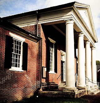
Edinburg is a town in Shenandoah County, Virginia, United States. The population was 1,041 at the 2010 census.

<span class="mw-page-title-main">Capron, Virginia</span> Town in Virginia, United States

Capron is a town in Southampton County, Virginia, United States. The population was 141 at the 2020 census.

<span class="mw-page-title-main">Stony Creek, Virginia</span> Town in Virginia, United States

Stony Creek is a town in Sussex County, Virginia, United States. The population was 198 at the 2010 census.

<span class="mw-page-title-main">Tazewell, Virginia</span> Town in Virginia, United States

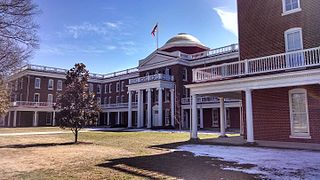
Tazewell is a town in Tazewell County, Virginia, United States. The population was 4,627 at the 2010 census. It is part of the Bluefield, WV-VA micropolitan area, which has a population of 107,578. It is the county seat of Tazewell County.

<span class="mw-page-title-main">Mitchell Heights, West Virginia</span> Town in West Virginia, United States

Mitchell Heights is a town in Logan County, West Virginia, United States. The population was 315 at the 2020 census. The town was named for an early farm on which it was established.

<span class="mw-page-title-main">Pamplin City, Virginia</span> Town in Virginia, United States

Pamplin City is a town in Appomattox and Prince Edward counties in the U.S. state of Virginia. The population was 138 at the 2020 United States census.

<span class="mw-page-title-main">Belle Haven, Accomack County, Virginia</span> Town in Virginia, United States

Belle Haven is a town in Accomack and Northampton counties in the U.S. state of Virginia. The population was 532 at the 2010 census.

References

  1. "2019 U.S. Gazetteer Files". United States Census Bureau. Retrieved August 7, 2020.
  2. 1 2 "Population and Housing Unit Estimates". United States Census Bureau. May 24, 2020. Retrieved May 27, 2020.
  3. 1 2 "U.S. Census website". United States Census Bureau . Retrieved January 31, 2008.
  4. "US Board on Geographic Names". United States Geological Survey. October 25, 2007. Retrieved January 31, 2008.
  5. Edwards, Richard (1855). Statistical Gazetteer of the State of Virginia. Richmond, Virginia: Richard Edwards. p.  193.
  6. "National Register Information System". National Register of Historic Places . National Park Service. July 9, 2010.
  7. "US Gazetteer files: 2010, 2000, and 1990". United States Census Bureau. February 12, 2011. Retrieved April 23, 2011.
  8. "Census of Population and Housing". Census.gov. Retrieved June 4, 2015.