Betteshanger

Last updated

Betteshanger
Betteshanger Community Park.jpg
Betteshanger Park
United Kingdom adm location map.svg
Red pog.svg
Betteshanger
Location within the United Kingdom
OS grid reference TR3352
Civil parish
District
Shire county
Country England
Sovereign state United Kingdom
Post town Deal
Postcode district CT14
Dialling code 01304
List of places
UK
England
51°13′30″N1°19′12″E / 51.225°N 1.32°E / 51.225; 1.32

Betteshanger is a village and former civil parish. now in the parish of Northbourne, in the Dover district, in east Kent, UK, near Deal. It gave its name to the largest of the four chief collieries of the Kent coalfield. [1] In 1931 the parish had a population of 55. [2] On 1 April 1935 the parish was abolished and merged with Northbourne. [3]

Contents

Before the coal mine

St Mary's Church, Betteshanger St Mary Betteshanger 1.jpg
St Mary's Church, Betteshanger

Betteshanger parish (with variation 'Betleshangre' [4] ) has existed at least since Domesday times. It remained a small scattered parish until the advent of the Kent Coalfield. St Mary's Church sits almost alone in woodland in the centre of the parish. At 'Little Betteshanger' a cluster of houses surround Betteshanger Farm and are very close to Northbourne Primary School.

Mining in Betteshanger

Betteshanger Colliery opened in the late 1920s and was the largest of the Kent collieries. Miners from other coalfields travelled to Deal in the hope of finding work at the new pit, and many lodging houses, cafes and pubs in Deal put up signs saying "no miners" owing to fear of the arrival of the often dirty men who spoke very different dialects. [5] It had two shafts of almost 2,300 feet, plaques can still be seen where the shafts were once sunk. The colliery was served by a railway branch which left the main line between Deal & Sandwich. [6]

Betteshanger had a tradition of union militancy. Many of the miners who moved to Kent to work at Betteshanger had been blacklisted in their home areas after the 1926 strike, so there was a high proportion of "hardline union men". [5] It was the first pit to come out on strike during the Second World War and took active part in the miners' strikes of 1969, 1972, 1974 and 1984/85.

A sit-in was staged at the colliery in 1984 and those involved were sacked for trespass. [5] The Kent Area's NUM initially refused to return to work until those sacked were reinstated and continued to picket the rest of the country after the NUM's national executive had voted to return to work, [7] so Betteshanger was actually the last pit in Britain to return to work after the strike. [5]

Thereafter, Betteshanger became known for the brutality with which strikebreakers were treated. Posters had gone up in the village with photographs and names of the 30 men who had broken the strike. [8] It was the last Kent colliery to close, closing for good in 1989.

The village is also on the Miner's Way Trail that links up the coalfield parishes of East Kent. [9]

Village layout

The miners' houses were laid out in three streets: Circular Road, Northway and Broad Lane. Circular Road, often known simply as 'the circle' is in fact oval in shape and is a one-way street. Houses have even numbers on inside of the circle, and odd on the outside. Northway connects the circle with the rest of the world and is a short two-way street. As a road Broad Lane predates the coal mine and has miners' houses on just one side. Additionally, the former village shop is now a domestic dwelling and although numbered as part of Circular Road, sits on an unnamed stub-road which used to serve as the entrance to the colliery itself.

Betteshanger Park Development

With support from South East England Development Agency (SEEDA), as part of the National Coalfields Programme (NCP) [10] a children's play area, including play equipment and a skateboard ramp, and more recently an industrial park, have opened on the site of the former colliery. Betteshanger Park has also been developed on a former spoil tip (on the north of the site). Current plans for Betteshanger Industrial Park is the proposal from Hadlow College to set up the agricultural centre, creating more than 1,000 jobs. But this is still yet to be confirmed. Local opposition to this proposal, wants to turn the site into a charitable trust with the development of free enterprise formulas and continued growth of the site. [11]

Betteshanger Sustainable Parks

Launched on 6 November at the House of Commons, [12] this £40m scheme will re-develop the site of the former colliery and create approximately 1,000 jobs in the local area.

It is planned that Betteshanger Sustainable Parks, a scheme bringing together Hadlow College, Dover District Council, the Homes and Communities Agency and Kent County Council will generate green energy [13] together with a Mining Heritage Museum, Visitor Centre and Sustainable Education Centre. In total, the Betteshanger Sustainable Education and Business Incubation Centre will provide 2,000 square metres of internal space [14] and provide an incubation service for fledgling businesses. The Business and Commercial Park will comprise 6,700 square metres of internal space. [15]

The development which, prior to launch in November 2013, took four years of preparation is a UK first, and aims to help regenerate Dover district, as well as the wider East Kent communities. It is planned that the project will start on site in summer 2015 and open in spring 2016. The Kent Mining Museum is scheduled to open in summer 2016 [16]

Betteshanger Summer School

Betteshanger occupies an important place in the history and development of organic and biodynamic farming. It was the bridge between these two forms of agriculture. The 'Betteshanger Summer School and Conference on Biodynamic Farming' was held in July 1939. It was the first biodynamic agriculture conference to be held in Britain. Ehrenfried Pfeiffer travelled from Switzerland to be the lead presenter at the summer school which was held at the farm of Lord Northbourne. The following year Northbourne presented and expanded on these ideas for a British audience in his book 'Look to the Land' in which he introduced the term 'organic farming'. [17]

Related Research Articles

<span class="mw-page-title-main">Organic movement</span>

The organic movement broadly refers to the organizations and individuals involved worldwide in the promotion of organic food and other organic products. It started during the first half of the 20th century, when modern large-scale agricultural practices began to appear.

Biodynamic agriculture is a form of alternative agriculture based on pseudo-scientific and esoteric concepts initially developed in 1924 by Rudolf Steiner (1861–1925). It was the first of the organic farming movements. It treats soil fertility, plant growth, and livestock care as ecologically interrelated tasks, emphasizing spiritual and mystical perspectives.

<span class="mw-page-title-main">Dover District</span> Non-metropolitan district in England

Dover is a local government district in Kent, England. It is named after its largest town, the port town of Dover. The council is based in Whitfield on the outskirts of Dover. The district also covers the towns of Deal, Sandwich, Walmer and the surrounding rural areas.

<span class="mw-page-title-main">Wingham, Kent</span> Human settlement in England

Wingham is a village and civil parish in the Dover District of Kent, England. The village lies along the ancient coastal road, now the A257, from Richborough to London, and is close to Canterbury.

<span class="mw-page-title-main">Barfrestone</span> Human settlement in England

Barfrestone is a village and a former civil parish, now in the parish of Eythorne, in the Dover district, in east Kent, England. It is between Shepherdswell, Eythorne and Nonington, close to the pit villages of Elvington and Snowdown. In 1931 the parish had a population of 91. On 1 April 1935 the parish was abolished and merged with Eythorne.

<span class="mw-page-title-main">Elvington, Kent</span> Human settlement in England

Elvington is a small pit village on a ridge in between Canterbury and Dover in the county of Kent in Southeast England. Located near Eythorne, Elvington was mostly built in the early 20th century to serve the nearby coal mine at Tilmanstone, as were other Kent Coalfield villages including Snowdown, Aylesham and Betteshanger.

<span class="mw-page-title-main">Aylesham</span> Village in Kent, England

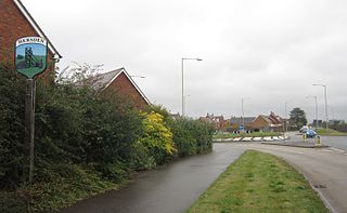
Aylesham is a village and civil parish in the Dover district of Kent, England. The village is 6.5 miles (10.5 km) southeast of the cathedral city of Canterbury, and 8.5 miles (13.7 km) northwest of the town and port of Dover. According to the 2001 Census, the parish had a population including Drellingore and Snowdown of 3,884, increasing to 3,999 at the 2011 Census.

<span class="mw-page-title-main">History of organic farming</span> Aspect of history

Traditional farming was the original type of agriculture, and has been practiced for thousands of years. All traditional farming is now considered to be "organic farming" although at the time there were no known inorganic methods. For example, forest gardening, a fully organic food production system which dates from prehistoric times, is thought to be the world's oldest and most resilient agroecosystem. The industrial revolution introduced inorganic methods, most of which were not well developed and had serious side effects. An organic movement began in the 1940s as a reaction to agriculture's growing reliance on synthetic fertilizers and pesticides. The history of this modern revival of organic farming dates back to the first half of the 20th century at a time when there was a growing reliance on these new synthetic, non-organic methods.

<span class="mw-page-title-main">Ehrenfried Pfeiffer</span> German soil scientist

Ehrenfried Pfeiffer was a German scientist, soil scientist, leading advocate of biodynamic agriculture, anthroposophist and student of Rudolf Steiner.

<span class="mw-page-title-main">Kent Coalfield</span> Coal mining area in England

The Kent Coalfield is a coalfield in the eastern part of the English county of Kent. The Coalfields Trust defines the Kent Coalfield as the wards of Barham Downs and Marshside in the Canterbury district, and the wards of Aylesham, Eastry, Eythorne & Shepherdswell, Middle Deal & Sholden, Mill Hill and North Deal in the Dover district.

<span class="mw-page-title-main">Hersden</span> Human settlement in England

Hersden is a village east of Canterbury in Kent, South East England. It was established as a planned coalmining village in the 1920s and is on the A28 road between Canterbury and the Isle of Thanet. Work in the Kent Coalfield was the main source of employment in the village until the closure of the Kent colliery in the 1980s.

<span class="mw-page-title-main">Cortonwood</span> Colliery in South Yorkshire, England

Cortonwood was a colliery near Rotherham, South Yorkshire, England. The colliery's proposed closure was a tipping point in the 1984-85 miners' strike. The site is now a shopping and leisure centre.

<span class="mw-page-title-main">Tilmanstone</span> Human settlement in England

Tilmanstone is a small village and civil parish in Kent, in the South East of England, near Eastry, a much bigger and more developed area. Tilmanstone no longer has a village school; however, the independent Northbourne Park School is close to the parish boundary. The name of Tilmanstone has historically been famous for its colliery, although it is located in the village of Eythorne, operated from 1906 to 1986 as one of the four main pits of the Kent coalfield. The population taken at the 2011 Census also included that of the nearby hamlet of Ashley.

Walter Ernest Christopher James, 4th Baron Northbourne, was an English agriculturalist, author and rower who competed in the 1920 Summer Olympics.

<span class="mw-page-title-main">Finglesham</span> Human settlement in England

Finglesham is a village in the civil parish of Northbourne, and near Deal in Kent, England, which was the location of the Finglesham Anglo-Saxon cemetery, site of a seventh-century Anglo-Saxon archaeology find known as "Finglesham man," as described in 1965 by Sonia Chadwick Hawkes and Hilda Ellis Davidson. The village takes its name from the Old English Pengles-ham, meaning 'prince's manor', with the Anglo-Saxon cemetery containing a number of aristocratic burials. The population of the village is included in the civil parish of Northbourne.

<span class="mw-page-title-main">Northbourne, Kent</span> Human settlement in England

Northbourne is a village and civil parish near Deal in Kent, England. It has a public house, The Hare and Hounds, a primary school and is the home of the current, and prior, Baron Northbourne. It should not be confused with an area in Bournemouth of the same name.

<span class="mw-page-title-main">Hadlow College</span> FE and HE college in Kent, UK

Hadlow College is a further and higher education college in Hadlow, Kent, England, with a satellite site in Greenwich. The curriculum primarily covers land-based subjects including Agriculture, Horticulture, Conservation and Wildlife Management, Animal Management, Fisheries Management, Equine Studies and Floristry. Additionally, intermediate and advanced apprenticeships are offered in Golf Greenkeeping, Sports Turf, Agriculture, Horticulture and Land-based Engineering.

<span class="mw-page-title-main">Betteshanger Park</span> Park in Kent, England

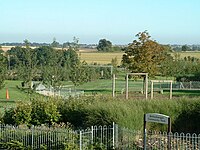
Betteshanger Park is a park near Deal, in Kent, England. It covers the site of a former colliery spoil tip.

<span class="mw-page-title-main">Miner's Way Trail</span> Walking trail in Kent, England

The Miner's Way Trail is a long-distance circular footpath in England, starting at Sholden, Kent. Linking up the coalfield parishes of East Kent. Including; the parishes of Deal, Ash, Aylesham, Chillenden, Eastry, Eythorne, Elvington, Goodnestone, Nonington, Northbourne, Coldred, Staple, Tilmanstone and Wingham.

<span class="mw-page-title-main">1942 Betteshanger miners' strike</span>

The 1942 Betteshanger Miners' Strike took place in January 1942 at the Betteshanger colliery in Kent, England. The strike had its origins in a switch to a new coalface, No. 2. This face was much narrower and harder to work than the previous face and outputs were reduced. The miners proved unable to meet management production quotas and the mine owners refused to pay the previously agreed minimum daily wage, alleging deliberate slow working. An arbitrator called in to review the dispute ruled that the quotas were achievable. The miners disagreed and went on strike from 9 January.

References

  1. Betteshanger Colliery Archived 23 April 2008 at the Wayback Machine , Coalfields Heritage Initiative Kent
  2. "Population statistics Betteshanger AP/CP through time". A Vision of Britain through Time . Retrieved 12 June 2023.
  3. "Relationships and changes Betteshanger AP/CP through time". A Vision of Britain through Time. Retrieved 12 June 2023.
  4. Plea Rolls of the Court of Common Pleas; National Archives; CP 40/555; http://aalt.law.uh.edu/H4/CP40no555/bCP40no555dorses/IMG_0348.htm; sixth entry; with 'Stephen Peyntour' as complainant; the place where the alleged assault took place is given as 'Betleshangre'
  5. 1 2 3 4 Dover Museum – Betteshanger Colliery
  6. "Eastkentlightrailway".
  7. Strike: 358 Days that Shook the Nation. London: Sunday Times. 1985. p. 254. ISBN   0-340-38445-X.
  8. Winterton, Jonathan; Winterton, Ruth (1989). Coal, Crisis, and Conflict: The 1984–85 Miners' Strike in Yorkshire. Manchester University Press. p. 217. ISBN   9780719025488.
  9. "The History of the Coalfield Parishes". www.dover.gov.uk. Archived from the original on 13 January 2014. Retrieved 20 November 2013.
  10. "Coalfields projects | Homes and Communities Agency (HCA)". Archived from the original on 14 May 2014. Retrieved 14 May 2014.
  11. "Betteshanger local trust proposed | This is Kent". Archived from the original on 2 April 2012. Retrieved 30 June 2011.
  12. "New look for old Betteshanger Colliery site to create 1,000 jobs in east Kent". www.kentonline.co.uk. Archived from the original on 9 November 2013.
  13. "'Green energy' for old colliery". BBC News.
  14. "Betteshanger Sustainable Parks | Education - Betteshanger Sustainable Parks". Archived from the original on 20 December 2013. Retrieved 20 December 2013.
  15. "Betteshanger Sustainable Parks | Tenancy - Betteshanger Sustainable Parks". Archived from the original on 20 December 2013. Retrieved 20 December 2013.
  16. "Betteshanger Sustainable Parks | Investors - Betteshanger Sustainable Parks". Archived from the original on 20 December 2013. Retrieved 20 December 2013.
  17. Paull, John (2011) "The Betteshanger Summer School: Missing link between biodynamic agriculture and organic farming", Journal of Organic Systems, 6(2):13–26.

Commons-logo.svg Media related to Betteshanger at Wikimedia Commons