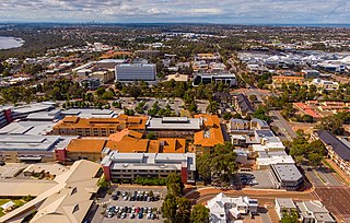
Gwelup is a suburb of Perth, the capital city of Western Australia 12 km north of Perth's central business district (CBD) along the Mitchell Freeway. Its local government area is the City of Stirling.

Karrinyup is a suburb of Perth, the capital city of Western Australia, and is located 12 km north of Perth's central business district. Its local government area is the City of Stirling.

Mount Lawley is an inner northern suburb of Perth, Western Australia. The suburb is bounded by the Swan River to the east, Vincent, Harold and Pakenham Streets to the south, Central Avenue and Alexander Drive to the north, and Norfolk Street to the west.

Yangebup is a southern suburb of Perth, Western Australia in the City of Cockburn. It takes its name from the nearby Yangebup Lake.

Edgewater is a suburb of Perth, Western Australia 23 kilometres (14 mi) north of Perth's central business district. Edgewater was approved as a suburb name in 1974, and its local government area is the City of Joondalup. It is named after its location on the western edge of Lake Joondalup, which is surrounded by Yellagonga Regional Park.

Coolbellup is a suburb in Perth, Western Australia, located 15 km (9mi) south of the central business district within the local government area of the City of Cockburn.

Joondalup is a suburb of Perth, Western Australia, approximately 26 kilometres (16 mi) north of Perth's central business district. It contains the central business district of the regional City of Joondalup and acts as the primary urban centre of Perth's outer northern suburbs.

Willagee is a suburb of Perth, Western Australia 15 kilometres (9 mi) south-southwest of the Perth central business district. It is within the local government area of City of Melville, and the electoral district of Willagee, which takes its name from the suburb.

Neerabup is a rural locality in Perth, the capital of Western Australia, within the local government area of the City of Wanneroo.

Pinjar is a rural locality in Perth, Western Australia. Its local government area is the City of Wanneroo.

Beeliar is a suburb of Perth, Western Australia, located within the City of Cockburn. The name refers to the Beeliar people, a group of Aboriginal Australians who had land rights over the southern half of Perth's metropolitan area. The suburb contains the Thomsons Lake Nature Reserve.

Bibra Lake is a suburb of Perth, Western Australia; it takes its name from the extensive freshwater lake within its boundaries, Bibra Lake. It is located within the City of Cockburn and its postcode is 6163.

Coogee is a southern coastal suburb of Perth, Western Australia, located within the City of Cockburn.

Henderson is a suburb of Perth, Western Australia, located within the City of Cockburn.

North Lake is a suburb located 18 kilometres (11 mi) south of the central business district of Perth, the capital of Western Australia, and 8 kilometres (5 mi) from the Indian Ocean. Named after the eponymous lake, the suburb and lake are located within the City of Cockburn local government area.

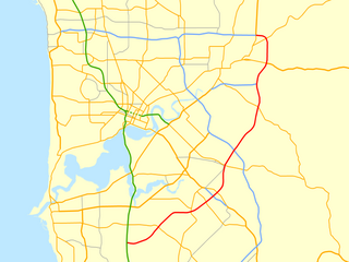
Roe Highway is a 35-kilometre-long (22 mi) limited-access highway and partial freeway in Perth, Western Australia, linking Kewdale with the city's north-eastern and south-western suburbs. The northern terminus is at Reid Highway and Great Northern Highway in Middle Swan, and the southern terminus is with Murdoch Drive at the Kwinana Freeway interchange in Bibra Lake. Roe Highway, in addition to Reid Highway, form State Route 3, a partial ring road around the outer suburbs of the Perth metropolitan area. Roe Highway also forms part of National Highway 94 from Great Eastern Highway Bypass to Great Eastern Highway, and National Highway 95 from Great Eastern Highway to Great Northern Highway.

Stirling is a suburb of Perth, the capital city of Western Australia, about 10 km north of Perth's central business district (CBD) along the Mitchell Freeway. Its local government area is the City of Stirling, whose council offices and administration centre are located in the southwest of the mostly residential suburb.
The Beeliar Wetlands is a wetland located in the southwest portion of Western Australia. It is made up of two chains of lakes and wetlands that run parallel to the west coast of Western Australia. They are situated on the Swan Coastal Plain between the Darling Escarpment and the Indian Ocean. Beeliar was the name given to the area by the Aboriginal people that lived and hunted in the area.
Lakeland Senior High School is an independent public co-educational high day school, located in the Perth suburb of South Lake, Western Australia.

North Lake is a freshwater lake in the suburb of North Lake, located 18 kilometres (11 mi) south of the central business district of Perth, the capital of Western Australia, and 8 kilometres (5 mi) from the Indian Ocean. The suburb and lake are located within the City of Cockburn local government area.


