Big Arm, Montana

Last updated

Big Arm, Montana
Flathead Lake from Big Arm.jpg
Flathead Lake from Big Arm
Lake County Montana Incorporated and Unincorporated areas Big Arm Highlighted.svg
Location of Big Arm, Montana
Coordinates: 47°48′8″N114°16′51″W / 47.80222°N 114.28083°W / 47.80222; -114.28083
Country United States
State Montana
County Lake
Area
[1]
  Total5.42 sq mi (14.03 km2)
  Land5.42 sq mi (14.03 km2)
  Water0.00 sq mi (0.00 km2)
Elevation
2,953 ft (900 m)
Population
 (2020)
  Total218
  Density40.23/sq mi (15.53/km2)
Time zone UTC-7 (Mountain (MST))
  Summer (DST) UTC-6 (MDT)
ZIP code
59910
Area code 406
FIPS code 30-05800
GNIS feature ID0768742

Big Arm is a census-designated place (CDP) in Lake County, Montana, United States. The population was 177 at the 2010 census, [2] up from 131 in 2000.

Contents

The town is situated on the south side of Big Arm, a large bay on Flathead Lake, hence its name. The name was used by the Kootenai people, who lived there prior to the town being established. [3] The post office opened in 1911, with Marion F. Lamb as postmaster. [4]

Big Arm State Park is located just north of the town.

Geography

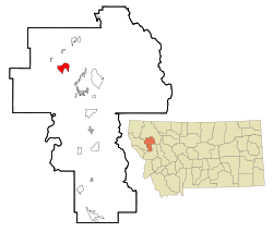
Big Arm is located in northwestern Lake County at 47°48′8″N114°16′51″W / 47.80222°N 114.28083°W / 47.80222; -114.28083 (47.802296, -114.280952). [5] The census-designated place contains the settlement of Big Arm along the southern shore of Flathead Lake's Big Arm, as well as undeveloped grassland to the south, up to the base of an unnamed 5,100-foot (1,600 m) mountain. The CDP is bordered to the northeast by the community of Lindisfarne.

U.S. Route 93 passes through Big Arm, running just south of the lake shore. The highway leads southeast 12 miles (19 km) to Polson, the Lake county seat, and northwest 4 miles (6 km) to Elmo. The city of Kalispell is 39 miles (63 km) north of Big Arm.

According to the United States Census Bureau, the CDP has a total area of 5.4 square miles (14.0 km2), all land. [6]

Climate

This climatic region is typified by large seasonal temperature differences, with warm to hot (and often humid) summers and cold (sometimes severely cold) winters. According to the Köppen Climate Classification system, Big Arm has a humid continental climate, abbreviated "Dfb" on climate maps. [7]

Demographics

Historical population
CensusPop.Note
2020 218
U.S. Decennial Census [8]
Big Arm postmark Big Arm MT Postmark.jpg
Big Arm postmark

As of the census [9] of 2000, there were 131 people, 56 households, and 39 families residing in the CDP. The population density was 24.0 inhabitants per square mile (9.3/km2). There were 124 housing units at an average density of 22.8 per square mile (8.8/km2). The racial makeup of the CDP was 69.47% White and 30.53% Native American.

There were 56 households, out of which 23.2% had children under the age of 18 living with them, 53.6% were married couples living together, 8.9% had a female householder with no husband present, and 28.6% were non-families. 21.4% of all households were made up of individuals, and 7.1% had someone living alone who was 65 years of age or older. The average household size was 2.34 and the average family size was 2.60.

In the CDP, the population was spread out, with 19.8% under the age of 18, 9.2% from 18 to 24, 18.3% from 25 to 44, 29.8% from 45 to 64, and 22.9% who were 65 years of age or older. The median age was 47 years. For every 100 females there were 111.3 males. For every 100 females age 18 and over, there were 110.0 males.

The median income for a household in the CDP was $29,000, and the median income for a family was $38,750. Males had a median income of $16,750 versus $21,875 for females. The per capita income for the CDP was $16,620. There were no families and 8.0% of the population living below the poverty line, including no under eighteens and 30.0% of those over 64.

See also

Related Research Articles

<span class="mw-page-title-main">Lake County, Montana</span> County in Montana, United States

Lake County is a county located in the northwest part of the U.S. state of Montana. As of the 2020 census, the population was 31,134. Its county seat is Polson.

<span class="mw-page-title-main">Bigfork, Montana</span> Unincorporated community in Montana, United States

Bigfork is a census-designated place (CDP) in Flathead County, Montana, United States. It is within Montana's Rocky Mountains. The population was 4,270 at the 2010 census, up from 1,421 in 2000.

<span class="mw-page-title-main">Coram, Montana</span> Unincorporated community in Montana, United States

Coram is an unincorporated community and census-designated place (CDP) in Flathead County, Montana, United States. The population was 539 in 2010, up from 337 at the 2000 census. Coram lies 7 miles (11 km) southwest of the western entrance of Glacier National Park.

<span class="mw-page-title-main">Evergreen, Montana</span> Unincorporated community in Montana, United States

Evergreen is a census-designated place (CDP) in Flathead County, Montana, United States. Its population was 8,149 at the 2020 census, up from 7,616 at the 2010 census, and 6,215 in 2000.

<span class="mw-page-title-main">Lakeside, Montana</span> Unincorporated community in Montana, United States

Lakeside is an unincorporated area and census-designated place (CDP) in Flathead County, Montana, United States. The population was 2,669 at the 2010 census, up from 1,679 in 2000.

<span class="mw-page-title-main">Somers, Montana</span> Unincorporated community in Montana, United States

Somers is an unincorporated community and census-designated place (CDP) in Flathead County, Montana, United States. The population was 1,109 at the 2010 census, up from 556 in 2000.

<span class="mw-page-title-main">Elmo, Montana</span> Census-designated place in Montana, United States

Elmo is a census-designated place (CDP) in Lake County, Montana, United States. The population was 180 at the 2010 census, up from 143 in 2000.

<span class="mw-page-title-main">Finley Point, Montana</span> Census-designated place in Montana, United States

Finley Point is a census-designated place (CDP) in Lake County, Montana, United States. As of the 2010 census the population was 480.

<span class="mw-page-title-main">Kerr, Montana</span> Census-designated place in Montana, United States

Kerr is a census-designated place (CDP) in Lake County, Montana, United States. The population was 251 at the 2010 census, up from 17 in 2000.

<span class="mw-page-title-main">Kings Point, Montana</span> Census-designated place in Montana, United States

Kings Point is a census-designated place (CDP) in Lake County, Montana, United States. The population was 151 at the 2010 census, down from 169 in 2000.

<span class="mw-page-title-main">Rocky Point, Montana</span> Census-designated place in Montana, United States

Rocky Point is a census-designated place (CDP) in Lake County, Montana, United States. The population was 97 at the 2010 census.

<span class="mw-page-title-main">Rollins, Montana</span> Census-designated place in Montana, United States

Rollins is an unincorporated community and census-designated place (CDP) in Lake County, Montana, United States. The population was 209 at the 2010 census, up from 183 in 2000.

<span class="mw-page-title-main">Turtle Lake, Montana</span> Census-designated place in Montana, United States

Turtle Lake is a census-designated place (CDP) in Lake County, Montana, United States. The population was 209 at the 2010 census.

<span class="mw-page-title-main">Woods Bay, Montana</span> Census-designated place in Montana, United States

Woods Bay is a census-designated place (CDP) in Lake County, Montana, United States. The population was 661 at the 2010 census, down from 748 at the 2000 census.

<span class="mw-page-title-main">Evaro, Montana</span> CDP in Montana, United States

Evaro is a census-designated place (CDP) in Missoula County, Montana, United States, and part of the Missoula Metropolitan Statistical Area. It is located on the southernmost tip of the Flathead Indian Reservation, approximately 12 miles (19 km) north of downtown Missoula and is served by US Highway 93. In 2010, Evaro had a population of 322, a decrease from 329 in 2000.

<span class="mw-page-title-main">Dayton, Montana</span> Census-designated place in Montana, United States

Dayton is an unincorporated community and census-designated place (CDP) in Lake County, Montana, United States. The population was 84 at the 2010 census.

<span class="mw-page-title-main">Jette, Montana</span> Census-designated place in Montana, United States

Jette is a census-designated place (CDP) in Lake County, Montana, United States. The population was 253 at the 2010 census.

<span class="mw-page-title-main">Pablo, Montana</span> Census-designated place in Montana, United States

Pablo is a census-designated place (CDP) in Lake County, Montana, United States. The population was 2,254 at the 2010 census, up from 1,814 in 2000. It is the home of Salish Kootenai College and the seat of government of the Flathead Indian Reservation.

<span class="mw-page-title-main">Polson, Montana</span> Town in Montana, United States

Polson is a city in Lake County, Montana, United States, on the southern shore of Flathead Lake. It is also on the Flathead Indian Reservation. The population was 5,148 at the 2020 census. It is the county seat of Lake County. In 1898 the city was named after pioneer rancher David Polson. It was incorporated in 1910.

<span class="mw-page-title-main">Niarada, Montana</span> Unincorporated community in Montana, United States

Niarada is a census-designated place (CDP) in Flathead and Sanders counties in Montana, United States. The population was 27 at the 2010 census, down from 50 in 2000.

References

  1. "ArcGIS REST Services Directory". United States Census Bureau. Retrieved September 5, 2022.
  2. "Total Population: 2010 Census DEC Summary File 1 (P1), Big Arm CDP, Montana". data.census.gov. U.S. Census Bureau. Retrieved April 15, 2020.
  3. "Montana Place Names Companion". Montana Historical Society. Retrieved July 22, 2017.
  4. Carkeek Cheney, Roberta (1983). Names on the Face of Montana. Missoula, Montana: Mountain Press Publishing Company. p. 5. ISBN   0-87842-150-5.
  5. "US Gazetteer files: 2010, 2000, and 1990". United States Census Bureau. February 12, 2011. Retrieved April 23, 2011.
  6. "U.S. Gazetteer Files: 2019: Places: Montana". U.S. Census Bureau Geography Division. Retrieved April 15, 2020.
  7. Climate Summary for Big Arm, Montana
  8. "Census of Population and Housing". Census.gov. Retrieved June 4, 2016.
  9. "U.S. Census website". United States Census Bureau . Retrieved January 31, 2008.

Commons-logo.svg Media related to Big Arm, Montana at Wikimedia Commons