Kicking Horse, Montana

Last updated
Kicking Horse, Montana
Lake County Montana Incorporated and Unincorporated areas Kicking Horse Highlighted.svg
Location of Kicking Horse, Montana
Coordinates: 47°27′43″N114°5′4″W / 47.46194°N 114.08444°W / 47.46194; -114.08444 Coordinates: 47°27′43″N114°5′4″W / 47.46194°N 114.08444°W / 47.46194; -114.08444
Country United States
State Montana
County Lake
Area
[1]
  Total3.56 sq mi (9.21 km2)
  Land2.42 sq mi (6.26 km2)
  Water1.14 sq mi (2.95 km2)
Elevation
3,064 ft (934 m)
Population
 (2020)
  Total76
  Density31.46/sq mi (12.15/km2)
Time zone UTC-7 (Mountain (MST))
  Summer (DST) UTC-6 (MDT)
Area code 406
FIPS code 30-40580
GNIS feature ID1867339

Kicking Horse is a census-designated place (CDP) in Lake County, Montana, United States. The population was 286 at the 2010 census, [2] up from 80 in 2000.

Contents

Geography

Kicking Horse is located in south-central Lake County at 47°27′43″N114°5′4″W / 47.46194°N 114.08444°W / 47.46194; -114.08444 (47.461892, -114.084475). [3] It covers all of Kicking Horse Reservoir and land to the east and south. The CDP extends west to U.S. Route 93, south to Eagle Pass Trail, and east to Hillside Road. The northwest boundary follows Kicking Horse Road and the northwest side of Kicking Horse Reservoir up to Mollmann Pass Trail, which forms the short northern border of the CDP. [4] Kicking Horse is 19 miles (31 km) south of Polson, the Lake county seat, 5 miles (8 km) south of Ronan, and 15 miles (24 km) north of Ravalli via US 93.

According to the United States Census Bureau, the Kicking Horse CDP has a total area of 3.6 square miles (9.2 km2), of which 2.4 square miles (6.3 km2) are land and 1.2 square miles (3.0 km2), or 32.06%, are water. [5]

Demographics

Historical population
CensusPop.Note
2020 76
U.S. Decennial Census [6]

As of the census [7] of 2000, there were 80 people, 27 households, and 19 families residing in the CDP. The population density was 32.4 inhabitants per square mile (12.5/km2). There were 29 housing units at an average density of 11.7/sq mi (4.5/km2). The racial makeup of the CDP was 47.50% White, 46.25% Native American, 2.50% from other races, and 3.75% from two or more races. Hispanic or Latino of any race were 1.25% of the population.

There were 27 households, out of which 48.1% had children under the age of 18 living with them, 51.9% were married couples living together, 7.4% had a female householder with no husband present, and 29.6% were non-families. 18.5% of all households were made up of individuals, and 3.7% had someone living alone who was 65 years of age or older. The average household size was 2.96 and the average family size was 3.32.

In the CDP, the population was spread out, with 33.8% under the age of 18, 7.5% from 18 to 24, 35.0% from 25 to 44, 21.3% from 45 to 64, and 2.5% who were 65 years of age or older. The median age was 29 years. For every 100 females, there were 95.1 males. For every 100 females age 18 and over, there were 112.0 males.

The median income for a household in the CDP was $28,906, and the median income for a family was $60,078. Males had a median income of $38,750 versus $7,500 for females. The per capita income for the CDP was $16,524. There were 22.6% of families and 41.8% of the population living below the poverty line, including 100.0% of under eighteens and 50.0% of those over 64.

Related Research Articles

<span class="mw-page-title-main">Coram, Montana</span> Unincorporated community in Montana, United States

Coram is an unincorporated community and census-designated place (CDP) in Flathead County, Montana, United States. The population was 539 in 2010, up from 337 at the 2000 census. Coram lies 7 miles (11 km) southwest of the western entrance of Glacier National Park.

<span class="mw-page-title-main">Hungry Horse, Montana</span> Unincorporated community in Montana, United States

Hungry Horse is an unincorporated community and census-designated place (CDP) in Flathead County, Montana, United States. The population was 828 at the 2020 census. The ZIP code for Hungry Horse is 59919.

<span class="mw-page-title-main">Martin City, Montana</span> Unincorporated community in Montana, United States

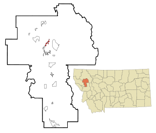
Martin City is an unincorporated community and census-designated place (CDP) in Flathead County, Montana, United States. As of the 2010 census, it had a population of 500, up from 331 in 2000.

<span class="mw-page-title-main">Big Arm, Montana</span> Census-designated place in Montana, United States

Big Arm is a census-designated place (CDP) in Lake County, Montana, United States. The population was 177 at the 2010 census, up from 131 in 2000.

<span class="mw-page-title-main">Elmo, Montana</span> Census-designated place in Montana, United States

Elmo is a census-designated place (CDP) in Lake County, Montana, United States. The population was 180 at the 2010 census, up from 143 in 2000.

<span class="mw-page-title-main">Finley Point, Montana</span> Census-designated place in Montana, United States

Finley Point is a census-designated place (CDP) in Lake County, Montana, United States. As of the 2010 census the population was 480.

<span class="mw-page-title-main">Kings Point, Montana</span> Census-designated place in Montana, United States

Kings Point is a census-designated place (CDP) in Lake County, Montana, United States. The population was 151 at the 2010 census, down from 169 in 2000.

<span class="mw-page-title-main">Ravalli, Montana</span> Census-designated place in Montana, United States

Ravalli is an unincorporated community and census-designated place (CDP) in Lake County, Montana, United States. The population was 76 at the 2010 census, down from 119 in 2000. At one time Charlie Allard, the country's leading expert on breeding bison, owned the country's largest herd of buffalo in Ravalli.

<span class="mw-page-title-main">Rocky Point, Montana</span> Census-designated place in Montana, United States

Rocky Point is a census-designated place (CDP) in Lake County, Montana, United States. The population was 97 at the 2010 census.

<span class="mw-page-title-main">Rollins, Montana</span> Census-designated place in Montana, United States

Rollins is an unincorporated community and census-designated place (CDP) in Lake County, Montana, United States. The population was 209 at the 2010 census, up from 183 in 2000.

<span class="mw-page-title-main">Turtle Lake, Montana</span> Census-designated place in Montana, United States

Turtle Lake is a census-designated place (CDP) in Lake County, Montana, United States. The population was 209 at the 2010 census.

<span class="mw-page-title-main">Riverbend, Montana</span> CDP in Montana, United States

Riverbend is a census-designated place (CDP) in Mineral County, Montana, United States. The population was 442 at the 2000 census. The Zip Code is 59872.

<span class="mw-page-title-main">Evaro, Montana</span> CDP in Montana, United States

Evaro is a census-designated place (CDP) in Missoula County, Montana, United States, and part of the Missoula Metropolitan Statistical Area. It is located on the southernmost tip of the Flathead Indian Reservation, approximately 12 miles (19 km) north of downtown Missoula and is served by US Highway 93. In 2010, Evaro had a population of 322, a decrease from 329 in 2000.

<span class="mw-page-title-main">Dixon, Montana</span> CDP in Montana, United States

Dixon is a census-designated place (CDP) in Sanders County, Montana, United States. The population was 216 at the 2000 census.

<span class="mw-page-title-main">Lonepine, Montana</span> CDP in Montana, United States

Lonepine is a census-designated place (CDP) in Sanders County, Montana, United States. The population was 137 at the 2000 census.

<span class="mw-page-title-main">Old Agency, Montana</span> CDP in Montana, United States

Old Agency is a census-designated place (CDP) in Sanders County, Montana, United States. The population was 95 at the 2000 census.

<span class="mw-page-title-main">Paradise, Montana</span> CDP in Montana, United States

Paradise is a census-designated place (CDP) in Sanders County, Montana, United States. The population was 166 at the 2020 census.

<span class="mw-page-title-main">Dayton, Montana</span> Census-designated place in Montana, United States

Dayton is an unincorporated community and census-designated place (CDP) in Lake County, Montana, United States. The population was 84 at the 2010 census.

<span class="mw-page-title-main">Jette, Montana</span> Census-designated place in Montana, United States

Jette is a census-designated place (CDP) in Lake County, Montana, United States. The population was 253 at the 2010 census.

<span class="mw-page-title-main">Niarada, Montana</span> Unincorporated community in Montana, United States

Niarada is a census-designated place (CDP) in Flathead and Sanders counties in Montana, United States. The population was 27 at the 2010 census, down from 50 in 2000.

References

  1. "ArcGIS REST Services Directory". United States Census Bureau. Retrieved September 5, 2022.
  2. "Total Population: 2010 Census DEC Summary File 1 (P1), Kicking Horse CDP, Montana". data.census.gov. U.S. Census Bureau. Retrieved April 17, 2020.
  3. "US Gazetteer files: 2010, 2000, and 1990". United States Census Bureau. 2011-02-12. Retrieved 2011-04-23.
  4. TIGERweb. Geography Division, U.S. Census Bureau https://tigerweb.geo.census.gov/tigerweb/ . Retrieved April 17, 2020.{{cite web}}: Missing or empty |title= (help)
  5. "U.S. Gazetteer Files: 2019: Places: Montana". U.S. Census Bureau Geography Division. Retrieved April 17, 2020.
  6. "Census of Population and Housing". Census.gov. Retrieved June 4, 2016.
  7. "U.S. Census website". United States Census Bureau . Retrieved 2008-01-31.