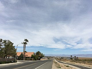
Ridgecrest is a city in Kern County, California, United States, along U.S. Route 395 in the Indian Wells Valley in northeastern Kern County, adjacent to the Naval Air Weapons Station China Lake. It was incorporated as a city in 1963. The population was 27,959 at the 2020 census, up slightly from 27,616 at the 2010 census.

Naval Air Weapons Station (NAWS) China Lake is a large military installation in California that supports the research, testing and evaluation programs of the United States Navy. It is part of Navy Region Southwest under Commander, Navy Installations Command, and was originally known as Naval Ordnance Test Station (NOTS).

The Coso Volcanic Field is located in Inyo County, California, at the western edge of the Basin and Range geologic province and northern region of the Mojave Desert. The Fossil Falls are part of the Coso Field, created by the prehistoric Owens River. They are within the Naval Air Weapons Station China Lake and northeast of Little Lake and U.S. Route 395.
The Coso Range of eastern California is located immediately south of Owens Lake, east of the Sierra Nevada, and west of the Argus Range. The southern part of the range lies in the restricted Naval Air Weapons Station China Lake and the northern part of the range is designated as the Coso Range Wilderness. The mountains include Coso Peak, at 8,160 feet (2,487 m) above sea level, as well as Silver Peak and Silver Mountain, both more than 7,400 ft (2,300 m) in height.

Red Rock Canyon State Park is a state park in the U.S. state of California which features scenic desert cliffs, buttes and spectacular rock formations. The park consists of approximately 27,000 acres (110 km2) within the Mojave Sector of the Tehachapi District of the California State Park System, and is located along State Highway 14 in Kern County, about 80 miles (129 km) east of Bakersfield and 25 miles (40 km) north of Mojave, where the southernmost tip of the Sierra Nevada converges with the El Paso Mountains.
Coso Hot Springs is a hot spring complex in the Coso Volcanic Field in the Mojave Desert of Inyo County, California. The Springs are on the National Register of Historic Places.

The Kawaiisu are a Native Californian ethnic group in the United States who live in the Tehachapi Valley and to the north across the Tehachapi Pass in the southern Sierra Nevada, toward Lake Isabella and Walker Pass. Historically, the Kawaiisu also traveled eastward on food-gathering trips to areas in the northern Mojave Desert, to the north and northeast of the Antelope Valley, Searles Valley, as far east as the Panamint Valley, the Panamint Mountains, and the western edge of Death Valley. Today, some Kawaiisu people are enrolled in the Tule River Indian Tribe.
The Timbisha are a Native American tribe federally recognized as the Death Valley Timbisha Shoshone Band of California. They are known as the Timbisha Shoshone Tribe and are located in south central California, near the Nevada border. As of the 2010 Census the population of the Village was 124. The older members still speak the ancestral language, also called Timbisha.
The El Paso Mountains are located in the northern Mojave Desert, in central Southern California in the Western United States.

The Grapevine Canyon Petroglyphs are located in Grapevine Canyon on Spirit Mountain near Laughlin, Nevada, and are listed on the United States National Register of Historic Places. The area is also known as Christmas Tree Pass. While the petroglyphs extend through the canyon, a significant concentration lies at the entrance to the canyon which is at an elevation of 2,395 feet (730 m). The area features over 700 petroglyphs and many rock shelters.

Coso Rock Art District is a rock art site containing over 100,000 Petroglyphs by Paleo-Indians and/or Native Americans. The district is located near the towns of China Lake and Ridgecrest, California. Big and Little Petroglyph Canyons were declared a National Historic Landmark in 1964. In 2001, they were incorporated into this larger National Historic Landmark District. There are several other distinct canyons in the Coso Rock Art District besides the Big and Little Petroglyph Canyons. Also known as Little Petroglyph Canyon and Sand Tanks, Renegade Canyon is but one of several major canyons in the Coso Range, each hosting thousands of petroglyphs. The majority of the Coso Range images fall into one of six categories: bighorn sheep, entopic images, anthropomorphic or human-like figures, other animals, weapons & tools, and "medicine bag" images. Scholars have proposed a few potential interpretations of this rock art. The most prevalent of these interpretations is that they could have been used for rituals associated with hunting.

Martis is the name given by scientists to the group of Native Americans who lived in Northern California on both the eastern and western sides of the Sierra Nevada. The Martis complex lasted from 2000 BCE to 500 CE, during the Middle Archaic era. Evidence of Martis habitation has been found from Carson River and Reno, Nevada in the east to Auburn, California and Oroville, California in the west. The Martis name refers to the geographic region of Martis Creek which spans Nevada County, California and Placer County, California.

Maturango Museum is located in Ridgecrest, California. The museum is best known for the guided tours of the Coso Rock Art District located on China Lake Naval Weapons Station. The museum offers exhibits and displays featuring both the natural and the cultural history and diversity of the Northern Mojave Desert with exhibits of animals, plants, rocks and minerals, Native American artifacts, and contemporary arts and crafts.

China Lake is an unincorporated community in Kern County, California. It is located 2.5 miles (4 km) north-northeast of Ridgecrest, at an elevation of 2,264 feet. The place is on China Lake, a dry lake on the Naval Air Weapons Station China Lake.
Maturango Peak is the highest mountain in the Argus Range. It is located in Inyo County, California and reaches an elevation of 8,843 feet (2,695 m). The area is under the control of the Naval Air Weapons Station China Lake and access is restricted.
Archeological Site CA-INY-134, in Inyo County, California near Olancha, California, is an archeological site that is listed on the National Register of Historic Places (NRHP). The site is located in the Coso Range 6 miles (9.7 km) northwest of Coso Hot Springs. It has also been known as Ayer's Rock Pictograph Site, as Bob Rabbit's Pictographs, as INY-134 and as INY-105. Prehistorically, it served as a camp and as a ceremonial site. The site includes three pictograph panels carved into a monolith. The pictographs are painted in a variety of colors and depict animal and human figures.
The Ridgecrest Petroglyph Festival is an annual weekend-long festival held in Ridgecrest, California, celebrating the Coso people, and specifically the 10,000-year-old petroglyphs of the Coso Rock Art District. The festival was founded in 2014, and attracted over 15,000 guests in its first year and was named one of Groupon's "10 Most Unique Autumn Festivals in the Country". Events include an Intertribal Pow Wow, street fair, and guided tours to the local petroglyphs.

Melon gravel are a geological deposit of mostly basalt boulders that were formed by the Lake Bonneville flood and deposited along the Snake River Plain in the United States around 15,000 years ago. Melon gravel range in size from course sand to well over 15 feet in diameter, and generally appear rounded. Melon gravel were formed by the Bonneville Flood's intense erosion of the surrounding basalt flows of the area. This process also created several bars of melon gravel that, at their largest, can be 1-mile (1.6 km) long, 1.5-miles (2.41 km) wide, and 150 feet (45.72m) deep.

