Ashe County is a county located in the U.S. state of North Carolina. As of the 2020 census, the population was 26,577. Its county seat is Jefferson.

Scouting in North Carolina has a long history, from the 1910s to the present day, serving thousands of youth in programs that suit the environment in which they live.

Mount Jefferson State Natural Area is a 1,188-acre (4.81 km2) North Carolina state park in Ashe County, North Carolina in the United States. Located near Jefferson, North Carolina, it includes the peak of Mount Jefferson, named for Thomas Jefferson and his father Peter, who owned land nearby and surveyed the North Carolina-Virginia border in 1749. In 1974, Mount Jefferson State Natural Area was designated as a National Natural Landmark by the National Park Service.
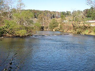
New River State Park is a North Carolina state park in Ashe County, North Carolina in the United States. Located near Jefferson, North Carolina, it covers 3,323 acres (13.45 km2) in the protected New River watershed. The New River is one of the oldest rivers in the United States. It is considered by some geologists to be possibly one of the oldest rivers in the world, between 10 million and 360 million years old. New River State Park is open for year-round recreation, including canoeing, hiking, picnicking, fishing, camping and environmental education. The park is just off U.S. Route 221 in northwestern North Carolina.
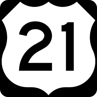
U.S. Route 21 or U.S. Highway 21 (US 21) is a major north–south United States Numbered Highway in the Southeastern United States that travels 394 miles (634 km). The southern terminus is in Hunting Island State Park, South Carolina, 14.4 miles (23.2 km) south of the junction with US 21 Business and South Carolina Highway 802 (SC 802) in Beaufort. The northern terminus is in Wytheville, Virginia at an interchange with Interstate 81 (I-81) and US 52. Despite the "1" indicating that it is a major north-south highway, U.S. 21 only travels through three states, and is no longer a cross-country route as it has been replaced with Interstate 77 in both Ohio and West Virginia. It also has the second-shortest length of all of the major north-south routes, just behind U.S. 91. The route travels through the states of South Carolina, North Carolina, and Virginia. It also connects through major Southeastern cities such as Columbia, South Carolina and Charlotte, North Carolina. The northern portion of the road travels parallel to I-77 in northern South Carolina and North Carolina. The road also has three interchanges with I-26 in Lexington and Calhoun counties in South Carolina.

Mount Jefferson is a mountain located in Ashe County, North Carolina. The mountain is part of the Mount Jefferson State Natural Area. The mountain has an elevation of 4,665 feet (1,422 m) above sea level, and it sharply rises more than 1,600 feet above the towns of Jefferson, North Carolina and West Jefferson.

U.S. Route 221 (US 221) is a 734-mile-long (1,181 km) spur of U.S. Route 21. It travels from Perry, Florida, at US 19/US 98/US 27 Alternate to Lynchburg, Virginia, at US 29 Business. It travels through the states of Florida, Georgia, South Carolina, North Carolina, and Virginia. It travels through the cities of Valdosta, Georgia; Spartanburg, South Carolina; Marion, North Carolina; Roanoke, Virginia; and Lynchburg, Virginia.

William Shepperd Ashe was a Democratic U.S. Representative from North Carolina between 1849 and 1855.
The Virginia–Carolina Railway was an interstate railroad in southwestern Virginia and northwestern North Carolina. It ran from Abingdon in Washington County, Virginia to Todd in Ashe County, North Carolina. The line charted a complicated course through the mountains of the area, crossing the Blue Ridge not far from Mount Rogers.

WKSK is an AM radio station in West Jefferson, North Carolina. It is operated by Caddell Broadcasting, Inc., and broadcasts on a frequency of 580 kHz and, as of June 2014, simulcast on 93.5 MHz in FM stereo. Its 5,000-watt AM signal covers Ashe County, North Carolina and extends into neighboring Watauga, Wilkes and Alleghany counties in North Carolina, Grayson County, Virginia and Johnson County, Tennessee.
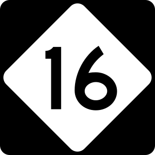
North Carolina Highway 16 (NC 16) is a 143.8-mile primary state highway in the U.S. state of North Carolina. Traveling in a north–south direction, it connects the cities and towns of Charlotte, Newton, Conover, Taylorsville, Wilkesboro and Jefferson, linking the Charlotte metropolitan area with the mountainous High Country. NC 16 is part of a three-state route 16 that connects the Charlotte region with northwestern West Virginia.

North Carolina Highway 18 (NC 18) is a primary state highway in the U.S. state of North Carolina. Traveling north–south through the Foothills region, it connects the cities of Shelby, Morganton, Lenoir, Wilkesboro and North Wilkesboro.

North Carolina's 5th congressional district covers the central western portion of North Carolina from the Appalachian Mountains to the Metrolina western suburbs. The district borders Tennessee and Virginia, with the bulk of its territory in the mountains. The district is overwhelmingly Republican. Large portions were controlled by Republicans even during the "Solid South" era as much of northwestern North Carolina was Quaker or mountaineer and therefore resisted secession. Two counties in the district – Avery and Yadkin – have never voted for a Democratic presidential candidate since their creation, and Wilkes County has never done so since before the Second Party System. For the 2020 election the district has been updated per House Bill 1029 enacted by the NC General Assembly on November 15, 2019, becoming Session Law 2019–249. District boundaries are based on 2010 census tabulation blocks.

Todd is an unincorporated community straddling the county lines of Watauga and Ashe counties in northwestern North Carolina, United States on the South Fork of the New River. It lies at an elevation of 2,992 feet. The population was 2,141 at the 2010 United States Census. The ZIP Code for Todd is 28684.
Beaver Creek is an unincorporated community in Ashe County, North Carolina, United States, located off U.S. Route 221, south of West Jefferson.

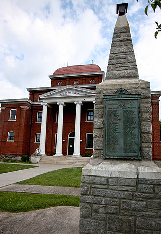
This list includes properties and districts listed on the National Register of Historic Places in Ashe County, North Carolina. Click the "Map of all coordinates" link to the right to view an online map of all properties and districts with latitude and longitude coordinates in the table below.

North Carolina Highway 113 is a primary state highway in the U.S. state of North Carolina. It runs from NC 18 in the community of Laurel Springs, to NC 93 in the community of Piney Creek.

North Carolina Highway 194 (NC 194) is a primary state highway in the U.S. state of North Carolina. Entirely in the High Country, it runs from US 19E, in Ingalls, to the Virginia state line, near Helton.

North Carolina Highway 88 (NC 88) is a 41.3-mile-long (66.5 km) primary state highway in the U.S. state of North Carolina. Primarily in the High Country, it runs from the Tennessee state line near Trade east to NC 18 in Laurel Springs.
The Lost Provinces were relatively inaccessible regions of North Carolina in the 19th and early 20th centuries, under-served by roads and railroads. In the mountainous northwest corner of the state, west of the Eastern Continental Divide. Ashe, Alleghany and Watauga counties in the New River basin were cut off from the rest of the state by the high Blue Ridge Mountains. The area's mountainous topography caused these counties to be most closely connected to Smyth and Grayson counties in Virginia, and to Johnson and Carter counties in Tennessee. The first highway to connect the area to points east was the Blowing Rock Turnpike. Started in 1911, it ran to Lenoir in Caldwell County. In 1914 a railroad was built to connect Ashe County to Abingdon, Virginia. After 1921 North Carolina Highway 16 connected Ashe County to Wilkesboro.


