Binji Binji | |
|---|---|
LGA and town | |
 Interactive map of Binji | |
 Binji | |
| Coordinates: 13°13′N4°55′E / 13.217°N 4.917°E | |
| Country | |
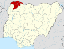
| State | Sokoto State |
| Area | |
• Total | 559 km2 (216 sq mi) |
| Population (2006) | |
• Total | 105,027 |
| Time zone | UTC+1 (WAT) |
| 3-digit postal code prefix | 853 |
| ISO 3166 code | NG.SO.BI |
Binji is a Local Government Area in Sokoto State, Nigeria. Its headquarters are in the town of Binji. It was originally established by the sons of the military commander Ali Jedo as a Ribat. [1]
Contents
It has an area of 559 km2 and a population of 105,027 at the 2006 census. [2] The postal code of the area is 853. [3]