Sokoto South

Last updated

Sokoto South
LGA
Nigeria location map.svg
Red pog.svg
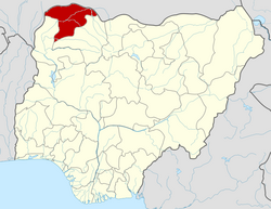
Sokoto South
Location in Nigeria
Coordinates: 13°03′N5°13′E / 13.050°N 5.217°E / 13.050; 5.217
CountryFlag of Nigeria.svg  Nigeria
State Sokoto State
Area
  Total41 km2 (16 sq mi)
Population
 (2006 census)
  Total194,914
Time zone UTC+1 (WAT)
3-digit postal code prefix
840
ISO 3166 code NG.SO.SS
Sokoto South

Sokoto South is a Local Government Area in Sokoto State, Nigeria. Its headquarters is in Sarkin Zamfara.

It has an area of 41 km2 and a population of 194,914 at the 2006 census. [1]

The postal code of the area is 840. [2]

Related Research Articles

Kebbe is a Local Government Area in Sokoto State, Nigeria. Its headquarters are in the town of Kebbe. The LGA shares a border with Zamfara State in the east and Kebbi State in the south and west.

Rabah is a Local Government Area in Sokoto State, Nigeria. Its headquarters are in the town of Rabah.

Isa is a town and Local Government Area of Sokoto state, Nigeria. It shares borders with Shinkafi in Zamfara State, Goronyo and Sabon Birni from west and north respectively in Sokoto and the Republic of Niger in the east.

Sokoto North is a Local Government Area in Sokoto State, Nigeria. Its headquarters is in the state capital of Sokoto.

Wamako is a Local Government Area in Sokoto State, Nigeria. Its headquarters is in the town of Wamako on the Sokoto River.

Gudu is a Local Government Area in Sokoto State, Nigeria. Its headquarters are in the town of Balle.

Tangaza is a Local Government Area in Sokoto State, Nigeria. Its headquarters is in the town of Gidan Madi.

Kware is a Local Government Area in Sokoto State, Nigeria. Its headquarters are in the town of Kware on the A1 highway.

Wurno is a Local Government Area in Sokoto State, Nigeria. Its headquarters is in the town of Wurno, near the Gagere River.

Goronyo is a Local Government Area in Sokoto State, Nigeria. Its headquarters are in the town of Goronyo, on the Sokoto River. It has an area of 1,704 km2 and a population of 182,296 at the 2006 census. The postal code of the area is 842.

Sabon Birni is a Local Government Area in Sokoto State, Nigeria. Its headquarters are in the town of Sabon Birni.

Illela is a Local Government Area in Sokoto State, Nigeria. Its headquarters are in the town of Illela.

Gwadabawa is a Local Government Area in Sokoto State, Nigeria. Its headquarters are in the town of Gwadabawa on the A1 highway. It comprises Gwadabawa, Salame, Chimola and Asara districts

Tambuwal is a Local Government Area in Sokoto State, Nigeria. Its headquarters is in the town of Tambuwal on the A1 highway at 12°24′00″N4°40′00″E.

Yabo is a Local Government Area in Sokoto State, Nigeria. Its headquarters is in the town of Yabo, and Yabo local Government is one of the oldest local governments in Sokoto. Since Sokoto, Kebbi and Zamfara are known as Sokoto. by then Yabo, Tambuwal and Shagari are all known as Yabo local government.

Shagari is a Local Government Area in Sokoto State, Nigeria. Its headquarters are in the town of Shagari on the A1 highway. The local government area (LGA) shares a border with Zamfara State in the south.

Bodinga is a Local Government Area in Sokoto State, Nigeria. Its headquarters are in the town of Bodinga. It was first established by Abdullahi dan Fodio in 1809.

Dange Shuni is a Local Government Area in Sokoto State, Nigeria. Its headquarters are in the town of Dange.

Silame is a Local Government Area in Sokoto State, Nigeria. Its headquarters is in the town of Silame, on the Sokoto River.

Binji is a Local Government Area in Sokoto State, Nigeria. Its headquarters are in the town of Binji. It was originally established by the sons of the military commander Ali Jedo as a Ribat.

References

  1. HASC, population, area and Headquarters Statoids
  2. "Post Offices- with map of LGA". NIPOST. Archived from the original on 2009-10-07. Retrieved 2009-10-20.