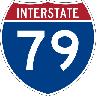
Interstate 79 (I-79) is an Interstate Highway in the Eastern United States, designated from I-77 in Charleston, West Virginia, north to Pennsylvania Route 5 (PA 5) and PA 290 in Erie, Pennsylvania. It is a primary thoroughfare through western Pennsylvania and West Virginia and makes up part of an important corridor to Buffalo, New York, and the Canada–United States border. Major metropolitan areas connected by I-79 include Charleston and Morgantown in West Virginia and Greater Pittsburgh and Erie in Pennsylvania.
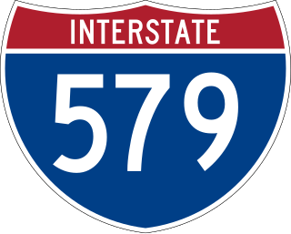
Interstate 579 (I-579) is a north–south Interstate Highway entirely within Pittsburgh, Pennsylvania. The highway is 2.73 miles (4.39 km) long. I-579 is also known as the Crosstown Boulevard since it crosses the backside of Downtown Pittsburgh.

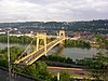
The Smithfield Street Bridge is a lenticular truss bridge crossing the Monongahela River in Pittsburgh, Pennsylvania, USA.
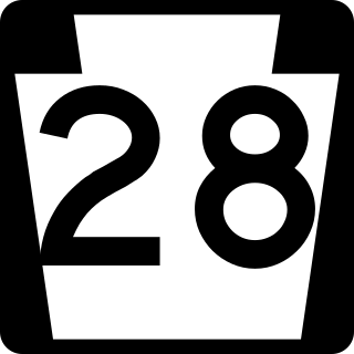
Pennsylvania Route 28 is a major state highway, which runs for 98 miles (158 km) from Anderson Street in Pittsburgh to U.S. Route 219 (US 219) in Brockway in Pennsylvania in the United States.
The Mon–Fayette Expressway is a partially-completed controlled-access toll road that is planned to eventually link Interstate 68 near Morgantown, West Virginia with Interstate 376 near Monroeville, Pennsylvania. The ultimate goal of the highway is to provide a high speed north–south connection between Morgantown and the eastern side of Pittsburgh while revitalizing economically distressed Monongahela River Valley towns in Fayette and Washington counties, serving as an alternative to Interstate 79 to the west, as well as relieving the PA 51 alignment from Pittsburgh to Uniontown.

The Liberty Bridge, which was completed in 1928, connects downtown Pittsburgh, Pennsylvania, to the Liberty Tunnels and the South Hills neighborhoods beyond. It crosses the Monongahela River and intersects Interstate 579 at its northern terminus.

The South Tenth Street Bridge, most often called the Tenth Street Bridge, but officially dubbed the Philip Murray Bridge, is a suspension bridge that spans the Monongahela River in Downtown Pittsburgh, Pennsylvania.

The Hot Metal Bridge is a truss bridge in Pittsburgh, Pennsylvania, that crosses the Monongahela River. The bridge consists of two parallel spans on a single set of piers: the former Monongahela Connecting Railroad Bridge, built in 1887, on the upstream side and the former Hot Metal Bridge, built in 1900, on the downstream side. The Monongahela Connecting Railroad Bridge carried conventional railroad traffic, while the Hot Metal Bridge connected parts of the J&L Steel mill, carrying crucibles of molten iron from the blast furnaces in ladle transfer cars to the open hearth furnaces on the opposite bank to be converted to steel. During World War II 15% of America's steel making capacity crossed over the Hot Metal Bridge, up to 180 tons per hour. The upstream span was converted to road use after a $14.6 million restoration, and opened by Mayor Tom Murphy with a ceremony honoring former steel workers on June 23, 2000. The bridge connects 2nd Avenue at the Pittsburgh Technology Center in South Oakland with Hot Metal Street in the South Side. The downstream span reopened for pedestrian and bicycle use in late 2007 after two years of work. The Great Allegheny Passage hiker/biker trail passes over this bridge as it approaches Pittsburgh's Golden Triangle area.

The Cypress Street Viaduct, often referred to as the Cypress Structure or the Cypress Freeway, was a 1.6-mile-long (2.5 km), raised two-deck, multi-lane freeway constructed of reinforced concrete that was originally part of the Nimitz Freeway in Oakland, California, United States.

The George Rankin Jr. Memorial Bridge is a cantilever bridge that carries the Green Belt across the Monongahela River between Whitaker and Rankin in Pennsylvania in the USA. It carries four lanes of automobile traffic, plus pedestrian walkways, both paved with concrete. The bridge carries over 22,500 people per day. The bridge and many of its approach ramps were originally built with tram tracks, all of which have since been removed.

The Rachel Carson Bridge, also known as the Ninth Street Bridge, spans the Allegheny River in Downtown Pittsburgh, Pennsylvania in the United States.

The Neville Island Bridge is a tied arch bridge which carries Interstate 79 and the Yellow Belt across the Ohio River and over Neville Island, west of Pittsburgh, Pennsylvania.

Interstate 95 (I-95) is a major north–south Interstate Highway that runs along the East Coast of the United States from Miami, Florida, north to the Canada–United States border at Houlton, Maine. In the state of Pennsylvania, it runs 51.00 miles (82.08 km) from the Delaware state line near Marcus Hook in Delaware County in the southeastern part of the state northeast to the Delaware River–Turnpike Toll Bridge at the New Jersey state line near Bristol in Bucks County, closely paralleling the New Jersey state line for its entire length through Pennsylvania.

The Boulevard of the Allies is a mostly four-lane road in the U.S. state of Pennsylvania, connecting Downtown Pittsburgh with the Oakland neighborhood of the city.

Pennsylvania Route 885 is a 14.1-mile-long (22.69 km) north–south state highway in the U.S. state of Pennsylvania. It runs from Pennsylvania Route 837 in Clairton north to Interstate 579 in Pittsburgh. The route is entirely within Allegheny County and serves as a connector between the city of Pittsburgh and its southern suburbs.

The Brady Street Bridge, also known as the South 22nd Street Bridge, was a steel bowstring arch bridge in Pittsburgh, Pennsylvania, which crossed over the Monongahela River at South 22nd Street. Its main span was a tied arch with a suspended road deck, with two through-truss side spans, carrying two traffic lanes between Brady Street on the Pittsburgh side and South 22nd Street on the south side. Approach viaducts were built at either end. The bridge was built by the Schultz Bridge and Iron Company.

U.S. Route 202 is a US Highway running from New Castle, Delaware, northeast to Bangor, Maine. In the U.S. state of Pennsylvania, the route runs for 59 miles (95 km), from the Delaware state line in Bethel Township, Delaware County, to the New Hope–Lambertville Toll Bridge over the Delaware River in Solebury Township, where the route crosses into New Jersey. The highway runs through the western and northern suburbs of Philadelphia in the Delaware Valley metropolitan area, and serves as a toll-free bypass around the city, avoiding the busy traffic and congestion on Interstate 95 (I-95). It is signed north–south and follows a general southwest–northeast direction through the state.

The Carl E. Stotz Memorial Little League Bridge, formerly known as the Market Street Bridge, carries approximately 27,700 vehicles a day on U.S. Route 15 over the West Branch Susquehanna River between Williamsport and South Williamsport in Lycoming County, Pennsylvania, in the United States. It is the seventh bridge on the site and was built at a cost of over $60,000,000.

The Fleming Park Bridge is a through truss bridge which spans the back channel of the Ohio River, between Neville Island and Stowe Township, PA. Although the Ohio River's back channel is only 590 feet wide, roughly 660 feet of this newer bridge was erected over water due to the unique 65-degree angle of the structure's trajectory.