Black Eagle, Montana

Last updated
Black Eagle, Montana
CDP
Cascade County Montana Incorporated and Unincorporated areas Black Eagle Highlighted.svg
Location of Black Eagle, Montana
Coordinates: 47°31′35″N111°16′42″W / 47.52639°N 111.27833°W / 47.52639; -111.27833 Coordinates: 47°31′35″N111°16′42″W / 47.52639°N 111.27833°W / 47.52639; -111.27833
Country United States
State Montana
County Cascade
Area
[1]
  Total1.73 sq mi (4.48 km2)
  Land1.54 sq mi (3.99 km2)
  Water0.19 sq mi (0.49 km2)
Elevation
3,379 ft (1,030 m)
Population
 (2020)
  Total949
  Density615.83/sq mi (237.71/km2)
Time zone UTC-7 (Mountain (MST))
  Summer (DST) UTC-6 (MDT)
ZIP code
59414
Area code 406
FIPS code 30-07150
GNIS feature ID0802039

Black Eagle is a census-designated place (CDP) in Cascade County, Montana, United States. The population was 904 at the 2010 census. [2] It is a suburb of Great Falls.

Contents

History

With early activity from smelters and refineries, Black Eagle was first called "Little Chicago". [3] [4] This was a reference to the industrialized nature of the town. When the post office was established in 1917, the name of the town officially became Black Eagle. It was named for the Black Eagle Falls on the Missouri River, which were named by Capt. Meriwether Lewis. [4]

Construction of the Boston & Montana smelter, which formed the town's skyline, began in 1891. [4] It was demolished on September 18, 1982. [4]

Geography

Black Eagle is located at 47°31′35″N111°16′42″W / 47.52639°N 111.27833°W / 47.52639; -111.27833 (47.526385, -111.278459). [5] It is near Giant Springs State Park.

According to the United States Census Bureau, the CDP has a total area of 1.7 square miles (4.4 km2), of which 1.5 square miles (3.9 km2) is land and 0.1 square miles (0.26 km2) (8.33%) is water.

Demographics

Historical population
CensusPop.Note
2020 949
U.S. Decennial Census [6]

As of the census [7] of 2000, there were 914 people, 418 households, and 237 families residing in the CDP. The population density was 590.3 inhabitants per square mile (227.9/km2). There were 458 housing units at an average density of 295.8 per square mile (114.2/km2). The racial makeup of the CDP was 88.07% White, 0.55% African American, 7.66% Native American, 0.22% Asian, 0.55% from other races, and 2.95% from two or more races. Hispanic or Latino of any race were 2.52% of the population.

There were 418 households, out of which 24.4% had children under the age of 18 living with them, 38.8% were married couples living together, 12.0% had a female householder with no husband present, and 43.1% were non-families. 38.3% of all households were made up of individuals, and 11.7% had someone living alone who was 65 years of age or older. The average household size was 2.19, and the average family size was 2.86.

In the CDP, the population was spread out, with 23.9% under the age of 18, 8.6% from 18 to 24, 29.1% from 25 to 44, 24.8% from 45 to 64, and 13.6% who were 65 years of age or older. The median age was 38 years. For every 100 females, there were 105.4 males. For every 100 females age 18 and over, there were 104.7 males.

The median income for a household in the CDP was $23,529, and the median income for a family was $31,771. Males had a median income of $26,250 versus $17,321 for females. The per capita income for the CDP was $18,269. About 8.1% of families and 11.1% of the population were below the poverty line, including 10.1% of those under age 18 and 3.8% of those age 65 or over.

Climate

According to the Köppen Climate Classification system, Black Eagle has a semi-arid climate, abbreviated "BSk" on climate maps. [8]

Related Research Articles

<span class="mw-page-title-main">Radersburg, Montana</span> Census-designated place in Montana, United States

Radersburg is a census-designated place (CDP) in Broadwater County, Montana, United States. The population was 66 at the 2010 census.

<span class="mw-page-title-main">Toston, Montana</span> Census-designated place in Montana, United States

Toston is a census-designated place (CDP) in Broadwater County, Montana, United States. The population was 108 at the 2010 census.

<span class="mw-page-title-main">Winston, Montana</span> Census-designated place in Montana, United States

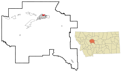
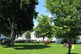
Winston is a census-designated place (CDP) in Broadwater County, Montana, United States. The population was 147 at the 2010 census.

<span class="mw-page-title-main">Fort Shaw, Montana</span> CDP in Montana, United States

Fort Shaw is a census-designated place (CDP) in Cascade County, Montana, United States. The population was 280 at the 2010 census. Named for a former United States military outpost, it is part of the Great Falls, Montana Metropolitan Statistical Area.

<span class="mw-page-title-main">Simms, Montana</span> CDP in Montana, United States

Simms is a census-designated place (CDP) in Cascade County, Montana, United States. The population was 354 at the 2010 census. It is part of the Great Falls, Montana Metropolitan Statistical Area.

<span class="mw-page-title-main">Sun Prairie, Montana</span> CDP in Montana, United States

Sun Prairie is a census-designated place (CDP) in Cascade County, Montana, United States. The population was 1,630 at the 2010 census. It is part of the Great Falls Metropolitan Statistical Area and may have evolved as a remote suburb of Great Falls.

<span class="mw-page-title-main">Sun River, Montana</span> CDP in Montana, United States

Sun River is a census-designated place (CDP) in Cascade County, Montana, United States. The population was 124 at the 2010 census. It is part of the Great Falls, Montana Metropolitan Statistical Area.

<span class="mw-page-title-main">Ulm, Montana</span> CDP in Montana, United States

Ulm is a census-designated place (CDP) in Cascade County, Montana, United States. It was originally a large ranch owned by Indiana-born cattleman William Ulm. The population was 738 at the 2010 census. It is part of the Great Falls, Montana Metropolitan Statistical Area.

<span class="mw-page-title-main">Carter, Montana</span> Census-designated place in Montana, United States

Carter is a census-designated place (CDP) in Chouteau County, Montana, United States. The population was 58 at the 2010 census.

<span class="mw-page-title-main">Four Corners, Montana</span> Census-designated place in Montana, United States

Four Corners is a census-designated place (CDP) in Gallatin County, Montana, United States. The population was 5,901 at the 2020 census, up from 3,146 in 2010. It is part of the Bozeman, MT Micropolitan Statistical Area.

<span class="mw-page-title-main">Big Arm, Montana</span> Census-designated place in Montana, United States

Big Arm is a census-designated place (CDP) in Lake County, Montana, United States. The population was 177 at the 2010 census, up from 131 in 2000.

<span class="mw-page-title-main">Ravalli, Montana</span> Census-designated place in Montana, United States

Ravalli is an unincorporated community and census-designated place (CDP) in Lake County, Montana, United States. The population was 76 at the 2010 census, down from 119 in 2000. At one time Charlie Allard, the country's leading expert on breeding bison, owned the country's largest herd of buffalo in Ravalli.

<span class="mw-page-title-main">Augusta, Montana</span> Census-designated place in Montana, United States

Augusta is an unincorporated community and census-designated place (CDP) in Lewis and Clark County, Montana, United States. The population was 309 at the 2010 census and rose to 316 in the 2020 census. The most accepted version in the naming of this town is after Augusta Hogan, thought to be the first child born in this town, the daughter of J. D. Hogan, an early rancher.

<span class="mw-page-title-main">Helena Valley Southeast, Montana</span> Census-designated place in Montana, United States

Helena Valley Southeast is a census-designated place (CDP) in Lewis and Clark County, Montana, United States. The population was 8,227 at the 2010 census. It is part of the Helena Micropolitan Statistical Area.

<span class="mw-page-title-main">Lonepine, Montana</span> CDP in Montana, United States

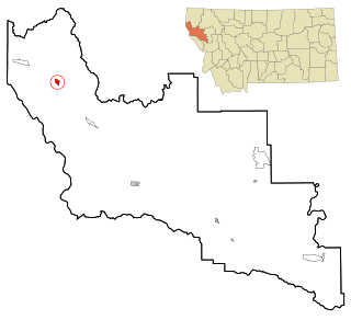
Lonepine is a census-designated place (CDP) in Sanders County, Montana, United States. The population was 137 at the 2000 census.

<span class="mw-page-title-main">Noxon, Montana</span> CDP in Montana, United States

Noxon is a census-designated place (CDP) in Sanders County, Montana, United States. The population of the whole CDP was 255 at the 2020 census.

<span class="mw-page-title-main">Cardwell, Montana</span> Census-designated place in Montana, United States

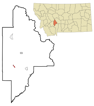
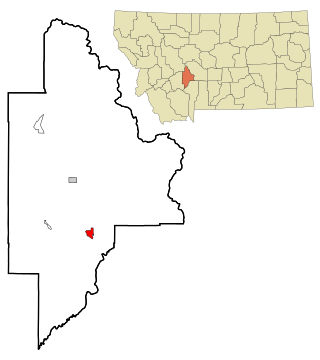
Cardwell is a census-designated place (CDP) in Jefferson County, Montana, United States. The population was 50 at the 2010 census. It is part of the Helena Micropolitan Statistical Area.

<span class="mw-page-title-main">Pablo, Montana</span> Census-designated place in Montana, United States

Pablo is a census-designated place (CDP) in Lake County, Montana, United States. The population was 2,254 at the 2010 census, up from 1,814 in 2000. It is the home of Salish Kootenai College and the seat of government of the Flathead Indian Reservation.

<span class="mw-page-title-main">Belchertown (CDP), Massachusetts</span> Census-designated place in Massachusetts, United States

Belchertown is a census-designated place (CDP) comprising the central village in the town of Belchertown in Hampshire County, Massachusetts, United States. The population was 2,899 at the 2010 census, out of a total town population of 14,649. It is part of the Springfield, Massachusetts Metropolitan Statistical Area.

<span class="mw-page-title-main">Power, Montana</span> CDP in Montana, United States

Power is a census-designated place (CDP) in Teton County, Montana, United States. The population was 171 at the 2000 census. The town is named after Montana pioneer, Thomas Charles Power, who platted the townsite in 1910.

References

  1. "ArcGIS REST Services Directory". United States Census Bureau. Retrieved September 5, 2022.
  2. "Profile of General Population and Housing Characteristics: 2010 Demographic Profile Data (DP-1): Black Eagle CDP, Montana". United States Census Bureau . Retrieved January 26, 2012.
  3. Carkeek Cheney, Roberta (1983). Names on the Face of Montana. Missoula, Montana: Mountain Press Publishing Company. p. 5. ISBN   0-87842-150-5.
  4. 1 2 3 4 "Montana Place Names Companion". Montana Historical Society. Retrieved 25 July 2017.
  5. "US Gazetteer files: 2010, 2000, and 1990". United States Census Bureau. 2011-02-12. Retrieved 2011-04-23.
  6. "Census of Population and Housing". Census.gov. Retrieved June 4, 2016.
  7. "U.S. Census website". United States Census Bureau . Retrieved 2008-01-31.
  8. Climate Summary for Black Eagle, Montana