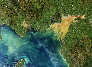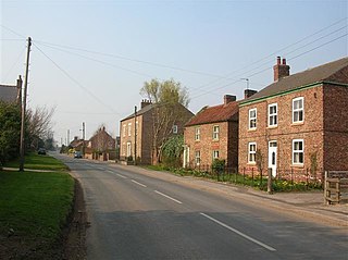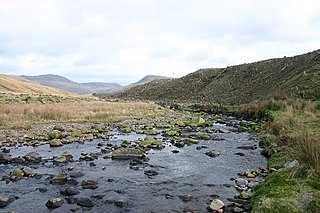
The Solway Firth is a firth that forms part of the border between England and Scotland, between Cumbria and Dumfries and Galloway. It stretches from St Bees Head, just south of Whitehaven in Cumbria, to the Mull of Galloway, on the western end of Dumfries and Galloway. The Isle of Man is also very near to the firth. The firth comprises part of the Irish Sea.
The toponymy of England derives from a variety of linguistic origins. Many English toponyms have been corrupted and broken down over the years, due to language changes which have caused the original meanings to be lost. In some cases, words used in these place-names are derived from languages that are extinct, and of which there are no known definitions. Place-names may also be compounds composed of elements derived from two or more languages from different periods. The majority of the toponyms predate the radical changes in the English language triggered by the Norman Conquest, and some Celtic names even predate the arrival of the Anglo-Saxons in the first millennium AD.
Gretna is a town in Dumfries and Galloway, Scotland, originally part of the historic county of Dumfriesshire. It is located close to the A74(M) on the border of Scotland and England and near the mouth of the River Esk. It is the most southeasterly settlement in Scotland.

Wast Water or Wastwater is a lake located in Wasdale, a valley in the western part of the Lake District National Park, England. The lake is almost 3 miles (4.8 km) long and more than one-third mile (500 m) wide. It is a glacial lake, formed in a glacially 'over-deepened' valley. It is the deepest lake in England at 258 feet (79 m). The surface of the lake is about 200 feet (60 m) above sea level, while its bottom is over 50 feet (15 m) below sea level. It is owned by the National Trust.

Blennerhasset and Torpenhow is a civil parish in Cumbria, England. According to the 2001 census it had a population of 437, reducing to 423 at the 2011 Census. It includes the villages of Blennerhasset grid reference NY178415 and Torpenhow at NY202397 and the smaller settlement of Kirkland Guards at NY187401. It is located just outside the Lake District National Park. Baggrow railway station was immediately north of Blennerhasset.

Flawith is a village and civil parish in Hambleton district of North Yorkshire, England. It is situated approximately 4 miles (6.4 km) south-west of Easingwold. The population taken at the 2011 Census was less than 100. Details are included in the civil parish of Aldwark.

Langwathby is a village and civil parish in northern Cumbria, England, about 5 miles (8 km) north east of Penrith on the A686 road. The village lies on the east bank of the River Eden. At the 2001 census the parish had a population of 748, increasing to 866 at the 2011 Census.

Melmerby is a village and civil parish in the Harrogate district of North Yorkshire, England, that lies 3.7 miles (6 km) north of Ripon and 0.6 miles (1 km) west of the A1(M) motorway. The population was 386 in the 2011 census.

The River Bleng is a tributary of the River Irt in the county of Cumbria in northern England.

Wath is a village and civil parish 3.7 miles (6 km) north of Ripon in the Harrogate district of North Yorkshire, England. The population of the parish was estimated at 210 in 2015.
A mere is a shallow lake, pond, or wetland, particularly in Great Britain and other parts of western Europe.

Middleton Quernhow is a settlement and civil parish in the Harrogate district of North Yorkshire, England. The parish is included in the Wathvale Ward with a population of 3,479. North Yorkshire County Council estimated that the population of the parish was 60 in 2015. It is very near the A1(M) road and is 4 miles (7 km) north of Ripon.
West Stockwith is a village within the Bassetlaw district of Nottinghamshire, England. The population at the 2011 census was 327. it lies on the west bank of the River Trent, 3 miles (4.8 km) north-west of Gainsborough and 1.5 miles (2.4 km) east of Misterton. West Stockwith is an ecclesiastical parish in the Church of England Diocese of Southwell and Nottingham with the parish church of St Mary the Virgin's Church, West Stockwith being built in 1722.

Yanwath is a village in the Westmorland and Furness District of Cumbria, England, 1 mile south of Penrith.

Boustead Hill is a hamlet in Cumbria, England. It has two separate equestrian centres. In 1831 the township had a population of 63.
Baldwinholme is a village in Cumbria, England. In 1870-72 the township had a population of 234.

Bagley is a village in the City of Leeds metropolitan borough, West Yorkshire, England, once in the township of Farsley. The remains of the village are on Bagley Lane, on the section between the A657 road in Rodley and the junction with Coalhill Lane.

An ayre is the name used for shingle beaches found in Orkney, Shetland, the Isle of Man, Lancashire, Cumbria and Northumbria. The word is derived from the Old Norse eyrr, meaning a shingle beach or gravelly place, and may be applied to ordinary beaches, cliff-foot beaches such as the Lang Ayre in Northmavine, Shetland, spits, bars or tombolos, but only if formed of shingle. More than 130 such shingle beaches are named on Ordnance Survey maps of Shetland, but far fewer in Orkney, where most beaches are formed of sand. The word in its Old Norse form is common in Iceland, and it also occurs in a few place names in the north and west of the Scottish mainland which had a strong Norse influence, such as Eriboll and in the names of several shingle banks—Salt Ayre, Green Ayre, Stake Ayre, Rabbit Ayre and Whinny Ayre—in the tidal reach of the River Lune at Lancaster.

Howtown is a hamlet in Cumbria, England, situated at a small harbour on the east shore of Ullswater in the Lake District. It lies within the civil parish of Martindale.


