Blue Ridge, Virginia

Last updated
Blue Ridge, Virginia
Oak Drive, Blue Ridge.jpg
Houses on Oak Drive
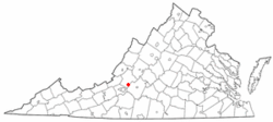
VAMap-doton-BlueRidge.PNG
Location of Blue Ridge, Virginia
Coordinates: 37°22′19″N79°48′59″W / 37.37194°N 79.81639°W / 37.37194; -79.81639 Coordinates: 37°22′19″N79°48′59″W / 37.37194°N 79.81639°W / 37.37194; -79.81639
Country United States
State Virginia
County Botetourt
Area
  Total6.088 sq mi (15.77 km2)
  Land6.087 sq mi (15.77 km2)
  Water0.001 sq mi (0.003 km2)
Elevation
1,263 ft (385 m)
Population
 (2020)
  Total3,185
  Density520/sq mi (200/km2)
Time zone UTC−5 (Eastern (EST))
  Summer (DST) UTC−4 (EDT)
ZIP Code
24064
Area code(s) 540 and 826
FIPS code 51-08200 [1]
GNIS feature ID1499150 [2]

Blue Ridge is a census-designated place (CDP) in southern Botetourt County, Virginia, United States. The population was 3,185 at the 2020 census. The CDP is located along U.S. Route 460. It is part of the Roanoke Metropolitan Statistical Area.

Contents

Geography

According to the United States Census Bureau, the CDP has a total area of 6.088 square miles (15.77 km²).

Demographics

Historical population
CensusPop.Note
2000 3,188
2010 3,084−3.3%
2020 3,1853.3%
Source: U.S. Census Bureau

2020 census

As of the census of 2020, there were 3,185 people residing in the CDP. There were 1,318 housing units. The racial makeup of the CDP was 92.0% White, 2.9% African American or Black, 0.1% American Indian, 0.5% Asian, 0.0% Pacific Islander, 0.5% from other races, and 4.0% from two or more races. Hispanic or Latino of any race were 1.8% of the population.

The 2020 American Community Survey 5-Year Estimates found that median income for a household in the CDP was $78,536, and the median income for a family was $86,714. 3.1% of the population were living below the poverty line, including 1.8% of those under 18 and 4.6% of those 65 and older.

2010 census

As of the census of 2010, there were 3,084 people residing in the CDP. There were 1,269 housing units. The racial makeup of the CDP was 95.8% White, 2.6% African American, 0.2% Native American, 0.4% Asian, 0.0% Pacific Islander, 0.2% from other races, and 0.9% from two or more races. Hispanic or Latino of any race were 0.8% of the population.

2000 census

As of the census [1] of 2000, there were 3,188 people, 1,181 households, and 968 families residing in the CDP. The population density was 504.1 people per square mile (194.8/km²). There were 1,219 housing units at an average density of 192.8/sq mi (74.5/km²). The racial makeup of the CDP was 95.33% White, 2.85% African American, 0.22% Native American, 0.50% Asian, 0.06% from other race, and 1.04% from two or more races. Hispanic or Latino of any race were 0.53% of the population.

There were 1,181 households, out of which 34.8% had children under the age of 18 living with them, 72.5% were married couples living together, 6.9% had a female householder with no husband present, and 18.0% were non-families. 15.1% of all households were made up of individuals, and 6.1% had someone living alone who was 65 years of age or older. The average household size was 2.70 and the average family size was 2.99.

In the CDP, the population was spread out, with 25.0% under the age of 18, 4.9% from 18 to 24, 29.6% from 25 to 44, 30.1% from 45 to 64, and 10.5% who were 65 years of age or older. The median age was 40 years. For every 100 females there were 93.0 males. For every 100 females age 18 and over, there were 92.3 males.

The median income for a household in the CDP was $59,239, and the median income for a family was $63,926. Males had a median income of $39,226 versus $27,284 for females. The per capita income for the CDP was $24,683. None of the families and 2.4% of the population were living below the poverty line, including no under eighteens and 7.9% of those over 64.

Economy

Blue Ridge is predominately a bedroom community of Roanoke and Salem, however there are some industrial employers within the community. Boxley Materials Company operates a large quarry along the Bedford-Botetourt border, Adams Construction Company operates an asphalt plant, and General Shale Brick operates a brickyard.

Parks and recreation

Boxley Fields Park, a public park maintained by the Botetourt County Parks and Recreation Department is located in the CDP. The park is named after the Boxley Materials Company. The park includes baseball fields, a soccer field, a walking trail, and outdoor classroom. [3]

Another county maintained park, Blue Ridge Park, is located just outside of the CDP. The park includes a baseball field, softball field, soccer field, basketball courts, tennis courts, walking trail, and paved track. [4]

Government

The United States Postal Service operates the Blue Ridge Post Office within the CDP. The Blue Ridge ZIP Code extends into parts of neighboring Bedford County.

Education

The CDP is served by Botetourt County Public Schools. Public school students residing in Blue Ridge are zoned to attend Colonial Elementary School, Read Mountain Middle School, and Lord Botetourt High School.

Higher education institutions are located in Hollins and Roanoke.

Infrastructure

Aqua Virginia operates a number of community water systems within Blue Ridge.

Public safety

Law enforcement is provided by the Botetourt County Sheriff's Office. Fire protection and emergency medical services are provided by the Botetourt County Department of Fire and EMS and the Blue Ridge Volunteer Fire Department and Rescue Squad, which operates a fire station within the CDP.

Transportation

Air

The Roanoke-Blacksburg Regional Airport is the closest airport with commercial service to the CDP.

Highways

Rail

The Norfolk Southern operated Blue Ridge District runs through the CDP. The closest passenger rail service is located in Roanoke.

Related Research Articles

<span class="mw-page-title-main">Roanoke County, Virginia</span> County in Virginia, United States

Roanoke County is a county located in the U.S. state of the Commonwealth of Virginia. As of the 2020 census, the population was 96,929. Its county seat is Salem, but the county administrative offices are located in the unincorporated Cave Spring area of the county.

<span class="mw-page-title-main">Craig County, Virginia</span> County in Virginia, United States

Craig County is a county located in the Commonwealth of Virginia. As of the 2020 census, the population was 4,892. Its county seat is New Castle.

<span class="mw-page-title-main">Botetourt County, Virginia</span> County in Virginia, United States

Botetourt County is a US county that lies in the Roanoke Region of the Commonwealth of Virginia. Located in the mountainous portion of the state, the county is bordered by two major ranges, the Blue Ridge Mountains and the Appalachian Mountains.

<span class="mw-page-title-main">Blue Ridge, Alabama</span> Census-designated place in Alabama, United States

Blue Ridge is an unincorporated community and census-designated place (CDP) in Elmore County, Alabama, United States. At the 2020 census, the population was 1,485. It is part of the Montgomery Metropolitan Statistical Area.

Blue Hills is a community in Hartford County, Connecticut, encompassing the northwest corner of the city of Hartford and the southeast corner of the town of Bloomfield. The Bloomfield portion is listed by the U.S. Census Bureau as a census-designated place (CDP), with a population of 2,762 at the 2020 census.

<span class="mw-page-title-main">Mountain Park, Gwinnett County, Georgia</span> CDP in Georgia, United States

Mountain Park is an unincorporated, census-designated place in Gwinnett County, Georgia, United States. The population was 11,554 at the 2010 census. The older name for the area is Trickum, which is reflected in Five Forks-Trickum Road which bisects the community. The older community was centered on Five Forks and Rockbridge Roads.

<span class="mw-page-title-main">Claysburg, Pennsylvania</span> Census-designated place in Pennsylvania, United States

Claysburg is a census-designated place (CDP) along Interstate 99 and the Allegheny Front in Blair County, Pennsylvania, United States, situated near the base of Blue Knob. As of the 2020 census, it had a population of 1,291.

<span class="mw-page-title-main">Cameron Park, Texas</span> CDP in Texas, United States

Cameron Park is a census-designated place (CDP) in Cameron County, Texas, United States. The population was 6,963 at the 2010 census. It is part of the Brownsville–Harlingen Metropolitan Statistical Area.

<span class="mw-page-title-main">Iron Gate, Virginia</span> Town in Virginia, United States

Iron Gate is a town in eastern Alleghany County, Virginia, United States. The population was 324 at the 2020 census. The town is located along U.S. Route 220, near Clifton Forge.

<span class="mw-page-title-main">Fishersville, Virginia</span> CDP in Virginia, United States

Fishersville is a census-designated place (CDP) in Augusta County, Virginia, United States. The population was 7,462 at the 2010 census, an increase of nearly fifty percent from the 4,998 reported in 2000. It is part of the Staunton–Waynesboro Micropolitan Statistical Area. Fishersville is also home to Barren Ridge Vineyards, winner of the 2009 Best in Show wine at the Virginia State Fair.

<span class="mw-page-title-main">Weyers Cave, Virginia</span> CDP in Virginia, United States

Weyers Cave is a census-designated place (CDP) in Augusta County, Virginia, United States. The population was 2,473 at the 2010 census. It is part of the Staunton–Waynesboro Micropolitan Statistical Area.

<span class="mw-page-title-main">Forest, Virginia</span> Census-designated place in Virginia, United States

Forest is a census-designated place (CDP) in eastern Bedford County, Virginia, United States. The population was 11,709 at the 2020 census. It is part of the Lynchburg Metropolitan Statistical Area.

<span class="mw-page-title-main">Buchanan, Virginia</span> Town in Virginia, United States

Buchanan is a town in Botetourt County, Virginia, United States. The population was 1,196 at the 2020 census. It is part of the Roanoke Metropolitan Statistical Area. It was the western terminus of the James River and Kanawha Canal when construction on the canal ended.

Cloverdale is a census-designated place (CDP) in Botetourt County, Virginia, United States. The population was 3,410 at the 2020 census, which was an increase from the 3,119 reported in 2010. It is part of the Roanoke Metropolitan Statistical Area.

Daleville is a census-designated place (CDP) in southern Botetourt County, Virginia, United States. The population was 3,070 at the 2020 census. The CDP is located along U.S. Route 220. It is part of the Roanoke Metropolitan Statistical Area.

Laymantown is a census-designated place (CDP) in southern Botetourt County, Virginia, United States. The population was 1,867 at the 2020 census. The community is located along State Route 658. It is part of the Roanoke Metropolitan Statistical Area.

<span class="mw-page-title-main">Troutville, Virginia</span> Town in Virginia, United States

Troutville is a town in Botetourt County, Virginia, United States. The population was 458 at the 2020 census. The town is located along the U.S. Route 11 between Cloverdale and Buchanan. It is part of the Roanoke Metropolitan Statistical Area.

North Shore is a census-designated place (CDP) in Franklin County, Virginia, United States. The community lies along State Route 616. It is part of the Roanoke Metropolitan Statistical Area.

Cave Spring is a census-designated place (CDP) in Roanoke County, Virginia, United States. The population was 26,755 at the 2020 census. Cave Spring covers much of the area known locally as "Southwest County" which has the most affluent suburbs of Roanoke. It is part of the Roanoke Metropolitan Statistical Area.

Hollins is a census-designated place (CDP) in Botetourt and Roanoke counties in the U.S. state of Virginia. Hollins covers much of the area known locally as "North County". The population was 15,574 at the 2020 census. It is part of the Roanoke Metropolitan Statistical Area. The area is also the home of Hollins University in addition to four properties listed on the National Register of Historic Places: the Black Horse Tavern-Bellvue Hotel and Office, Harshbarger House, the Hollins College Quadrangle, and Old Tombstone.

References

  1. 1 2 "U.S. Census website". United States Census Bureau . Retrieved 2008-01-31.
  2. "US Board on Geographic Names". United States Geological Survey. 2007-10-25. Retrieved 2008-01-31.
  3. "Boxley Fields Park". www.botetourtva.gov. Botetourt County. Retrieved 1 April 2023.
  4. "Blue Ridge Park". www.botetourtva.gov. Botetourt County. Retrieved 1 April 2023.