Bogue Chitto, Lincoln County, Mississippi

Last updated

Bogue Chitto, Lincoln County,
Mississippi
USA Mississippi location map.svg
Red pog.svg
Bogue
Chitto
Location in Mississippi
Usa edcp location map.svg
Red pog.svg
Bogue
Chitto
Location in the United States
Coordinates: 31°26′20″N90°27′08″W / 31.43889°N 90.45222°W / 31.43889; -90.45222
CountryUnited States
State Mississippi
County Lincoln
Area
  Total2.26 sq mi (5.85 km2)
  Land2.26 sq mi (5.85 km2)
  Water0.0 sq mi (0.0 km2)
Elevation
404 ft (123 m)
Population
 (2020)
  Total437
  Density231/sq mi (89.2/km2)
Time zone UTC-6 (Central (CST))
  Summer (DST) UTC-5 (CDT)
ZIP code
39629
FIPS code 28-07322
GNIS feature ID667378 [1]

Bogue Chitto is an unincorporated community and census-designated place (CDP) in Lincoln County, Mississippi, United States. As of the 2020 census, it had a population of 437. [2] Bogue Chitto is the only municipal hamlet in the state of Mississippi. [3]

Contents

History

Bogue Chitto takes its name from the nearby Bogue Chitto River, the name of which is a Choctaw word, Bok Chito, meaning "big river". [4] [5]

The population in 1900 was 582. At that time, the settlement had telephone and telegraph services, a school, and several churches. The local economy involved the lumber industry, and a lumber mill and cotton gin were located there. [5]

The settlement is located on a branch of the Illinois Central Railroad. [5]

Geography

Bogue Chitto is in southern Lincoln County, west of the Bogue Chitto River and east of Interstate 55, which provides access to the town at Exit 30 (Bogue Chitto Road). I-55 leads north 65 miles (105 km) to Jackson, the state capital, and south the same distance to Hammond, Louisiana. U.S. Route 51 runs through the community, just west of the center of town and parallel to I-55. US 51 leads north 10 miles (16 km) to Brookhaven, the Lincoln county seat, and south 14 miles (23 km) to McComb.

According to the U.S. Census Bureau, the Bogue Chitto CDP has an area of 2.2 square miles (5.8 km2), all of it recorded as land. The Bogue Chitto River flows south past the community, then southeast into Louisiana, where it joins the Pearl River.

Demographics

Historical population
CensusPop.Note
2010 522
2020 437−16.3%
U.S. Decennial Census [6]
2010 [7] 2020 [8]

Bogue Chitto (Lincoln County) first appeared as a census designated place in the 2010 U.S. Census. [7]

2020 census

Bogue Chitto CDP, Lincoln County, Mississippi – Racial and ethnic composition
Note: the US Census treats Hispanic/Latino as an ethnic category. This table excludes Latinos from the racial categories and assigns them to a separate category. Hispanics/Latinos may be of any race.
Race / Ethnicity (NH = Non-Hispanic)Pop 2010 [7] Pop 2020 [8] % 2010% 2020
White alone (NH)23418244.83%41.65%
Black or African American alone (NH)27723053.07%52.63%
Native American or Alaska Native alone (NH)020.00%0.46%
Asian alone (NH)100.19%0.00%
Pacific Islander alone (NH)000.00%0.00%
Some Other Race alone (NH)000.00%0.00%
Mixed Race or Multi-Racial (NH)4160.77%3.66%
Hispanic or Latino (any race)671.15%1.60%
Total522437100.00%100.00%

As of the 2020 United States census, there were 437 people, 110 households, and 80 families residing in the CDP.

Education

Bogue Chitto is part of the Lincoln County School District. The Bogue Chitto Attendance Center serves area students in grades K-12. The community's first school was built in 1924. The original Art Deco-style building was demolished in 2003 by Jackson Salvage Company.

Related Research Articles

<span class="mw-page-title-main">Bogue Chitto, Mississippi</span> Census-designated place in Mississippi, United States

Bogue Chitto is a census-designated place (CDP) situated in Kemper and Neshoba counties, Mississippi. The population was 864 at the 2020 census. It is part of the Mississippi Band of Choctaw Indians Reservation and the population is 93% Choctaw.

Armorel is an unincorporated community and census-designated place (CDP) in Mississippi County, Arkansas, United States. As of the 2020 census, it had a population of 312. It is in a largely rural area with most of its land devoted to forests and farms. Most of the town lies between Arkansas highways 18 and 312. The town's name was formed from the abbreviations of Arkansas and Missouri, along with the first three initials of its founder, Wilson.

<span class="mw-page-title-main">Eastabuchie, Mississippi</span> Community in Mississippi, U.S.

Eastabuchie is a census-designated place and unincorporated community in southwestern Jones County, Mississippi. It is located along U.S. Route 11, just north of the Forrest County line. the community has a post office with the ZIP code 39436. Eastabuchie is part of the Laurel Micropolitan Statistical Area.

<span class="mw-page-title-main">Farrell, Mississippi</span> Census-designated place in Mississippi, United States

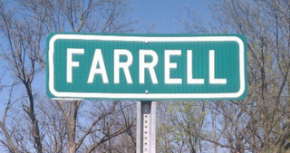
Farrell is an unincorporated community and census-designated place in Coahoma County, Mississippi, United States. Per the 2020 census, the population was 200. Farrell is located approximately 4 miles (6 km) south of Stovall and 4 miles (6 km) north of Sherard on Mississippi Highway 1. It is approximately 9 miles (14 km) northwest of Clarksdale, the county seat.

Pleasant Hill is a census-designated place and unincorporated community located in DeSoto County, Mississippi, United States, located approximately 9 miles (14 km) southwest of Hernando and 8 miles (13 km) southeast of Eudora, just east of Arkabutla Lake.

<span class="mw-page-title-main">White Oak, Mississippi</span> CDP in Mississippi, United States

White Oak is a census-designated place located on Mississippi Highway 4 in Tunica County, Mississippi. White Oak is approximately 2 miles (3.2 km) east of Evansville and approximately 8 miles (13 km) west of Savage. The population at the 2020 census was 692.

Bayou Goula is an unincorporated community and census-designated place (CDP) in Iberville Parish, Louisiana, United States. Its population was 514 in 2020.

<span class="mw-page-title-main">Cullomburg, Alabama</span> Census-designated place in Alabama, United States

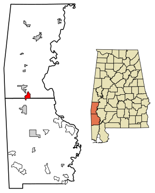
Cullomburg is a census-designated place and unincorporated community in Choctaw and Washington counties, Alabama, United States. Its population was 126 as of the 2020 census.

Mount Pleasant is a census-designated place and unincorporated community in Marshall County, Mississippi, United States, located along U.S. Highway 72 at State Highway 311. The community has a volunteer fire department on Boswell Road, and a K-12 school located off Highway 72.

Victoria is a census-designated place and unincorporated community in Marshall County, Mississippi, United States. It was first listed as a CDP in the 2020 census, which recorded a population of 1,066.

<span class="mw-page-title-main">Stewart, Mississippi</span> Census-designated place in Mississippi, United States

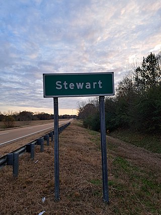
Stewart is a census-designated place and unincorporated community in Montgomery County, Mississippi, United States. As of the 2020 census, it had a population of 99.

Lemannville is an unincorporated community and census-designated place in Ascension and St. James parishes, Louisiana, United States. It was first listed as a CDP in the 2010 Census. Per the 2020 census, the population was 695.

Morgantown is a census-designated place (CDP) in Adams County, Mississippi, United States, located to the northeast of the city of Natchez. As of the 2020 census, it had a population of 1,334.

Cloverdale is a census-designated place (CDP) in Adams County, Mississippi, United States, located to the south of the city of Natchez. As of the 2020 census, it had a population of 557.

Bethlehem is a census-designated place and unincorporated community in Marshall County, Mississippi, United States. Its ZIP code is 38659.

Arnold Line is an unincorporated area and census-designated place (CDP) in Lamar County, Mississippi, United States. As of the 2020 census it had a population of 2,333. It is part of the Hattiesburg Metropolitan Statistical Area.

Romeville is an unincorporated community and census-designated place in St. James Parish, Louisiana, United States. Its population was 130 as of the 2010 census. The community is located along Louisiana Highway 44 on the east bank of the Mississippi River.

Union is an unincorporated community and census-designated place in St. James Parish, Louisiana, United States. The community is located along Louisiana Highway 44 on the east bank of the Mississippi River.

Cleary is an unincorporated community and census-designated place in Rankin County, Mississippi, United States. Per the 2020 census, the population was 1,688.

Robinhood is an unincorporated community and census-designated place in Rankin County, Mississippi, United States. Per the 2020 census, the population was 1,491.

References

    1. U.S. Geological Survey Geographic Names Information System: Bogue Chitto
    2. "Total Population: 2010 Census DEC Summary File 1 (P1), Bogue Chitto CDP (Lincoln County), Mississippi". data.census.gov. U.S. Census Bureau. Retrieved April 8, 2020.
    3. "Bogue Chitto Gets Grant for Street Work". The Daily Leader. February 21, 2012.
    4. Choctaw Nation of Oklahoma, 2016, "New Choctaw Dictionary, First Edition". Pgs. 202 and 361, "big: Chito","River: Bok"
    5. 1 2 3 Rowland, Dunbar (1907). Mississippi: Comprising Sketches of Counties, Towns, Events, Institutions, and Persons, Arranged in Cyclopedic Form. Vol. 1. Southern Historical Publishing Association. p.  259.
    6. "Decennial Census of Population and Housing by Decades". US Census Bureau.
    7. 1 2 3 "P2 Hispanic or Latino, and Not Hispanic or Latino by Race – 2010: DEC Redistricting Data (PL 94-171) – Bogue Chitto CDP, Lincoln County, Mississippi". United States Census Bureau .
    8. 1 2 "P2 Hispanic or Latino, and Not Hispanic or Latino by Race – 2020: DEC Redistricting Data (PL 94-171) - Bogue Chitto CDP, Lincoln County, Mississippi". United States Census Bureau .