
Rancho Palos Verdes is a city in Los Angeles County, California atop the Palos Verdes Hills and bluffs of the Palos Verdes Peninsula. A suburb of Los Angeles, it is known for expensive homes amidst large tracts of open space with expansive views of the Pacific Ocean. Rancho Palos Verdes is translated as "Ranch of Green Sticks", probably referring to the willows in the northeastern part of Bixby Slough shown on earlier maps.
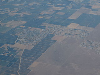
Bonadelle Ranchos-Madera Ranchos is a census-designated place (CDP) in Madera County, California, United States. It is part of the Madera–Chowchilla Metropolitan Statistical Area. The population was 8,569 at the 2010 census, up from 7,300 at the 2000 census.

Rancho Mirage is a city in Riverside County, California, United States. The population was 17,218 at the 2010 census, up from 13,249 at the 2000 census, but the seasonal (part-time) population can exceed 20,000. Located between Cathedral City and Palm Desert, it is one of the nine cities of the Coachella Valley. Rancho Mirage was incorporated in 1973 from a merger of Mirage Cove with five unincorporated areas known as the "Cove communities", and had 3,000 permanent residents at the time.

Rancho Cordova is a city in Sacramento County, California, United States which incorporated in 2003. It is part of the Sacramento Metropolitan Area. The population was 64,776 at the 2010 census. Rancho Cordova is the Sacramento area's largest employment sub-center, attracting over 50,000 commuters. The city is served by Sacramento Regional Transit's various bus lines and the Gold Line light rail line, though fewer than 0.1 percent of commuters to Rancho Cordova use the line according to the US Census Bureau's American Community Survey (2010-2012). In 2010 Rancho Cordova was named as a winner of the All-America City Award.

Rancho Cucamonga is a city of about 177,000 residents located just south of the foothills of the San Gabriel Mountains and Angeles National Forest in San Bernardino County, California, United States. About 37 miles (60 km) east of Downtown Los Angeles, Rancho Cucamonga is the 19th most populous city in southern California and the 27th state-wide. The city's seal, which centers on a cluster of grapes, alludes to the city's agricultural history including wine-making. The city's proximity to major transportation hubs, airports, and highways has attracted the business of several large corporations, including Coca-Cola, Frito-Lay, Big Lots, Mercury Insurance Group, Southern California Edison, and Amphastar Pharmaceuticals.
The Santa Ana Valley is located in Orange County, California and is bisected by the Santa Ana River. The valley is home to most of Orange County's central business districts. The cities of Anaheim, Buena Park, Costa Mesa, Fullerton, Irvine, Orange, Placentia, Santa Ana, and Yorba Linda are located in the Santa Ana Valley.

Area code 559 is a California telephone area code that was split from area code 209 on November 14, 1998.
Montaña de Oro is a state park in California, United States. The park is located six miles southwest of Morro Bay and 2 miles south of Los Osos. The name "Mountain of Gold" comes from the golden wildflowers found in the park.

Rancho Petaluma Adobe is a historic ranch house in Sonoma County, California. It was built from adobe bricks in 1836 by order of Mariano Guadalupe Vallejo. It was the largest privately owned adobe structure built in California and is the largest example of the Monterey Colonial style of architecture in the United States. A section of the former ranch has been preserved by the Petaluma Adobe State Historic Park and it is both a California Historic Landmark and a National Historic Landmark. The Rancho Petaluma Adobe State Historic Park is located on Adobe Road on the east side of the present-day town of Petaluma, California.

Ygnacio Ramón de Jesus del Valle was a Californio rancher and landowner in the eastern Santa Clara River Valley, California, United States, as well as an alcalde of Los Angeles. His estate, Rancho Camulos, is registered as a National Historic Landmark.
Diego de Borica was a Basque Spanish explorer and the seventh governor of Alta California from 1794 to 1800. He died on August 19, 1800 in Durango, Mexico.
The Spanish and later Mexican governments encouraged settlement of the coastal region of Alta California by giving prominent men large land grants called ranchos, usually two or more square leagues, or 35 square kilometres (14 sq mi). Land-grant titles (concessions) were government-issued, permanent, unencumbered property-ownership rights to land called ranchos. The ranchos encompassed virtually all of the most valuable land near the coast, around San Francisco Bay, and inland along the Sacramento River and nearby lands in the Central Valley.
The California Land Act of 1851, enacted following the Treaty of Guadalupe Hidalgo and the admission of California as a state in 1850, established a three-member Public Land Commission to determine the validity of prior Spanish and Mexican land grants. It required landowners who claimed title under the Mexican government to file their claim with a commission within two years. Contrary to the Treaty of Guadalupe Hidalgo, which guaranteed full protection of all property rights for Mexican citizens, it placed the burden on landholders to prove their title.
Rancho Los Cerritos was a 27,054-acre (109.48 km2) 1834 land grant in present-day southern Los Angeles County and Orange County, California The grant was the result of a partition of the Rancho Los Nietos grant. "Cerritos" means "little hills" in Spanish. The rancho lands include the present-day cities of Cerritos and Long Beach.

Bonadelle Ranchos Nine is an unincorporated community in Madera County, California. It lies at an elevation of 420 feet.
Madera Ranchos is an unincorporated community in Madera County, California. It lies at an elevation of 341 feet. For census purposes, Madera Ranchos is aggregated with Bonadelle Ranchos into the census-designated place Bonadelle Ranchos-Madera Ranchos.
Hahamongna and Hahamog-na are historic Tongva-Gabrieleño Native American settlements in the Verdugo Mountains of Southern California, named after the local Tongva band's name Hahamog'na, in present-day Pasadena and Glendale in Los Angeles County, California.
Rancho Dominguez is a former Spanish colonial and Mexican settlement in Alta California, and a present-day unincorporated community in Los Angeles County, California. Rancho Dominguez is located between Compton, California, Long Beach, California and Carson, California.
Rancho Temescal was a Mexican land grant in present-day Temescal Valley in Riverside County, California, granted by Governor José María de Echeandía in 1828 to Leandro Serrano.


