Narbo, California

Last updated
Narbo
Former settlement
USA California location map.svg
Red pog.svg
Narbo
Location in California
Coordinates: 37°13′02″N119°42′05″W / 37.21722°N 119.70139°W / 37.21722; -119.70139 Coordinates: 37°13′02″N119°42′05″W / 37.21722°N 119.70139°W / 37.21722; -119.70139
Country United States
State California
County Madera County
Elevation [1] 1,995 ft (608 m)

Narbo is a former settlement in Madera County, California. [1] It was located on Quartz Mountain about 4.25 miles (7 km) north of O'Neals, [2] at an elevation of 1995 feet (608 m). [1]

Madera County, California County in California, United States

Madera County, officially the County of Madera, is a county at the geographic center of the U.S. state of California. As of the 2010 census, the population was 150,865. The county seat is Madera.

California State of the United States of America

California is a state in the Pacific Region of the United States. With 39.6 million residents, California is the most populous U.S. state and the third-largest by area. The state capital is Sacramento. The Greater Los Angeles Area and the San Francisco Bay Area are the nation's second- and fifth-most populous urban regions, with 18.7 million and 9.7 million residents respectively. Los Angeles is California's most populous city, and the country's second-most populous, after New York City. California also has the nation's most populous county, Los Angeles County, and its largest county by area, San Bernardino County. The City and County of San Francisco is both the country's second-most densely populated major city after New York City and the fifth-most densely populated county, behind only four of the five New York City boroughs.

Quartz Mountain mountain in United States of America

Quartz Mountain is located in Greer County in southwest Oklahoma. It is the namesake of Quartz Mountain Nature Park and its eastern flank is enclosed by the park boundaries. It is near the cities of Mangum, Oklahoma and Altus, Oklahoma. The park is open to the public year round for rock climbing, hiking, boating, camping, nature observation and photography, and environmental education and interpretation. The mountain overlooks scenic Lake Altus-Lugert.

Narbo was a mining community financed by French investors. [2] The name Narbo comes from Narbonne, the name of one of the investors. [2] Narbo is the Latin name for the town Narbonne, France. A post office operated at Narbo from 1884 to 1887. [2]

Latin Indo-European language of the Italic family

Latin is a classical language belonging to the Italic branch of the Indo-European languages. The Latin alphabet is derived from the Etruscan and Greek alphabets and ultimately from the Phoenician alphabet.

Narbonne Subprefecture and commune in Occitanie, France

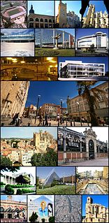
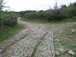
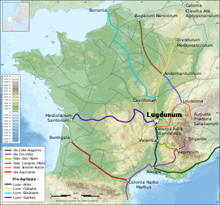
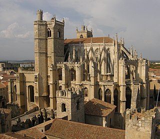
Narbonne is a commune in southern France in the Occitanie region. It lies 849 km (528 mi) from Paris in the Aude department, of which it is a sub-prefecture. It is located about 15 km (9.3 mi) from the shores of the Mediterranean Sea and was historically a prosperous port, but declined from the 14th century following a change in the course of the Aude River. It is marginally the largest commune in Aude, although the prefecture is the slightly smaller commune of Carcassonne.

France Republic with mainland in Europe and numerous oversea territories

France, officially the French Republic, is a country whose territory consists of metropolitan France in Western Europe and several overseas regions and territories. The metropolitan area of France extends from the Mediterranean Sea to the English Channel and the North Sea, and from the Rhine to the Atlantic Ocean. It is bordered by Belgium, Luxembourg and Germany to the northeast, Switzerland and Italy to the east, and Andorra and Spain to the south. The overseas territories include French Guiana in South America and several islands in the Atlantic, Pacific and Indian oceans. The country's 18 integral regions span a combined area of 643,801 square kilometres (248,573 sq mi) and a total population of 67.3 million. France, a sovereign state, is a unitary semi-presidential republic with its capital in Paris, the country's largest city and main cultural and commercial centre. Other major urban areas include Lyon, Marseille, Toulouse, Bordeaux, Lille and Nice.

Related Research Articles

Aude Department of France in Occitanie

Aude is a department in Southern France, located in the Occitanie region and named after the Aude River. The departmental council also calls it "Cathar Country" after a group of religious dissidents active in the 12th century.

Via Domitia Roman road linking Italy and Hispania through Gallia Narbonensis

The Via Domitia was the first Roman road built in Gaul, to link Italy and Hispania through Gallia Narbonensis, across what is now southern France. The route that the Romans regularised and paved was ancient when they set out to survey it, so old that it traces the mythic route travelled by Heracles.

Athaulf was king of the Visigoths from 411 to 415. During his reign, he transformed the Visigothic state from a tribal kingdom to a major political power of Late Antiquity.

Septimania Historical region in France

Septimania is a historical region in modern-day south of France. It referred to the western part of the Roman province of Gallia Narbonensis that passed to the control of the Visigoths in 462, when Septimania was ceded to their king, Theodoric II. Under the Visigoths it was known as simply Gallia or Narbonensis. Septimania territory roughly corresponds with the former administrative region of Languedoc-Roussillon that merged into the new administrative region of Occitanie. Septimania passed briefly to the Emirate of Córdoba, which had been expanding from the south during the eighth century before its subsequent conquest by the Franks, who by the end of the ninth century termed it Gothia or the Gothic March.

Gallia Narbonensis Roman province

Gallia Narbonensis was a Roman province located in what is now Languedoc and Provence, in southern France. It was also known as Provincia Nostra, from its having been the first Roman province north of the Alps, and as Gallia Transalpina, distinguishing it from Cisalpine Gaul in northern Italy. It became a Roman province in the late 2nd century BC. Its boundaries were roughly defined by the Mediterranean Sea to the south and the Cévennes and Alps to the north and west. The western region of Gallia Narbonensis was known as Septimania.

<i>Via Aquitania</i>

The Via Aquitania was a Roman road created in 118 BC in the Roman province of Gaul. It started at Narbonne, where it connected to the Via Domitia. It then went toward the Atlantic Ocean, via Toulouse and Bordeaux, covering approximately 400 kilometres (250 mi).

The Volcae were a tribal confederation constituted before the raid of combined Gauls that invaded Macedonia c. 270 BC and fought the assembled Greeks at the Battle of Thermopylae in 279 BC. Tribes known by the name Volcae were found simultaneously in southern Gaul, Moravia, the Ebro valley of the Iberian Peninsula, and Galatia in Anatolia. The Volcae appear to have been part of the late La Tène material culture, and a Celtic identity has been attributed to the Volcae, based on mentions in Greek and Latin sources as well as onomastic evidence. Driven by highly mobile groups operating outside the tribal system and comprising diverse elements, the Volcae were one of the new ethnic entities formed during the Celtic military expansion at the beginning of the 3rd century BC. Collecting in the famous excursion into the Balkans, ostensibly, from the Hellene point of view, to raid Delphi, a branch of the Volcae split from the main group on the way into the Balkans and joined two other tribes, the Tolistobogii and the Trocmi, to settle in central Anatolia and establish a new identity as the Galatians.

<i>Via Augusta</i> longest and busiest of the major roads built by the Romans in ancient Hispania

The Via Augusta, was the longest and busiest of the major roads built by the Romans in ancient Hispania. With an approximate length of 1,500 km 1,500 km (930 mi), the Via Augusta was built to link Spain with Italy, running from the interior city of Gades (Cádiz) to the Pyrenees along inland valleys parallel to the coast of the Mediterranean Sea. As the main axis of the road network in Roman Hispania, it appears in ancient sources such as the itinerary inscribed on the Vicarello Cups as well in as the Antonine Itinerary.

Narbonne High School California public school for grades 9 to 12

Nathaniel Narbonne High School (NHS) is a school located at 24300 South Western Avenue, in the Harbor City area of Los Angeles, California. Narbonne serves grades 9 through 12 and is part of the Los Angeles Unified School District. Narbonne serves the Harbor City area and the city of Lomita.

Tonantius Ferreolus, was a vir clarissimus, or Gallo-Roman senator.

Ancient Diocese of Narbonne diocese

The former Catholic diocese of Narbonne existed from early Christian times until the French Revolution. It was an archdiocese, with its see at Narbonne, from the year 445, and its influence ran over much of south-western France and into Catalonia.

Ferreolus, also called Ferreolus of Rodez was a Gallo-Roman senator from Narbonne, then Narbo, who later lived in Rodez where his family had also held Trevidos, a villa estate near Segodunum, since the mid-fifth century at least.

Ennodius was a Proconsul of Africa in 395. He may have fathered a son, born in 380 and married to someone who was born in 385 and daughter of Flavius Julius Agricola, Consul of Rome in 421 and the father of Avitus, who were the parents of Flavius Magnus, Senator of Narbonne, Consul of Rome in 460 and praetorian prefect of Gaul in 469.

Flavius Probus, a Roman Senator and a v. nob. of Narbonne, then Narbo, was a man of literary taste and precocious ability. His father was Flavius Magnus, Consul of Rome in 460. He was a friend of Sidonius Apollinaris from their schooldays.

Albas, Aude Commune in Occitanie, France

Albas is a commune in the Aude department in the Occitanie region of southern France.

Armissan Commune in Occitanie, France

Armissan is a commune in the Aude department in the Occitanie region of southern France.

Fabrezan Commune in Occitanie, France

Fabrezan is a commune in the Aude department in southern France.

Agroecius was the name of a number of men from Roman history, most of them distinguished Gauls:

Racing Club de Narbonne Méditerannée is a French rugby union club that play in the second-level Rugby Pro D2.

References

  1. 1 2 3 U.S. Geological Survey Geographic Names Information System: Narbo, California
  2. 1 2 3 4 Durham, David L. (1998). California's Geographic Names: A Gazetteer of Historic and Modern Names of the State. Clovis, Calif.: Word Dancer Press. p. 817. ISBN   1-884995-14-4.