Bonesteel, South Dakota

Last updated

Bonesteel, South Dakota
Gregory County South Dakota Incorporated and Unincorporated areas Bonesteel Highlighted.svg
Location in Gregory County and the state of South Dakota
Coordinates: 43°04′39″N98°56′48″W / 43.07750°N 98.94667°W / 43.07750; -98.94667
Country United States
State South Dakota
County Gregory
Founded1902 [1]
Area
[2]
  Total0.35 sq mi (0.92 km2)
  Land0.35 sq mi (0.92 km2)
  Water0.00 sq mi (0.00 km2)
Elevation
[3]
1,965 ft (599 m)
Population
 (2020) [4]
  Total258
  Density728.81/sq mi (281.72/km2)
Time zone UTC-6 (Central (CST))
  Summer (DST) UTC-5 (CDT)
ZIP code
57317
Area code 605
FIPS code 46-06220 [5]
GNIS feature ID1267288 [3]

Bonesteel is a city in Gregory County, South Dakota, United States. The population was 258 at the 2020 census. [6]

Contents

History

Bonesteel was laid out in 1902. [7] The city named for H. E. Bonesteel, who operated as a freight forwarder in the area. [8]

Geography

According to the United States Census Bureau, the city has a total area of 0.35 square miles (0.91 km2), all land. [9]

Demographics

Historical population
CensusPop.Note
1910 563
1920 65215.8%
1930 564−13.5%
1940 532−5.7%
1950 485−8.8%
1960 452−6.8%
1970 354−21.7%
1980 3581.1%
1990 297−17.0%
2000 2970.0%
2010 275−7.4%
2020 258−6.2%
U.S. Decennial Census [10] [4]

2010 census

As of the census [11] of 2010, there were 275 people, 125 households, and 74 families residing in the city. The population density was 785.7 inhabitants per square mile (303.4/km2). There were 170 housing units at an average density of 485.7 per square mile (187.5/km2). The racial makeup of the city was 73.5% White, 22.9% Native American, 1.8% from other races, and 1.8% from two or more races. Hispanic or Latino of any race were 4.0% of the population.

There were 125 households, of which 24.8% had children under the age of 18 living with them, 47.2% were married couples living together, 9.6% had a female householder with no husband present, 2.4% had a male householder with no wife present, and 40.8% were non-families. 38.4% of all households were made up of individuals, and 20% had someone living alone who was 65 years of age or older. The average household size was 2.20 and the average family size was 2.88.

The median age in the city was 49.8 years. 26.5% of residents were under the age of 18; 2.6% were between the ages of 18 and 24; 18.1% were from 25 to 44; 22.5% were from 45 to 64; and 30.2% were 65 years of age or older. The gender makeup of the city was 48.0% male and 52.0% female.

2000 census

As of the census [5] of 2000, there were 297 people, 137 households, and 90 families residing in the city. The population density was 863.1 inhabitants per square mile (333.2/km2). There were 164 housing units at an average density of 476.6 per square mile (184.0/km2). The racial makeup of the city was 90.57% White, 7.07% Native American, and 2.36% from two or more races. Hispanic or Latino of any race were 0.34% of the population.

There were 137 households, out of which 21.9% had children under the age of 18 living with them, 53.3% were married couples living together, 6.6% had a female householder with no husband present, and 34.3% were non-families. 33.6% of all households were made up of individuals, and 23.4% had someone living alone who was 65 years of age or older. The average household size was 2.09 and the average family size was 2.53.

In the city, the population was spread out, with 18.5% under the age of 18, 5.1% from 18 to 24, 16.5% from 25 to 44, 26.3% from 45 to 64, and 33.7% who were 65 years of age or older. The median age was 54 years. For every 100 females, there were 96.7 males. For every 100 females age 18 and over, there were 90.6 males.

The median income for a household in the city was $26,389, and the median income for a family was $30,833. Males had a median income of $21,500 versus $21,250 for females. The per capita income for the city was $13,621. About 8.0% of families and 14.6% of the population were below the poverty line, including 17.6% of those under the age of eighteen and 17.3% of those 65 or over.

Climate

This climatic region is typified by large seasonal temperature differences, with warm to hot (and often humid) summers and cold (sometimes severely cold) winters. According to the Köppen Climate Classification system, Bonesteel has a humid continental climate, abbreviated "Dfa" on climate maps. [12]

Climate data for Bonesteel, South Dakota
MonthJanFebMarAprMayJunJulAugSepOctNovDecYear
Average high °C (°F)−1
(30)
2
(36)
7
(45)
16
(60)
22
(71)
27
(81)
31
(87)
30
(86)
24
(76)
18
(64)
8
(46)
1
(34)
16
(60)
Average low °C (°F)−13
(8)
−11
(13)
−6
(22)
2
(35)
8
(46)
13
(56)
17
(62)
16
(60)
9
(49)
3
(37)
−5
(23)
−11
(13)
2
(35)
Average precipitation mm (inches)10
(0.4)
18
(0.7)
41
(1.6)
76
(3)
110
(4.2)
94
(3.7)
81
(3.2)
69
(2.7)
69
(2.7)
46
(1.8)
23
(0.9)
10
(0.4)
640
(25.1)
Source: Weatherbase [13]

Related Research Articles

<span class="mw-page-title-main">Litchville, North Dakota</span> City in North Dakota, United States

Litchville is a city in Barnes County, North Dakota, United States, known for their canoeing and kayaking opportunities. The population was 169 at the 2020 census. Litchville was founded in 1900.

<span class="mw-page-title-main">Rogers, North Dakota</span> City in North Dakota, United States

Rogers is a city in Barnes County, North Dakota, United States. The population was 49 at the 2020 census. Rogers was founded in 1897.

<span class="mw-page-title-main">Maddock, North Dakota</span> City in North Dakota, United States

Maddock is a city in Benson County, North Dakota, United States. The population was 402 at the 2020 census. Maddock was founded in 1901.

<span class="mw-page-title-main">Warwick, North Dakota</span> City in North Dakota, United States

Warwick is a city in Benson County, North Dakota, United States. The population was 55 at the 2020 census. Warwick was founded in 1907.

<span class="mw-page-title-main">Lansford, North Dakota</span> City in North Dakota, United States

Lansford is a city in Bottineau County, North Dakota, United States. The population was 238 at the 2020 census. Lansford was founded in 1903.

<span class="mw-page-title-main">Newburg, North Dakota</span> City in North Dakota, United States

Newburg is a city in Bottineau County, North Dakota, United States. The population was 96 at the 2020 census. Newburg was founded in 1906.

<span class="mw-page-title-main">Bowman, North Dakota</span> City in North Dakota, United States

Bowman is a city and county seat of Bowman County, North Dakota, United States. The population was 1,470 at the 2020 census.

<span class="mw-page-title-main">Lincoln, North Dakota</span> City in North Dakota, United States

Lincoln is a city in Burleigh County, North Dakota, United States. It is a suburb of adjacent Bismarck, and also a core city of the Bismarck-Mandan Metropolitan Statistical Area. The population was 4,257 at the 2020 census, making it the fourteenth largest city in North Dakota. Lincoln was founded in 1977.

<span class="mw-page-title-main">Crosby, North Dakota</span> City in North Dakota

Crosby is a city and the county seat of Divide County, North Dakota, United States. The population was 1,065 at the 2020 census.

<span class="mw-page-title-main">Wishek, North Dakota</span> City in North Dakota, United States

Wishek is a city in McIntosh County, North Dakota, United States. The population was 864 at the 2020 census.

<span class="mw-page-title-main">Alexander, North Dakota</span> City in North Dakota, United States

Alexander is a city in McKenzie County, North Dakota, United States. The population was 319 at the 2020 census. Alexander was founded in 1905 and is named after early North Dakota politician Alexander McKenzie.

<span class="mw-page-title-main">Lakota, North Dakota</span> City in North Dakota, United States

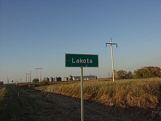
Lakota is a city in Nelson County, North Dakota, United States. It is the county seat of Nelson County Lakota is located 63 miles west of Grand Forks and 27 miles east of Devils Lake. The population was 683 at the 2020 census, making Lakota the 76th-largest city in North Dakota.

<span class="mw-page-title-main">Petersburg, North Dakota</span> City in North Dakota, United States

Petersburg is a city in Nelson County, North Dakota, United States. The population was 162 at the time of the 2020 census. Petersburg was founded in 1884.

<span class="mw-page-title-main">Lidgerwood, North Dakota</span> City in North Dakota, United States

Lidgerwood is a city in Richland County, North Dakota, United States. The population was 600 at the 2020 census. Lidgerwood was founded in 1886. It is part of the Wahpeton, ND–MN Micropolitan Statistical Area.

<span class="mw-page-title-main">Kenmare, North Dakota</span> City in North Dakota, United States

Kenmare is a city in Ward County, North Dakota, United States. The population was 961 at the 2020 census. Kenmare is part of the Minot Micropolitan Statistical Area.

<span class="mw-page-title-main">Springbrook, North Dakota</span> City in North Dakota, United States

Springbrook is a city in Williams County, North Dakota, United States. The population was 37 at the 2020 census. It is also spelled Spring Brook.

<span class="mw-page-title-main">Tyndall, South Dakota</span> City in South Dakota, United States

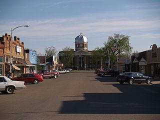
Tyndall is a city in and the county seat of Bon Homme County, South Dakota, United States. The population was 1,057 at the 2020 census.

<span class="mw-page-title-main">Newell, South Dakota</span> City in South Dakota, United States

Newell is a city in Butte County, South Dakota, United States. The population was 584 at the 2020 census.

<span class="mw-page-title-main">Platte, South Dakota</span> City in South Dakota, United States

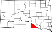
Platte is a city in Charles Mix County, South Dakota, United States. The population was 1,311 at the 2022 census. The community is named after the Platte Creek, a tributary of the Missouri River reservoir Lake Francis Case. Platte is located 15 miles east of Lake Francis Case on the Missouri River.

<span class="mw-page-title-main">Parkston, South Dakota</span> City in South Dakota, United States

Parkston is a city in Hutchinson County, South Dakota, United States. The population was 1,567 at the 2020 census.

References

  1. "SD Towns" (PDF). South Dakota State Historical Society. Archived from the original (PDF) on February 10, 2010. Retrieved February 11, 2010.
  2. "ArcGIS REST Services Directory". United States Census Bureau. Retrieved October 15, 2022.
  3. 1 2 U.S. Geological Survey Geographic Names Information System: Bonesteel, South Dakota
  4. 1 2 "Census Population API". United States Census Bureau. Retrieved October 15, 2022.
  5. 1 2 "U.S. Census website". United States Census Bureau . Retrieved January 31, 2008.
  6. "U.S. Census Bureau: Bonesteel city, South Dakota". www.census.gov. United States Census Bureau. Retrieved December 28, 2021.
  7. Federal Writers' Project (1940). South Dakota place-names, v.1-3. University of South Dakota. p. 27.
  8. Chicago and North Western Railway Company (1908). A History of the Origin of the Place Names Connected with the Chicago & North Western and Chicago, St. Paul, Minneapolis & Omaha Railways. p. 45.
  9. "US Gazetteer files 2010". United States Census Bureau. Archived from the original on January 25, 2012. Retrieved June 21, 2012.
  10. "Census of Population and Housing". Census.gov. Retrieved June 4, 2015.
  11. "U.S. Census website". United States Census Bureau . Retrieved June 21, 2012.
  12. Climate Summary for Bonesteel, South Dakota
  13. "Weatherbase.com". Weatherbase. 2013. Retrieved on October 10, 2013.