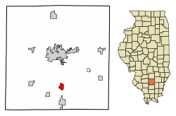
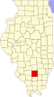
Bonnie, Illinois

Last updated

Bonnie
Jefferson County Illinois Incorporated and Unincorporated areas Bonnie Highlighted.svg
Location of Bonnie in Jefferson County, Illinois.
Illinois in United States (US48).svg
Location of Illinois in the United States
Coordinates: 38°12′11″N88°54′24″W / 38.20306°N 88.90667°W / 38.20306; -88.90667 [1]
CountryUnited States
StateIllinois
County Jefferson
Township Spring Garden
Area
[2]
  Total1.27 sq mi (3.30 km2)
  Land1.27 sq mi (3.30 km2)
  Water0.00 sq mi (0.00 km2)
Elevation
[1]
440 ft (130 m)
Population
 (2020)
  Total374
  Density293.33/sq mi (113.22/km2)
Time zone UTC-6 (CST)
  Summer (DST) UTC-5 (CDT)
Area code 618
FIPS code 17-07263
GNIS ID2398152 [1]
Wikimedia CommonsBonnie, Illinois
Website www.villageofbonnie.com

Bonnie is a village located in the southern part of Jefferson County, Illinois. Bonnie had a population of 397 in the 2010 census, down from 424 in the 2000 census. It is part of the Mount Vernon Micropolitan Statistical Area.

Contents

History

The first settlement in this area was Spring Garden, about four miles southeast of Bonnie. There were several springs in the area. Early in the 19th century, Uriah Compton walled them up and built a resort called "Compton's Springs". In 1848, the village of Spring Garden was platted next to the resort. Spring Garden grew rapidly, becoming the second largest settlement in the County, even having a high school by 1888. In 1905, however, the Chicago and Eastern Illinois Railroad was built about three miles to the west. Spring Garden began a long decline as the business and population shifted to the rail depots at Bonnie and Ina. George Washington Hayes (1842–1927) donated some of the land originally making up Bonnie.

The Bonnie Campground is located to the west of Bonnie. This campground has been the scene of large religious outdoor gatherings since late in the 19th century.

Geography

According to the 2010 census, Bonnie has a total area of 1.231 square miles (3.19 km2), of which 1.23 square miles (3.19 km2) (or 99.92%) is land and 0.001 square miles (0.00 km2) (or 0.08%) is water. [3]

Demographics

Historical population
CensusPop.Note
1940 177
1950 25745.2%
1960 215−16.3%
1970 31446.0%
1980 45243.9%
1990 411−9.1%
2000 4243.2%
2010 397−6.4%
2020 374−5.8%
U.S. Decennial Census [4]

As of the 2010 US Census, Bonnie had 397 people. Among non-Hispanics this includes 387 White (97.5%), 3 African-American, 2 Native American, & 3 from two or more races. The Hispanic or Latino population included 2 people.

There were 177 households, out of which 39 had children under the age of 18 living with them, 98 were married couples living together, 4 had a female householder with children & no husband present, and 56 were non-families. 49 households were made up of individuals, and 49 had someone who was 65 years of age or older. The average household size was 2.24 and the average family size was 2.72.

The median age 45.4 years.

As of the census [5] of 2000, there were 424 people, 177 households, and 129 families residing in the village. The population density was 343.8 people/mi2 (133.1 people/km2). There were 196 housing units at an average density of 158.9 units/mi2 (61.5 units/km2). The racial makeup of the village was 97.17% White, 0.0% African American, 1.65% Native American, 0.0% Asian, 0.0% Pacific Islander, 0.0% from other races, and 1.18% from two or more races. Approximately 0.47% of the population was Hispanic or Latino of any race.

There were 177 households in which 27.1% had children under the age of 18 years living with them, 65.5% were married couples living together, 6.8% had a female householder with no husband present, and 26.6% were non-families. Approximately 21.5% of all households were made up of individuals, and 11.9% had someone living alone who was 65 years of age or older. The average household size was 2.4 people and the average family size was 2.77 people.

In the village, the population was spread out, with 20.8% under the age of 18 years, 9.0% from 18 to 24 years old, 27.4% from 25 to 44 years old, 26.2% from 45 to 64 years old, and 16.7% who were 65 years of age or older. The median age was 40 years. For every 100 females, there were 90.1 males. For every 100 females age 18 years old and older, there were 95.3 males.

The median income for a household in the village was $27,768 and the median income for a family was $29,554. Males had a median income of $31,389 versus $19,375 for females. The per capita income for the village was $13,998. Approximately 9.7% of the population and 9.6% of families were below the poverty line. Approximately 6.0% of those under the age of 18 years and 11.8% of those 65 years old and older were living below the poverty line.

Related Research Articles

<span class="mw-page-title-main">Whelen Springs, Arkansas</span> Town in Arkansas, United States

Whelen Springs is a town in Clark County, Arkansas, United States. The population was 92 at the 2010 census. From 1930 through 1939 the town thrived, being a main hub of operations for the then powerful Ozan Lumber Company.

<span class="mw-page-title-main">Tupelo, Arkansas</span> Town in Arkansas, United States

Tupelo is a town in Jackson County, Arkansas, United States. The population was 180 at the 2010 census.

<span class="mw-page-title-main">Orlo Vista, Florida</span> Census-designated place & Unincorporated community in Florida, United States

Orlo Vista is an unincorporated community and census-designated place in Orange County, Florida, United States. While the spelling "Orlo Vista" is used by the U.S. Postal Service, the community is shown as Orlovista on federal maps. The population of the Orlovista census-designated place was 6,123 at the 2010 census. It is part of the Orlando–Kissimmee Metropolitan Statistical Area. The boundaries of the Orlovista CDP are West Colonial Drive on the north, Pine Hills Road on the east, Old Winter Garden Road and Carter Street at the Orlando city limits on the south, and Hiawassee Road on the west.

<span class="mw-page-title-main">East Dennis, Massachusetts</span> Census-designated place in Massachusetts, United States

East Dennis is a village and census-designated place (CDP) in the town of Dennis in Barnstable County, Massachusetts, United States. It was settled in the 1630s. The population was 2,753 at the 2010 census.

<span class="mw-page-title-main">Monson Center, Massachusetts</span> Census-designated place in Massachusetts, United States

Monson Center is a census-designated place (CDP) in the town of Monson in Hampden County, Massachusetts, United States. The population was 2,107 at the 2010 census, out of a total 8,560 people in the town. It is part of the Springfield, Massachusetts Metropolitan Statistical Area.

<span class="mw-page-title-main">Upton (CDP), Massachusetts</span> Census-designated place in Massachusetts, United States

Upton is a census-designated place (CDP) in the town of Upton in Worcester County, Massachusetts, United States. The population was 3,013 at the 2010 census, out of 7,542 in the entire town. The CDP includes the villages of Upton and West Upton.

<span class="mw-page-title-main">Seabrook Farms, New Jersey</span> Populated place in Cumberland County, New Jersey, US

Seabrook Farms is an unincorporated community and census-designated place (CDP) located within Seabrook, which is in turn located in Upper Deerfield Township, in Cumberland County, in the U.S. state of New Jersey. It is part of the Vineland-Bridgeton metropolitan statistical area for statistical purposes. At the 2010 census, Seabrook Farms's population was 1,484. Seabrook Farms is named after Charles F. Seabrook, a businessman who ran a truck farm that was one of the state's largest.

<span class="mw-page-title-main">Crestwood Village, New Jersey</span> CDP in Ocean County, New Jersey, US

Crestwood Village is an unincorporated community and census-designated place (CDP) located within Manchester Township, in Ocean County, in the U.S. state of New Jersey. As of the 2010 United States Census, the CDP's population was 7,907.

<span class="mw-page-title-main">Leisure Village East, New Jersey</span> Populated place in Ocean County, New Jersey, US

Leisure Village East is an unincorporated community and census-designated place (CDP) located within Lakewood Township, in Ocean County, in the U.S. state of New Jersey. As of the 2010 United States Census, the CDP's population was 4,217. Leisure Village East is one of several active adult communities bearing similar names. Leisure Village and Leisure Village West are the other two communities nearby.

<span class="mw-page-title-main">Greenville, Rhode Island</span> Census-designated place in Rhode Island, United States

Greenville is a village and census-designated place (CDP) in the town of Smithfield in Providence County, Rhode Island, United States. The population was 8,658 at the 2010 census. The CDP is centered on the village of Greenville but also encompasses the nearby villages of West Greenville and Spragueville, as well as the Mountaindale Reservoir and beach.

<span class="mw-page-title-main">Harrisville, Rhode Island</span> Census-designated place in Rhode Island, United States

Harrisville is a census-designated place (CDP) and village in the town of Burrillville in Providence County, Rhode Island, United States. The population was 1,605 at the 2010 census. Much of the community composes a historic district listed on the National Register of Historic Places. The village was named after nineteenth century manufacturer Andrew Harris. Previously, the village was named Rhodesville, after Captain William Rhodes, an eighteenth century privateer.

<span class="mw-page-title-main">Valley Falls, Rhode Island</span> Village and census-designated place in Rhode Island, US

Valley Falls is a village and census-designated place (CDP) in the town of Cumberland, Providence County, Rhode Island, United States. The population was 12,094 at the 2020 census.

<span class="mw-page-title-main">Ashaway, Rhode Island</span> Village and CDP in Hopkinton, Rhode Island, US

Ashaway is an unincorporated village and census-designated place (CDP) in the town of Hopkinton, Rhode Island, USA. It is a principal village of Hopkinton, along with Hope Valley, although it is the smaller of the two. The population was 1,485 at the 2010 census. The name Ashaway is derived from the American Indian name for the river that runs through the village, the Ashawague or Ashawaug, which means "land in the middle" or "land between" in the Niantic and Mohegan languages. The name "Ashawague River" appears as late as 1832 on the Findley map of Rhode Island published in Philadelphia.

<span class="mw-page-title-main">Wakefield-Peacedale, Rhode Island</span> CDP in Rhode Island, United States

Wakefield-Peacedale is a census-designated place (CDP) in the town of South Kingstown in Washington County, Rhode Island, United States that includes the villages of Peace Dale and Wakefield. The population was 8,487 at the 2010 census.

<span class="mw-page-title-main">Ramtown, New Jersey</span> Populated place in Monmouth County, New Jersey, US

Ramtown is a census-designated place and unincorporated community located within Howell Township, in Monmouth County, in the U.S. state of New Jersey. As of the 2010 United States Census, the CDP's population was 6,242.

<span class="mw-page-title-main">Sandwich (CDP), Massachusetts</span> Census-designated place in Massachusetts, United States

Sandwich is a village and census-designated place (CDP) in the town of Sandwich in Barnstable County, Massachusetts, United States. The population was 2,962 at the 2010 census, out of a total of 20,675 people in the town of Sandwich.

<span class="mw-page-title-main">Windsor, Wisconsin</span> Village in Wisconsin, United States

Windsor is a village and former town in Dane County, Wisconsin. The population was 8,754 at the time of the 2020 census. The communities of Lake Windsor, Morrisonville, and Token Creek are located within the village. Windsor voted to incorporate as a village on November 3, 2015; prior to its incorporation, it was a town, and a portion of the town was a census-designated place. Windsor is a part of the Census Bureau's Madison metropolitan statistical area.

<span class="mw-page-title-main">Pepperell (CDP), Massachusetts</span> Census-designated place in Massachusetts, United States

Pepperell is a census-designated place (CDP) comprising the main village in the town of Pepperell in Middlesex County, Massachusetts, United States. The population was 2,390 at the 2020 census, out of 11,604 in the entire town of Pepperell.

<span class="mw-page-title-main">Shirley (CDP), Massachusetts</span> Census-designated place in Massachusetts, United States

Shirley is a census-designated place (CDP) comprising the main village in the town of Shirley in Middlesex County, Massachusetts, United States. The population was 1,611 at the 2020 census, out of 7,431 in the entire town of Shirley.

<span class="mw-page-title-main">Townsend (CDP), Massachusetts</span> Census-designated place in Massachusetts, United States

Townsend is a census-designated place (CDP) comprising the main village in the town of Townsend in Middlesex County, Massachusetts, United States. The population was 1,213 at the 2020 census, out of 9,127 in the entire town.

References

  1. 1 2 3 U.S. Geological Survey Geographic Names Information System: Bonnie, Illinois
  2. "2020 U.S. Gazetteer Files". United States Census Bureau. Retrieved March 15, 2022.
  3. "G001 - Geographic Identifiers - 2010 Census Summary File 1". United States Census Bureau. Archived from the original on February 13, 2020. Retrieved August 2, 2015.
  4. "Census of Population and Housing". Census.gov. Retrieved June 4, 2015.
  5. "U.S. Census website". United States Census Bureau . Retrieved January 31, 2008.