Related Research Articles
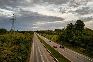
Interstate 579 (I-579) is a north–south Interstate Highway entirely within Pittsburgh, Pennsylvania. The highway is 1.57 mi (2.53 km) long. I-579 is also known as the Crosstown Boulevard since it crosses the backside of Downtown Pittsburgh.

A reversible lane is a lane in which traffic may travel in either direction, depending on certain conditions. Typically, it is meant to improve traffic flow during rush hours, by having overhead traffic lights and lighted street signs notify drivers which lanes are open or closed to driving or turning.
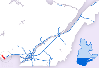
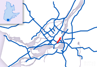
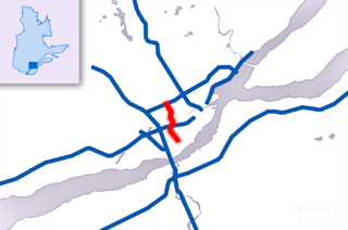
Autoroute 5 is a short Autoroute in the Outaouais region of western Quebec. It connects the central urban area of Gatineau with the recreational areas of Gatineau Park and the exurban rural areas of Chelsea and La Pêche. The southern terminus provides access to the Macdonald-Cartier Bridge, which continues into downtown Ottawa. The A-5 generally has four lanes of traffic with the exception of southernmost section across the Macdonald-Cartier Bridge where A-5 widens to six lanes.

Autoroute 15 is a highway in western Quebec, Canada. It was, until the extension of Autoroute 25 was opened in 2011, the only constructed north-south autoroute to go out of Montreal on both sides. A-15 begins at the end of Interstate 87 at the United States border at Saint-Bernard-de-Lacolle and extends via Montreal to Sainte-Agathe-des-Monts with an eventual continuation beyond Mont-Tremblant. The total length of A-15 is currently 164 km (101.9 mi), including a short concurrency with Autoroute 40 that connects the two main sections. This is one of the few autoroutes in Quebec that does not have any spinoff highways.
Route 136 (R-136), formerly Autoroute 720, known as the Ville-Marie Expressway (English) or Autoroute Ville-Marie (French) is an Autoroute highway in the Canadian province of Quebec that is a spur route of Autoroute 20 in Montreal. Its western terminus is located at the Turcot Interchange, a junction with Autoroute 15 and Autoroute 20, and its eastern terminus is near the Jacques Cartier Bridge, where the highway merges with Notre-Dame Street. The Autoroute Ville-Marie designation is named after the downtown borough of Ville-Marie, through which the expressway is routed. It was designated Autoroute 720 until 2021 when it was renamed to Route 136.
Boulevard Gréber is an important principal arterial road in Gatineau, Quebec. It runs from Montee Paiement to the Gatineau River. It is named after French urban planner Jacques Gréber. It was once part of Route 148 of the provincial network.
Boulevard Maloney is one of Gatineau's main commercial roads. It starts at Autoroute 50 via an incomplete interchange and ends at the boundary with the former city of Masson-Angers. It is also known as Route 148. However, one may notice a blue shield sign of the highway on the westbound lane at Boulevard Gréber even if it is not the highway itself as the western portion previous terminated at Maloney before more extensions towards Masson-Angers were made in 1986. Route 148 continues further east towards Buckingham and further east to Laval. Prior to the construction of A-50, was the main roadway through the urban community towards Montreal, the Papineau region and the Laurentides.
Rue Saint-Louis is a main street in Gatineau, Quebec, Canada, that runs mostly along the north and east side of the Gatineau River in the old city of Gatineau. It starts at the boundaries of the city of Gatineau and the suburban town of Cantley, Quebec and ends at Boulevard Maloney. On its northern end until Autoroute 50, it runs parallel to the Gatineau River, while it briefly runs parallel to the Ottawa River on its eastern end.
Boulevard Saint-Joseph is a commercial boulevard in the former city of Hull, Quebec. It runs from Boulevard Alexandre-Taché to the boundaries of the Gatineau and the suburban town of Chelsea.

Boulevard Maisonneuve is an important arterial in the heart of Downtown Gatineau, Quebec. It serves as connector route between the Portage Bridge from Ottawa to Quebec Autoroutes 5 and 50 as well as Boulevard Fournier towards the Gatineau sector of the city, northern portions of the Hull sector and the northern east suburbs. It also gives access to the Macdonald-Cartier Bridge and the Alexandra Bridge.

The Rapibus is a bus rapid transit system for the Société de Transport de l'Outaouais (STO) in the city of Gatineau, Quebec. Construction was completed in the summer of 2013 with service beginning in the fall. The Rapibus aims to speed up the service for commuters in growing sub-divisions in the northern and eastern areas of the city by alleviating the congestion on key arteries currently served by bus-designated lanes. A direct link to Ottawa is included.

Autoroute 19, also known as Autoroute Papineau, is an autoroute in Quebec. It crosses the Rivière des Prairies via the Papineau-Leblanc Bridge, connecting the borough of Ahuntsic-Cartierville in Montreal and the Duvernay neighbourhood in Laval.
Boulevard Alexandre-Taché is an east-west road located in the city of Gatineau, Quebec. It is named in honour of former member for the Hull electoral district, Alexandre Taché, who served for 15 years with the Union Nationale when the political party was in power under the leadership of Maurice Duplessis.

Boulevard des Allumettières is a major 13.7 km arterial road in Gatineau, Quebec, Canada, that connects Aylmer and Hull sectors of the city running from Eardley Road to the Alexandra Bridge towards Ottawa. It is the most recent east-west arterial connection from the West to the downtown core and construction of the entire length was completed during the fall of 2007.
Autoroute 740 is a Quebec Autoroute in metropolitan Quebec City, Canada. A spur route of Autoroute 40, the A-740 runs for 7.3 km (4.5 mi) on a north-south axis through the boroughs of Sainte-Foy–Sillery–Cap-Rouge and Les Rivières, with interchanges at the A-440 at exit 4 and the A-40 at exit 9.
Chemin d'Aylmer is an east–west main arterial road in Gatineau, Quebec. It starts near les Galeries d'Aylmer shopping centre and ends at Boulevard Saint-Raymond where it becomes Boulevard Alexandre-Tache heading towards downtown Gatineau and Ottawa. West of the shopping centre, it becomes Rue Principale until the Aylmer Marina on the eastern shores of the Ottawa River.
Boulevard Saint-Raymond is a major boulevard located in Gatineau, Quebec. It starts at Boulevard Saint-Joseph and ends at Boulevard Alexandre-Tache just west of the limits between the Hull and Aylmer sectors. Before 2003, it ended at Chemin Pink but since then it includes the former section of Chemin de la Montagne Sud.

Route 117, the Trans Canada Highway Northern Route, is a provincial highway within the Canadian province of Quebec, running between Montreal and the Quebec/Ontario border where it continues as Highway 66 east of McGarry, Ontario. It is an important road since it is the only direct route between southern Quebec and the Abitibi-Témiscamingue region.

Nicholas Street is an arterial road in the central area of Ottawa, Ontario which connects Highway 417 with the downtown core. Despite being a municipal road, the street is designated as part of Canada's National Highway System, as part of an interconnecting route between Highway 417 and Quebec Autoroute 5 in Gatineau.
References
Route map:
| KML file (edit • help) |
- ↑ "Archived copy" (PDF). Archived from the original (PDF) on 2007-09-28. Retrieved 2007-06-26.
{{cite web}}: CS1 maint: archived copy as title (link) - ↑ "Adolescente happée mortellement".