Homewood is an unincorporated community and census-designated place (CDP) in Horry County, South Carolina, United States, just north of Conway in the northeastern part of the state. It was first listed as a CDP in the 2020 census with a population of 1,693.

Alexis is an unincorporated community and census-designated place (CDP) in Gaston County, North Carolina, United States. It is located approximately three miles north of Stanley. It was first listed as a CDP in the 2020 census with a population of 589.

Ketchuptown is a historic unincorporated community and census-designated place (CDP) located in Horry County, South Carolina, United States. Ketchuptown is at the intersection of Highways 23 and 99, about 9 miles (14 km) north of Aynor. As of the 2020 census, it had a population of 84.
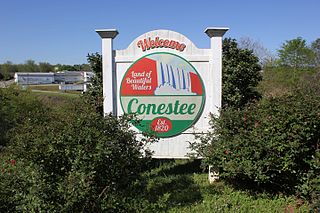
Conestee is an unincorporated community and census-designated place (CDP) in Greenville County, South Carolina, United States. It was first listed as a CDP in the 2020 census with a population of 904.
Emma is an unincorporated community and census-designated place (CDP) in Buncombe County, North Carolina, United States. It was first listed as a CDP in the 2020 census with a population of 2,174.
Brandywine Bay is a planned community and census-designated place (CDP) in Carteret County, North Carolina, United States. It was first listed as a CDP in the 2020 census with a population of 1,153.
Briar Chapel is a planned community and census-designated place (CDP) in Chatham County, North Carolina, United States. It was first listed as a CDP in the 2020 census with a population of 5,108.
Carolina Meadows is a planned community and census-designated place (CDP) in Chatham County, North Carolina, United States. It was first listed as a CDP in the 2020 census with a population of 727.
Governors Club is a golf course community and census-designated place (CDP) in Chatham County, North Carolina, United States. It was first listed as a CDP in the 2020 census with a population of 1,969.
Graingers is an unincorporated community and census-designated place (CDP) in Lenoir County, North Carolina, United States. It was first listed as a CDP in the 2020 census with a population of 229.
Long Creek is an unincorporated community and census-designated place (CDP) in Pender County, North Carolina, United States. It was first listed as a CDP in the 2020 census with a population of 277.
Wyboo is a lakeside community and census-designated place (CDP) in Clarendon County, South Carolina, United States. It was first listed as a CDP prior to the 2020 census with a population of 3,661.
Newtown is an unincorporated community and census-designated place (CDP) in Dillon County, South Carolina, United States. It was first listed as a CDP prior to the 2020 census which listed a population of 770.
Danwood is an unincorporated community and census-designated place (CDP) in Florence County, South Carolina, United States. It was first listed as a CDP prior to the 2020 census with a population of 453.
Ashwood is an unincorporated community and census-designated place (CDP) in Lee County, South Carolina, United States. It was first listed as a CDP prior to the 2020 census which showed a population of 116.
Edmund is an unincorporated community and census-designated place (CDP) in Lexington County, South Carolina, United States. It was first listed as a CDP in the 2020 census with a population of 969.
White Knoll is an unincorporated area and census-designated place (CDP) in Lexington County, South Carolina, United States. It was first listed as a CDP in the 2020 census with a population of 7,858.
Arkwright is an unincorporated area and census-designated place (CDP) adjacent to the city of Spartanburg in Spartanburg County, South Carolina, United States. It was first listed as a CDP prior to the 2020 census with a population of 2,311.
The Cliffs Valley is a resort community and census-designated place (CDP) in Greenville County, South Carolina, United States. It was first listed as a CDP prior to the 2020 census with a population of 736.
Whitney is an unincorporated area and census-designated place (CDP) adjacent to the city of Spartanburg in Spartanburg County, South Carolina, United States. It was first listed as a CDP prior to the 2020 census with a population of 4,409.


