
The Peak District is an upland area in central-northern England, at the southern end of the Pennines. Mostly in Derbyshire, it extends into Cheshire, Greater Manchester, Staffordshire, West Yorkshire and South Yorkshire. It is subdivided into the Dark Peak, moorland dominated by gritstone, and the White Peak, a limestone area with valleys and gorges. The Dark Peak forms an arc on the north, east and west of the district, and the White Peak covers central and southern areas. The highest point is Kinder Scout. Most of the area is within the Peak District National Park, a protected landscape designated in 1951.

Staffordshire is a landlocked ceremonial county in the West Midlands of England. It borders Cheshire to the north-west, Derbyshire and Leicestershire to the east, Warwickshire to the south-east, the West Midlands county and Worcestershire to the south, and Shropshire to the west. The largest settlement is the city of Stoke-on-Trent, and the county town is Stafford.

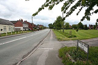
Disley is a village and civil parish in Cheshire, England. It is located on the edge of the Peak District in the Goyt Valley, south of Stockport and close to the county boundary with Derbyshire at New Mills. The population at the 2011 Census was 4,294. To the north, the River Goyt and the Peak Forest Canal, which opened in 1800, pass along the edge of the village. Today, it is a commuter town, retaining a semi-rural character.

Lyme Park is a large estate south of Disley, Cheshire, England, managed by the National Trust and consisting of a mansion house surrounded by formal gardens and a deer park in the Peak District National Park. The house is the largest in Cheshire, and is recorded in the National Heritage List for England as a designated Grade I listed building.

The Midlands is the central part of England, bordered by Wales, Northern England, Southern England and the North Sea. The Midlands correspond broadly to the early-medieval kingdom of Mercia, and later became important in the Industrial Revolution of the 18th and 19th centuries. They are now split into two official regions, the West Midlands and East Midlands. The Midlands' biggest city, Birmingham, is the second-largest in the United Kingdom. Other important cities include Coventry, Derby, Leicester, Lincoln, Nottingham, Stoke-on-Trent, Wolverhampton, and Worcester.

The Pennines, also known as the Pennine Chain or Pennine Hills, are a range of uplands mainly located in Northern England. Commonly described as the "backbone of England" because of its length and position, the range runs from Derbyshire and Staffordshire in the north of the Midlands to Northumberland in North East England. From the Tyne Gap in the north, the range extends south through the North Pennines, Yorkshire Dales, South Pennines, and Peak District to end near the valley of the River Trent. The Border Moors and Cheviot Hills, which lie beyond the Tyne Gap, are included in some definitions of the range.

Bakewell is a market town and civil parish in the Derbyshire Dales district of Derbyshire, England, known for Bakewell pudding. It lies on the River Wye, 15 miles (23 km) south-west of Sheffield. It is the largest settlement and only town within the boundaries of the Peak District National Park. At the 2011 census, the population of the civil parish was 3,949. It was estimated at 3,695 in 2019. The town is close to the tourist attractions of Chatsworth House and Haddon Hall.

Kinder Scout is a moorland plateau and National Nature Reserve in the Dark Peak of the Derbyshire Peak District in England. Part of the moor, at 636 metres (2,087 ft) above sea level, is the highest point in the Peak District, in Derbyshire and the East Midlands.

Poynton is a town in the civil parish of Poynton-with-Worth, in the Cheshire East district and the ceremonial county of Cheshire, England; from 1974 to 2009 it was in Macclesfield district. It is located on the easternmost fringe of the Cheshire Plain, 11 miles (18 km) south-east of Manchester, 7 miles (11 km) north of Macclesfield and 5 miles (8 km) south of Stockport.
Aston is a district of Birmingham, England.

Acton is a small village and former civil parish, now in the parish of Burland and Acton, lying immediately west of the town of Nantwich, in the unitary authority area of Cheshire East and the ceremonial county of Cheshire, England. The civil parish covered 762 acres (3.08 km2) and also included the small settlement of Dorfold and part of Burford, with an estimated population of 340 in 2006. It is administered jointly with the adjacent civil parishes of Henhull and Edleston. Historically, Acton refers to a township and also to an ancient parish in the Nantwich Hundred covering a wide area to the west of Nantwich. The area is agricultural, with dairy farming the main industry. Around a third of the area falls within the Dorfold Estate. Historically, agriculture was the major employer, but it has now been overtaken by the service industries, with many residents commuting significant distances outside the parish to work.

Kettleshulme is a village and former civil parish, now in the parish of Kettleshulme and Lyme Handley, in the Cheshire East district, in the ceremonial county of Cheshire, England. The village is close to the border with Derbyshire, on the B5470 road from Whaley Bridge to Macclesfield in the valley of the Todd Brook, a tributary of the River Goyt. In 2001 the parish had a population of 353.

Cheshire East is a unitary authority area with borough status in Cheshire, England. The local authority is Cheshire East Council, which is based in the town of Sandbach. Other towns within the area include Crewe, Macclesfield, Congleton, Wilmslow, Nantwich, Poynton, Knutsford, Alsager, Bollington and Handforth.

St Mary's Church is an active Anglican parish church located in Monk's Lane, Acton, a village to the west of Nantwich, Cheshire, England. Since 1967 it has been designated a Grade I listed building. A church has been present on this site since before the time of the Domesday Survey. The tower is the oldest in Cheshire, although it had to be largely rebuilt after it fell in 1757. One unusual feature of the interior of the church is that the old stone seating around its sides has been retained. In the south aisle are some ancient carved stones dating back to the Norman era. The architectural historian Alec Clifton-Taylor includes the church in his list of 'best' English parish churches. In the churchyard is a tall 17th-century sundial. The church is an active Anglican parish church in the diocese of Chester, the archdeaconry of Macclesfield and the deanery of Nantwich. Its benefice is united with those of St David, Wettenhall, St Oswald, Worleston, and St Bartholomew, Church Minshull.

St James' Church is in the village of Gawsworth, Cheshire, England, and is sited near Gawsworth Hall. It is recorded in the National Heritage List for England as a designated Grade I listed building. It is an active Anglican parish church in the diocese of Chester, the archdeaconry of Macclesfield and the deanery of Macclesfield. Clifton-Taylor includes it in his list of 'best' English parish churches. The authors of the Buildings of England series describe the church as being "pretty, but odd".

Hatherton is a hamlet and civil parish in the unitary authority of Cheshire East and the ceremonial county of Cheshire, England. The hamlet is on the B5071 at SJ687474, 2+3⁄4 miles (4.4 km) to the north east of Audlem and 3+3⁄4 miles (6.0 km) to the south east of Nantwich. The civil parish has an area of 673 hectares and also includes the small settlements of Birchall Moss, Broomlands and part of Artlebrook, with a total population of 360 in 2011. Nearby villages include Hankelow, Stapeley, Walgherton, Wybunbury, Blakenhall and Buerton. The A529 runs through the parish and the River Weaver forms the western boundary.

Woodhey Cross is a late-medieval stone cross, probably dating from the early 16th century, located at Woodhey Green near Faddiley in Cheshire, England. It stands at SJ5773052642, on Woodhey Lane at the junction with Woodhey Hall Lane, around 500 metres to the east of Woodhey Chapel. The structure is listed at grade II* and is also a scheduled ancient monument.

St Peter's Church is in the village of Heysham, Lancashire, England. It is recorded in the National Heritage List for England as a designated Grade I listed building. It is an active Anglican parish church in the deanery of Lancaster, the archdeaconry of Lancaster and the diocese of Blackburn.
Hankelow is a village and civil parish in the unitary authority of Cheshire East and the ceremonial county of Cheshire, England. The village lies on the A529, around 1.25 miles (2.0 km) north east of Audlem and 4.5 miles (7.2 km) south of Nantwich. The civil parish has an area 369 hectares and also includes the small settlement of The Dell and part of Corbrook, with a total population of just over 260 in 2011. Nearby villages include Aston, Broomhall Green, Sound, Hatherton and Buerton in Cheshire and Woore in Shropshire.

The Butter Cross in Dunster within the English county of Somerset is a Grade II* listed building and scheduled monument. The cross was originally erected in the late 14th or early 15th century in the main street, and was moved to its current site in the late 18th or early 19th century. Although the head of the cross is missing, the shaft and socket stone are original. The cross is in the care of English Heritage and is managed by the National Trust.
