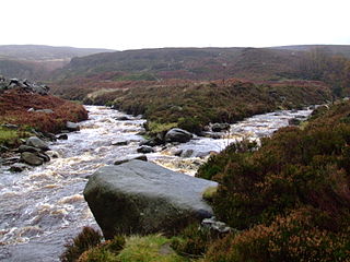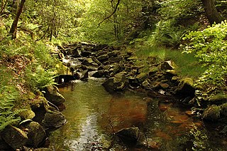
The River Etherow is a river in northern England, and a tributary of the River Goyt. Although now passing through South Yorkshire, Derbyshire and Greater Manchester, it historically formed the ancient county boundary between Cheshire and Derbyshire. The upper valley is known as Longdendale. The river has a watershed of approximately 30 square miles (78 km2), and the area an annual rainfall of 52.5 inches (1,330 mm).

The River Goyt is a river in North West England. It is one of the tributaries of the River Mersey.

The River Tame flows through Greater Manchester, England. It rises on Denshaw Moor and flows to Stockport where it joins the River Goyt to form the River Mersey.

Egerton,, is a village in the unparished area of South Turton, in the northern part of the Metropolitan Borough of Bolton, Greater Manchester, England. Historically a part of Lancashire, it is situated three miles north of Bolton and 12 miles north west of Manchester city centre within the West Pennine Moors.

The Colne is a river in England which is a tributary of the River Thames. Just over half its course is in south Hertfordshire. Downstream, it is the boundary between Buckinghamshire and London and finally between corners of Berkshire and Surrey. After leaving Hertfordshire it splits off into separate branches, a few of which as close anabranches rejoin it, and its main branch flows into the River Thames on the Staines reach at Staines-upon-Thames.

Belmont is a village in Lancashire, England. It is close to Darwen. It has around 500 inhabitants and lies within the civil parish of North Turton in the unitary authority area of Blackburn with Darwen.

The West Pennine Moors is an area of the Pennines covering approximately 90 square miles (230 km2) of moorland and reservoirs in Lancashire and Greater Manchester, England. It is a Site of Special Scientific Interest.

The River Roddlesworth is a river in Lancashire, England, a tributary of the River Darwen.

Eagley Brook is a small river of Lancashire and Greater Manchester in England.

Edgworth is a small village within the borough of Blackburn with Darwen, Lancashire, England. It is north east of North Turton between Broadhead Brook on the west and Quarlton Brook in the south east. The ground ranges from 650 feet (200 m) to 1,100 feet (340 m) above sea level.

Burbage Brook is an upper tributary stream of the River Derwent in the Peak District of England.

Entwistle is a village in the Blackburn with Darwen unitary authority in Lancashire in the north west of England.

The Jumbles Reservoir is a heavily modified, high alkalinity, shallow reservoir in North West England. It lies in Jumbles Country Park, in the valley of Bradshaw Brook, partly in the Metropolitan Borough of Bolton, Greater Manchester, and partly in Blackburn with Darwen, Lancashire. It was opened on 11 March 1971 by Queen Elizabeth II for the then Bolton Corporation Waterworks. The reservoir's original purpose was to guarantee water for the Croal-Irwell river system and the associated industries.

Yarnsdale is a dale or valley in Lancashire. The name is derived from the heron or hern.

The Peak District Boundary Walk is a circular 190-mile (310 km) walking trail, starting and finishing at Buxton and broadly following the boundary of the Peak District, Britain's first national park. The route was developed by the Friends of the Peak District and was launched on 17 June 2017.

Greenfield Valley is a river valley through Saddleworth Moor in England's Peak District National Park. Historically this area of the South Pennines was part of Yorkshire but since 1974 it has been within the eastern edge of the county of Greater Manchester.


