Bramble | |
|---|---|
 Bramble  Bramble | |
| Coordinates: 47°54′18″N93°09′53″W / 47.90500°N 93.16472°W | |
| Country | United States |
| State | Minnesota |
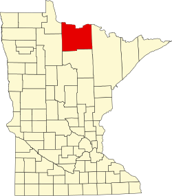
| County | Koochiching |
| Time zone | UTC-6 (Central (CST)) |
| • Summer (DST) | UTC-5 (CDT) |
| Area code | 218 |
| GNIS feature ID | 2106260 [1] |
Bramble is an unincorporated community in Koochiching County, Minnesota, United States; located in the southeast corner of the county.
Contents
The community is located between Togo and Rauch; near the intersection of State Highway 65 (MN 65) and Koochiching County Road 66 (CR 66).
The boundary line between Koochiching, Saint Louis, and Itasca counties is nearby.