Breitenstein, Lower Austria

Last updated
Breitenstein
Breitenstein - Panoramaansicht.JPG
Southeast view of Breitenstein
AUT Breitenstein COA.jpg
Austria adm location map.svg
Red pog.svg
Breitenstein
Location within Austria
Coordinates: 47°39′28″N15°49′10″E / 47.65778°N 15.81944°E / 47.65778; 15.81944 Coordinates: 47°39′28″N15°49′10″E / 47.65778°N 15.81944°E / 47.65778; 15.81944
Country Austria
State Lower Austria
District Neunkirchen
Government
   Mayor Engelbert Rinnhofer (ÖVP)
Area
[1]
  Total20.29 km2 (7.83 sq mi)
Elevation
779 m (2,556 ft)
Population
 (2018-01-01) [2]
  Total318
  Density16/km2 (41/sq mi)
Time zone UTC+1 (CET)
  Summer (DST) UTC+2 (CEST)
Postal code
2641
Area code 02664
Website www.breitenstein.at

Breitenstein is a small town in the Austrian state of Lower Austria. It is one of the towns found on the Semmering Railway line which is a UNESCO World Heritage Site. Translated from German the name means "Broad Stone" due to its large rock faces.

Contents

Population

Historical population
YearPop.±%
1869656    
1880613−6.6%
1890677+10.4%
1900811+19.8%
1910863+6.4%
1923827−4.2%
1934848+2.5%
1939710−16.3%
1951756+6.5%
1961620−18.0%
1971502−19.0%
1981467−7.0%
1991427−8.6%
2001371−13.1%
2011343−7.5%

Related Research Articles

<span class="mw-page-title-main">Horn, Austria</span> Place in Lower Austria, Austria

Horn is a small town in the Waldviertel in Lower Austria, Austria and the capital of the district of the same name.

<span class="mw-page-title-main">Seibersdorf</span> Place in Lower Austria, Austria

Seibersdorf is an Austrian market town with 1,283 residents in the District of Baden in Lower Austria.

<span class="mw-page-title-main">Schwarzenau, Lower Austria</span> Place in Lower Austria, Austria

Schwarzenau is a market town in the District Zwettl in the Austrian state of Lower Austria. Schwarzenau is located on the German Thaya.

<span class="mw-page-title-main">Waidhofen an der Thaya</span> Place in Lower Austria, Austria

Waidhofen an der Thaya is an Austrian town located on the German Thaya river in the district of the same name in Lower Austria. It is the northernmost of the capitals of the Districts of Austria.

Hohenau an der March is a town in the district of Gänserndorf in the Austrian state of Lower Austria, close to Vienna and the borders with the Czech Republic and Slovakia.

<span class="mw-page-title-main">Heidenreichstein</span> Place in Lower Austria, Austria

Heidenreichstein is a town in the district of Gmünd in the Austrian state of Lower Austria.

<span class="mw-page-title-main">Schrems, Lower Austria</span> Place in Lower Austria, Austria

Schrems is a town in the district of Gmünd in Lower Austria, Austria.

<span class="mw-page-title-main">Alberndorf im Pulkautal</span> Place in Lower Austria, Austria

Alberndorf im Pulkautal is a town in the district of Hollabrunn in Lower Austria, Austria.

<span class="mw-page-title-main">Guntersdorf</span> Place in Lower Austria, Austria

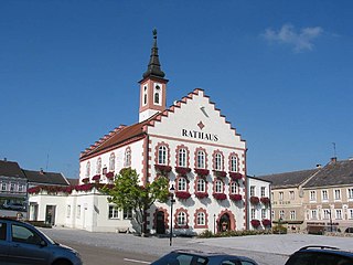
Guntersdorf is a market town in the district of Hollabrunn in Lower Austria, Austria. The market town of Guntersdorf has an area of 28.42 km2 and about 1,172 inhabitants. The current mayor of Guntersdorf, Mag. Roland Weber took over for Günther Bradac in November 2013.

<span class="mw-page-title-main">Langenzersdorf</span> Place in Lower Austria, Austria

Langenzersdorf is a town in the district of Korneuburg in Lower Austria, Austria.

<span class="mw-page-title-main">Langenlois</span> Place in Lower Austria, Austria

Langenlois is a town at the Kamp river in the Kamptal, district of Krems-Land in the Austrian state of Lower Austria. Famous for its wine production, it is also home to the Loisium, a centre celebrating and advertising the local wine and built by the American deconstructionist architect Steven Holl.

<span class="mw-page-title-main">Falkenstein, Lower Austria</span> Place in Lower Austria, Austria

Falkenstein is a town in the district of Mistelbach in the Austrian state of Lower Austria.

<span class="mw-page-title-main">Poysdorf</span> Place in Lower Austria, Austria

Poysdorf is a town in the district of Mistelbach in the Austrian state of Lower Austria.

<span class="mw-page-title-main">Maria Enzersdorf</span> Place in Lower Austria, Austria

Maria Enzersdorf is a town in the district of Mödling in the Austrian state of Lower Austria.

<span class="mw-page-title-main">Münchendorf</span> Place in Lower Austria, Austria

Münchendorf is a town in the district of Mödling in the Austrian state of Lower Austria.

<span class="mw-page-title-main">Neunkirchen, Austria</span> Place in Lower Austria, Austria

Neunkirchen is the capital of the district of Neunkirchen in the Austrian state of Lower Austria. As of 2020 it has a population of 12,721.

<span class="mw-page-title-main">Willendorf an der Schneebergbahn</span> Place in Lower Austria, Austria

Willendorf an der Schneebergbahn is a town in the district of Neunkirchen in the Austrian state of Lower Austria. It is not to be confused with Willendorf in der Wachau where the Venus of Willendorf was discovered.

<span class="mw-page-title-main">Michelbach, Lower Austria</span> Place in Lower Austria, Austria

Michelbach is a town in the district of Sankt Pölten-Land in the Austrian state of Lower Austria.

<span class="mw-page-title-main">Fischamend</span> Place in Lower Austria, Austria

Fischamend is a town in the district of Bruck an der Leitha in the Austrian state of Lower Austria. It belonged to Wien-Umgebung District which was dissolved in 2016.

<span class="mw-page-title-main">Ulrichsberg</span> Place in Upper Austria, Austria

Ulrichsberg is a municipality in the district of Rohrbach in the Austrian state of Upper Austria.

References

  1. "Dauersiedlungsraum der Gemeinden Politischen Bezirke und Bundesländer - Gebietsstand 1.1.2018". Statistics Austria. Retrieved 10 March 2019.
  2. "Einwohnerzahl 1.1.2018 nach Gemeinden mit Status, Gebietsstand 1.1.2018". Statistics Austria. Retrieved 9 March 2019.