
Alberschwende is a municipality and a village in the district of Bregenz in the Austrian state of Vorarlberg.
Bartholomäberg is a municipality and a village in the district of Bludenz in the Austrian state of Vorarlberg.

Zwischenwasser is a municipality in the district of Feldkirch in the Austrian state of Vorarlberg.

Kilb is a town in the district of Melk in the Austrian state of Lower Austria.

Fritzens is a municipality in the district Innsbruck country in Tyrol (Austria). It lies 16 km east of Innsbruck on the left side of the Inn River. The Iron Age Fritzens-Sanzeno culture is named for archaeological finds from the village.

Wöllersdorf-Steinabrückl is a municipality in the district of Wiener Neustadt-Land in the Austrian state of Lower Austria.

Bludesch is a municipality in the district of Bludenz in the Austrian state of Vorarlberg.

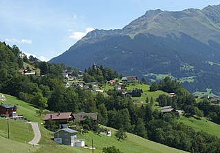
Sankt Gallenkirch is a municipality in the district of Bludenz in the Austrian state of Vorarlberg.
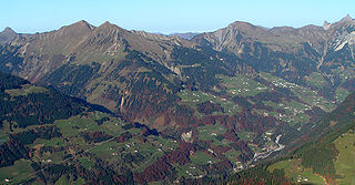
Sonntag is a municipality in the district of Bludenz in the Austrian state of Vorarlberg.

Höchst is a municipality in the district of Bregenz in the Austrian state of Vorarlberg.

Dünserberg is a municipality in the district of Feldkirch in the Austrian state of Vorarlberg.

Koblach is a municipality in the district of Feldkirch in the Austrian state of Vorarlberg.

Röns is a municipality in the district of Feldkirch in the Austrian state of Vorarlberg.

Schnifis is a municipality in the district of Feldkirch in the Austrian state of Vorarlberg.

Übersaxen is a municipality in the district of Feldkirch in the Austrian state of Vorarlberg.
Altschwendt is a municipality in the district of Schärding in the Austrian state of Upper Austria.

Zell an der Pram is a town and a municipality in the district of Schärding in the Austrian state of Upper Austria.
Weyer is a municipality in the district of Steyr-Land in the Austrian state of Upper Austria.
Pfaffing is a municipality in the district of Vöcklabruck in the Austrian state of Upper Austria.

Sankt Margarethen an der Raab is a municipality in the district of Weiz in the Austrian state of Styria.


