Altoona is a town in Etowah County in the U.S. state of Alabama. It is part of the Gadsden Metropolitan Statistical Area. At the 2020 census, the population was 948.
Mount High, also known as High Mount, High Mound, or Highmound, is an unincorporated community in Blount County, Alabama, United States, located approximately two miles west of Interstate 65 and Smoke Rise, and approximately 25 miles north of Birmingham. Mount High also is just southwest of Rickwood Caverns State Park.
Blount Springs is an unincorporated community in Blount County, Alabama United States.
Bangor, also known as Coopers Gap, Copperas Gap, or Coppers Gap, is an unincorporated community in Blount County, Alabama, United States. Nearby Bangor Cave housed a speakeasy during Prohibition and continues to be a popular attraction for area spelunkers.
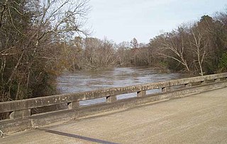
The Buttahatchee River is a tributary of the Tombigbee River, about 125 miles (201 km) long, in northwestern Alabama and northeastern Mississippi in the United States. Via the Tombigbee River, it is part of the watershed of the Mobile River, which flows to the Gulf of Mexico.

McCalla is a census-designated place in Jefferson and Tuscaloosa counties, Alabama, United States, southwest of Bessemer and the geographic terminus of the Appalachian Mountains.
Hopewell is an unincorporated community in Blount County, Alabama, United States. It lies at an elevation of 981 feet.
Arkadelphia is an unincorporated community in Cullman County, Alabama, United States.
Berlin is a town in Cullman County, Alabama, United States. It is located roughly five miles east of the city of Cullman in northern Alabama. U.S. Route 278 and Cullman County Road 747 intersect at Walker's Corner, considered to be the center of Berlin. The Berlin Community Center is located on U.S. Route 278, just west of the crossroads.
Blount is an unincorporated community in Kanawha County, West Virginia, United States. Blount is 11 miles (18 km) east-southeast of Charleston. Blount had a post office, founded by Harry and Stella Blount which opened on October 30, 1946, and closed on October 24, 2009.
Gosport is an unincorporated community in Clarke County, Alabama, United States. Gosport is also close to the unincorporated town of Whatley, the two are usually confused with one another, and sometimes thought as the same place.
Summit is an unincorporated community in Blount County, Alabama, United States. Summit is located along County Route 48 (CR-48) near US-231/SR-53, 10.1 miles (16.3 km) northeast of Blountsville.
Brooksville is an unincorporated community in Blount County, Alabama, United States, located at the junction of U.S. Route 278, Alabama State Route 74, and Alabama State Route 79, 8.7 miles (14.0 km) northeast of Blountsville. In 1999 Brooksville attempted to incorporate itself. Proponents of the move stated that the laws of the community would be based on the King James Bible and the Ten Commandments.
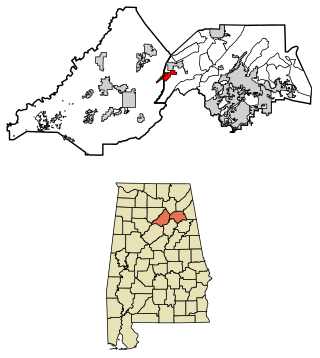
Remlap is a census-designated place in Blount County, Alabama, United States, located along Alabama State Route 75, 11.7 miles (18.8 km) southwest of Oneonta. Remlap has a post office with ZIP code 35133.
Kimbrell is an unincorporated community in Jefferson and Tuscaloosa counties, Alabama, United States. Kimbrell was named in honor of Miles Kimbrell, a storekeeper and sewing machine agent. A post office operated under the name Kimbrel from 1895 to 1905.
Little Warrior is an unincorporated community in Blount County, Alabama, United States.
Sky Ball, also spelled Skyball, is an unincorporated community and former city in Blount County, Alabama, United States. Sky Ball has been noted for its unusual place name.
Brightstar is an unincorporated community in Miller County, Arkansas, United States.
White City, also known as Centerdale, is an unincorporated community in Cullman County, Alabama, United States, located 2.0 miles (3.2 km) north of Hanceville. White City was damaged by an EF1 tornado on March 14, 2019, that was produced by the March 2019 North American blizzard.


