Muni Metro is a semi-metro system serving San Francisco, California, United States. Operated by the San Francisco Municipal Railway (Muni), a part of the San Francisco Municipal Transportation Agency (SFMTA), Muni Metro served an average of 68,700 passengers per weekday in the first quarter of 2023, making it the seventh-busiest light rail system in the United States.

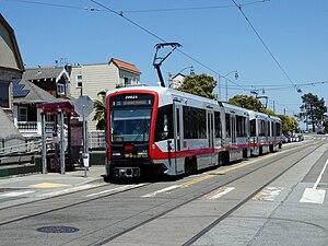
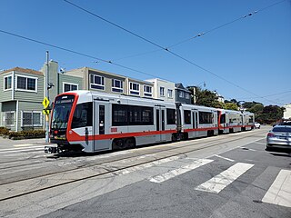
The M Ocean View is a hybrid light rail/streetcar line of the Muni Metro system in San Francisco, California. The line opened on October 6, 1925.

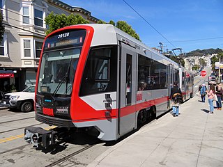
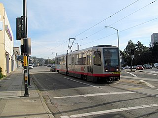
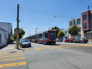
The K Ingleside is a hybrid light rail/streetcar line of the Muni Metro system in San Francisco, California. It mainly serves the West Portal and Ingleside neighborhoods. The line opened on February 3, 1918, and was the first line to use the Twin Peaks Tunnel.

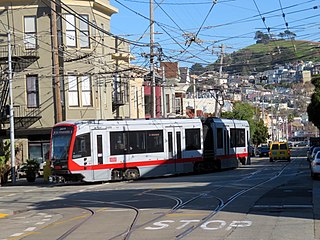
The J Church is a hybrid light rail/streetcar line of the Muni Metro system in San Francisco, California. The line runs between Embarcadero station and Balboa Park station through Noe Valley. Opened on August 11, 1917, it is the oldest and has the lowest ridership of all of the Muni Metro lines.

Balboa Park station is a Bay Area Rapid Transit (BART) station and Muni Metro complex in the Mission Terrace neighborhood of San Francisco, California, located near the eponymous Balboa Park. It is an intermodal hub served by four BART routes, three Muni Metro lines, and a number of Muni bus routes. The station complex also includes two rail yards, Cameron Beach Yard and Green Light Rail Center, where Muni maintains Muni Metro trains and heritage streetcars. BART uses a below-grade island platform on the west side of the complex; Muni Metro routes use several smaller side platforms located on surface-level rail loops around the yards.

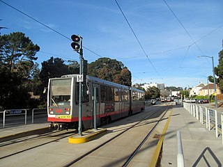
San Francisco State University station is a light rail station on the Muni Metro M Ocean View line, located adjacent to San Francisco State University and the Parkmerced neighborhood in the median of 19th Avenue in San Francisco, California. It opened in 1925 with the first phase of the line and was rebuilt with a high-level island platform in 1993. The station is accessible.
With five different modes of transport, the San Francisco Municipal Railway runs one of the most diverse fleets of vehicles in the United States. Roughly 550 diesel-electric hybrid buses, 300 electric trolleybuses, 250 modern light rail vehicles, 50 historic streetcars and 40 cable cars see active duty.
Church and 30th Street station is a one-way light rail stop on the Muni Metro J Church line, located in the Noe Valley neighborhood of San Francisco, California. The stop is only served by inbound trains; outbound trains stop further north at Day Street. The stop has no platforms, trains stop at marked poles and passengers cross a vehicle travel lanes to board trains. The stop is not accessible to people with disabilities.
St. Francis Circle is a light rail stop on the Muni Metro K Ingleside and M Ocean View lines, located in the St. Francis Wood neighborhood of San Francisco, California. It opened around 1907 when the United Railroads (URR) expanded its Ocean Avenue line west to Ocean Beach; Muni service followed with the K in 1918 and the M in 1925.

Ocean and Lee is a light rail stop on the Muni Metro K Ingleside line, located between the Westwood Park and Ingleside neighborhoods of San Francisco, California. The stop consists of two side platforms, with the eastbound (outbound) platform located on Ocean Avenue west of the intersection with Lee Street, and vice versa.

Ocean Avenue/CCSF Pedestrian Bridge station is a light rail station on the Muni Metro K Ingleside line, located between the Sunnyside and Ingleside neighborhoods of San Francisco, California adjacent to the City College of San Francisco (CCSF) campus. The stop consists of two side platforms in the median of Ocean Avenue, with stairs to a concrete footbridge that connects the campus to Geneva Avenue. It opened in 1979 with the extension of the line to Balboa Park station; it was previously served by the United Railroads 12 line from 1895 to 1945, and the K from 1945 to 1952.

Taraval and 22nd Avenue / Taraval and 23rd Avenue stations are a pair of light rail stops on the Muni Metro L Taraval line, located in the Parkside neighborhood of San Francisco, California. The eastbound stop is located on Taraval Street and 22nd Avenue, while westbound trains stop on Taraval Street at 23rd Avenue.
19th Avenue and Junipero Serra / 19th Avenue and Randolph stations are a pair of light rail stops on the Muni Metro M Ocean View line, located in the Merced Heights neighborhood of San Francisco, California. The inbound stop is located on 19th Avenue at Junipero Serra Boulevard, while outbound trains stop on 19th Avenue at Randolph Avenue. The stop has no platforms; trains stop at marked poles and passengers cross a vehicle travel lane on 19th Avenue to board and depart trains. The stop is not accessible.

19th Avenue and Randolph station is a light rail stop on the Muni Metro M Ocean View line, located in the Ingleside neighborhood of San Francisco, California. The stop has no platforms; trains stop at marked poles before crossing Randolph Street and passengers cross a parking lane on 19th Avenue to board trains. The stop is not accessible.

Randolph and Arch is a light rail stop on the Muni Metro M Ocean View line, located in the Ingleside Heights neighborhood of San Francisco, California. The stop has no regular platforms; passengers cross a parking lane to board trains. Mini-high platforms for accessibility are located on the far side of Arch Street.
Randolph and Bright station is a light rail stop on the Muni Metro M Ocean View line, located in the Ingleside neighborhood of San Francisco, California. The stop has no platforms; trains stop at marked poles before crossing Bright Street and passengers cross a parking lane on Randolph Street to board trains. The stop is not accessible.

Broad and Orizaba / Orizaba and Broad stations are a pair of light rail stops on the Muni Metro M Ocean View line, located in the Ingleside neighborhood of San Francisco, California. The inbound stop is located on Broad Street at Orizaba Avenue, while outbound trains stop on Orizaba Avenue at Broad Street. The stops opened with the line on October 6, 1925. The line was replaced with buses on August 6, 1939, but streetcar service resumed on December 17, 1944. The stop has no platforms, trains stop at marked poles and passengers cross a vehicle travel lanes to board or depart trains. The stop is not accessible to people with disabilities.
Broad and Capitol station is a light rail stop on the Muni Metro M Ocean View line, located in the Ingleside neighborhood of San Francisco, California. The stop has no platforms; trains stop at marked poles before crossing Capitol Avenue and passengers cross a vehicle travel lane on Broad Street to board trains. The stop is not accessible.

31 Balboa is a trolleybus line operated by the San Francisco Municipal Railway. It is one of several routes operating between the Financial District and the Richmond District.