Related Research Articles

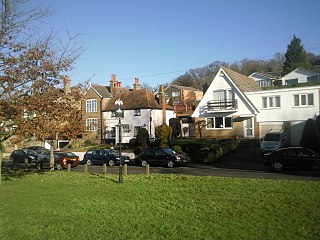
Chislehurst is a suburban district of south-east London, England, in the London Borough of Bromley. It lies east of Bromley, south-west of Sidcup and north-west of Orpington, 10 miles (16 km) south-east of Charing Cross. Before the creation of Greater London in 1965, it was in Kent. According to the 2021 census, Chislehurst has a population of 15,600.

Cudham is an area in Greater London, England, located within the London Borough of Bromley and beyond London's urban sprawl. It is located on the Greater London border with Kent, bordering the Sevenoaks District. Cudham lies south of Orpington and north west of Sevenoaks. It is located 15.9 miles (25.6 km) south-southeast of Charing Cross.

Pratt's Bottom is a village in Greater London, England, within the London Borough of Bromley and, prior to 1965, within the historic county of Kent. It is south of its parent parish of Orpington, lies about 100 metres above sea level and beyond London's urban sprawl.

The London Borough of Bromley is a borough in London, England. It borders the county of Kent, of which it formed part of until 1965. The borough's population in the 2021 census was 329,991. It is named after Bromley, its principal district. Other districts are Penge, Hayes, West Wickham, Chislehurst, Beckenham and Orpington. The local authority is Bromley London Borough Council.

Beckenham is a constituency in Greater London represented in the House of Commons of the UK Parliament since 2010 by Bob Stewart, an independent, formerly a member of the Conservative Party.

Bromley and Chislehurst is a constituency in Greater London represented in the House of Commons of the UK Parliament since 2006 by Bob Neill, a Conservative.

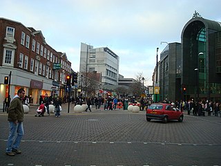
Bromley is a large town in Greater London, England, within the London Borough of Bromley. It is 9+1⁄2 miles southeast of Charing Cross, and had an estimated population of 88,000 as of 2023.

Downe, formerly Down, is a village in Greater London, England, located within the London Borough of Bromley but beyond London's contiguous urban area. Downe is 3.4 miles (5.5 km) south west of Orpington and 14.2 miles (22.9 km) south east of Charing Cross. Downe lies on a hill, and much of the centre of the village is unchanged; the former village school now acts as the village hall. The word Downe originates from the Anglo Saxon word dūn, latterly down, hence the South and North Downs. In April 1965, Downe and the remaining part of Orpington Urban District Council, was abolished, and transferred from the historic county of Kent and placed within the newly created London Borough of Bromley.

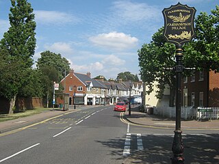
Farnborough is a village in south-eastern Greater London, England, and prior to 1965, in the historic county of Kent. Situated south of Locksbottom, west of Green Street Green, north of Downe and Hazelwood, and east of Keston, it is centred 13.4 miles (21.6 km) southeast of Charing Cross.

Orpington is a constituency created in 1945 and represented in the House of Commons of the UK Parliament since 2019 by Gareth Bacon, a Conservative. It is the largest constituency in Greater London by area, covering the east and south of the London Borough of Bromley.
Orpington was an English local government district in northwest Kent from 1934 to 1965 around the town of Orpington. It was a suburb of London and formed part of the Metropolitan Police District. Most of the former area of the urban district is now part of the London Borough of Bromley in Greater London.

St Mary Cray is an area of South East London, England, within the London Borough of Bromley. Historically it was a market town in the county of Kent. It is located north of Orpington, and 13 miles (21 km) south-east of Charing Cross.
Ruxley is a rural settlement of South East London, England that straddles the boundary of the London Boroughs of Bromley and Bexley. It is located 13 miles southeast of Charing Cross, the traditional centre of London, in the Metropolitan Green Belt between Sidcup and Swanley and is also adjacent to the Greater London border with the county of Kent.

Ruxley was an ancient hundred, a land division in the north west of the county of Kent, England. Its area has been mostly absorbed by the growth of London; with its name currently referring to the Ruxley district. Its former area now corresponds to a majority of the London Borough of Bromley, a large part of the London Borough of Bexley and a small part of the Kent District of Sevenoaks. The hundred was within the Lathe of Sutton-at-Hone, in the west division of Kent.

Green Street Green is an area in south-east London, located in the London Borough of Bromley and, prior to 1965, in the historic county of Kent. It is located south of Orpington, west of Chelsfield, north-west of Pratt's Bottom, north of Hazelwood, and south east of Farnborough.

Chelsfield is an area in south-east London, England, within the London Borough of Bromley and, prior to 1965, in the historic county of Kent. It lies south of Goddington, west of Well Hill, north of Pratt's Bottom and east of Green Street Green. The area is split into two distinct areas – the historic 'village' section, and the newer development by the train station.

The 2018 Bromley London Borough Council election took place on 3 May 2018 to elect members of Bromley London Borough Council in England. This was the same day as other local elections.
References
- ↑ "History of the Bromley area on BromleyGov". Archived from the original on 31 March 2021. Retrieved 28 November 2020.
- ↑ Vision of Britain Archived 11 March 2007 at the Wayback Machine – Historical Boundaries
- 1 2 Vision of Britain Archived 11 March 2007 at the Wayback Machine – Unit history
- 1 2 Youngs, Frederic A Jr. (1979). Guide to the Local Administrative Units of England. Vol. I, Southern England. London: Royal Historical Society. pp. 638–640. ISBN 0-901050-67-9.
- ↑ "Local Government in Kent". The Times . London. 23 September 1929. p. 11.
- ↑ "Local Government in Kent". The Times . London. 4 October 1929. p. 16.