Broughton Archipelago

Last updated

Broughton Archipelago
Beware Passage, Broughton Archipelago.jpg
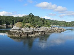
Forested islet in Beware Passage
Canada British Columbia location map 2.svg
Red pog.svg
Broughton Archipelago
Canada location map 2.svg
Red pog.svg
Broughton Archipelago
Geography
Location Queen Charlotte Strait
Coordinates 50°40′N126°30′W / 50.667°N 126.500°W / 50.667; -126.500
Administration
Province British Columbia
Regional District Mount Waddington

Broughton Archipelago is a group of islands located at the eastern end of Queen Charlotte Strait in Mount Waddington Regional District, British Columbia. The archipelago is the traditional territory of the Musgamagw Dzawada'enuxw, Namgis, Ma'amtagila and Tlowitsis nations of the Kwakwaka'wakw peoples.

Contents

Etymology

Broughton Archipelago was named in 1792 by George Vancouver in honour of William Robert Broughton, the captain of the expedition's second ship, HMS Chatham. [1]

Geography

The Broughton Archipelago includes numerous islands and islets scattered throughout the eastern end of Queen Charlotte Strait. The largest island of the archipelago is Gilford Island with a total area of 384 km2 (148 sq mi). [2] Cormorant Island is the most densely populated island with 270 residents/km2 (710 residents/mi2) as of 2016. [3]

The major islands of the Broughton Archipelago are as follows:

Major waterways

Major waterways include Beware Passage, Broughton Strait, Clio Channel, Fife Sound, Johnstone Strait, Kingcome Inlet, Knight Inlet, Retreat Passage, Tribune Channel, and Wells Passage.

Conservation

The archipelago is rich in biodiversity and culturally significant sites. Protected areas include Broughton Archipelago Conservancy, [4] Broughton Archipelago Provincial Park, Burdwood Group Conservancy, Cormorant Channel Marine Provincial Park, Echo Bay Marine Provincial Park, and Qwiquallaaq/Boat Bay Conservancy. [5]

See also

Related Research Articles

British Columbia Ferry Services Inc., operating as BC Ferries (BCF), is a former provincial Crown corporation, now operating as an independently managed, publicly owned Canadian company. BC Ferries provides all major passenger and vehicle ferry services for coastal and island communities in the Canadian province of British Columbia. Set up in 1960 to provide a similar service to that provided by the Black Ball Line and the Canadian Pacific Railway, which were affected by job action at the time, BC Ferries has become the largest passenger ferry line in North America, operating a fleet of 41 vessels with a total passenger and crew capacity of over 27,000, serving 47 locations on the B.C. coast.

<span class="mw-page-title-main">Gulf Islands</span> Islands in British Columbia, Canada

The Gulf Islands is a group of islands in the Salish Sea between Vancouver Island and the mainland coast of British Columbia.

<span class="mw-page-title-main">Queen Charlotte Strait</span> Strait in British Columbia

Queen Charlotte Strait is a strait between Vancouver Island and the mainland of British Columbia, Canada. It connects Queen Charlotte Sound with Johnstone Strait and Discovery Passage and via them to the Strait of Georgia and Puget Sound. It forms part of the Inside Passage from Washington to Alaska. The term Queen Charlotte Strait is also used to refer to the general region and its many communities, notably of the Kwakwakaʼwakw peoples. Despite its name, Queen Charlotte Strait does not lie between Haida Gwaii and the mainland; that body of water is named Hecate Strait.

<span class="mw-page-title-main">Knight Inlet</span> Inlet on the coast of British Columbia, Canada

Knight Inlet is one of the principal inlets of the British Columbia Coast, and the largest of the major inlets in the southern part of the Coast. It is fifth in sequence of the great saltwater inlets north from the 49th parallel near Vancouver, but it is the first whose outflow points away from the Strait of Georgia, opening into Queen Charlotte Strait at the Kwakwakaʼwakw community of Memkumlis on Village Island.

Kingcome Inlet is one of the lesser principal fjords of the British Columbia Coast, north and east of Broughton Island. It is sixth in sequence of the major saltwater fjords north from the 49th parallel near Vancouver and similar in width, on average 2.5 km (1.6 mi), to longer inlets such as Knight Inlet and Bute Inlet, but it is only 35 km (22 mi) in length from the mouth of the Kingcome River to Sutlej Channel, which ultimately connects around Broughton Island to the main regional waterway of the Queen Charlotte Strait. Kingcome Inlet has a short side inlet, Wakeman Sound, fed by the Wakeman River.

<span class="mw-page-title-main">Broughton Archipelago Provincial Park</span> Provincial park in British Columbia, Canada

Broughton Archipelago Provincial Park is the largest marine provincial park located in British Columbia, Canada. The park is located in the Queen Charlotte Strait around 30 km east of Port McNeill, a town situated on Vancouver Island. In terms of its functions, the park offers tourism opportunities such as kayaking and whale watching, preserves a wide array of wildlife including many at-risk species, and has a long history of use by First Nation peoples.

Cormorant Channel Marine Provincial Park is a provincial park in British Columbia, Canada, located in the Pearse Islands, a small archipelago to the east of Cormorant Island and the Village of Alert Bay at the western end of Johnstone Strait.

<span class="mw-page-title-main">Regional District of Mount Waddington</span> Regional district in British Columbia, Canada

The Regional District of Mount Waddington (RDMW) is a regional district in British Columbia. It takes in the lower Central Coast region centred on the Queen Charlotte Strait coast of northern Vancouver Island and the adjoining parts of mainland British Columbia. It has a total land area of 20,288.4 km2 and a 2016 census population of 11,035 persons, most of which is in towns on Vancouver Island and adjoining islands. The administrative centre is in the town of Port McNeill. Other municipalities include the district municipality of Port Hardy, the village of Port Alice, and the village of Alert Bay.

Ḵwiḵwa̱sut'inux̱w Ha̱xwa'mis, formerly the Kwicksutaineuk-ah-kwa-mish First Nation is a First Nations band government based on northern Vancouver Island in British Columbia, Canada, in the Queen Charlotte Strait region. It is a member of the Musgamagw Tsawataineuk Tribal Council, along with the ‘Namgis First Nation and the Tsawataineuk First Nation. The Kwikwasut'inuxw and Haxwa'mis are two of the many subgroups of the peoples known as Kwakwaka'wakw, which has two meanings: "smoke of the world" or "beach at the north side of the river."

<span class="mw-page-title-main">West Redonda Island</span>

West Redonda Island is an island in British Columbia, Canada. It is part of the Discovery Islands, an archipelago between Vancouver Island and the mainland, and between the Strait of Georgia and Johnstone Strait.

<span class="mw-page-title-main">Broughton Strait</span> Strait in British Columbia, Canada

Broughton Strait is a strait off the north coast of Vancouver Island, British Columbia, Canada, separating that island from Malcolm and Cormorant Islands, on the farther side of which is the larger Queen Charlotte Strait, which also lies beyond the western end of Broughton Strait, and the mouth of Knight Inlet. Farther east from Broughton Strait is the beginning of Johnstone Strait, which leads via Discovery Passage to the Strait of Georgia.

Tribune Channel is a channel or strait on the Central Coast of British Columbia, Canada, separating Gilford Island on the west and north from the mainland. The channel bends around Gilford Island, with the mouth of Thompson Sound at the elbow of the bend, opening eastwards to the mouth of the Kakweiken River.

The Pearse Islands are a small group of islands in the Queen Charlotte Strait region of the Central Coast of British Columbia, Canada. They are just east of Cormorant Island, which is the location of the Village of Alert Bay. Cormorant Channel Marine Provincial Park is located in this group of islands.

<span class="mw-page-title-main">Broughton Island (British Columbia)</span>

Broughton Island is an island in the Broughton Archipelago of the Queen Charlotte Strait area of the Central Coast of British Columbia, northwest of Gilford Island.

<span class="mw-page-title-main">Turnour Island</span> Island in Canada

Turnour Island is an island in the Johnstone Strait region of the Central Coast of British Columbia, located between Gilford Island and West Cracroft Island. On the other side Canoe Passage on its northwest is Village Island, while to its south and southwest is Beware Passage, across from which is Harbledown Island. Gilford Island is to the north across Tribune Channel. Separating Turnour from West Cracroft is Clio Channel.

<span class="mw-page-title-main">East Cracroft Island</span> Island in Canada

East Cracroft Island is an island in the Johnstone Strait region of the Central Coast region of British Columbia, Canada. It is the smaller of the two Cracroft Islands, and at low tide is really one island with its larger neighbour, West Cracroft Island. On the south side of the shallows that form an isthmus between them at low tide is Port Harvey, a short, wide inlet or bay. On its east shore is Keecekiltum Indian Reserve No. 2, which is under the governance of the Tlowitsis Nation of the Kwakwaka'wakw peoples. at 50°33′00″N126°16′00″W.

Call Inlet is an inlet on the Central Coast region of British Columbia, Canada, located south of the lower reaches of Knight Inlet to the east of East Cracroft Island. Pawala Indian Reserve No. 5 is at the head of the inlet. Chatham Channel connects the outlet of the inlet to Knight Inlet and separates East Cracroft Island from the mainland peninsula on the north side of the inlet. Havannah Channel leads southwest out of the inlet, south and east around East Cracroft and past Hull Island, to Johnstone Strait.

Drury inlet is an inlet in the Queen Charlotte Strait region of the Central Coast of British Columbia, Canada, extending west from Wells Passage to the northwest of North Broughton Island, northwest of the town of Port Hardy. Branching off to the northeast from the north side of the head of the inlet is Actaeon Sound.

Bonwick Island is an island in the Broughton Archipelago in Central Coast region of the Canadian province of British Columbia. The archipelago is on the northeast side of Queen Charlotte Strait and lies northwest of the village of Alert Bay and immediately to the west of Gilford Island, separated from it by Retreat Pass. Arrow Passage is to its northwest, separating it from Mars Island.

<span class="mw-page-title-main">Burdwood Group Conservancy</span> Conservancy in British Columbia, Canada

The Burdwood Group Conservancy is a conservancy located in the Broughton Archipelago in Mount Waddington Regional District, British Columbia. It was established by BC Parks on 13 March 2009 to protect a unique cluster of forested islands and islets situated at the entrance to Tribune Channel.

References

  1. "Broughton Archipelago". apps.gov.bc.ca. Retrieved 2020-10-02.
  2. "Atlas of Canada - Sea Islands". Atlas.nrcan.gc.ca. 2009-08-12. Archived from the original on 2013-01-22. Retrieved 2019-05-14.
  3. Government of Canada, Statistics Canada (2017-02-08). "Census Profile, 2016 Census - Alert Bay, Village [Census subdivision], British Columbia and Mount Waddington, Regional district [Census division], British Columbia". www12.statcan.gc.ca. Retrieved 2020-10-02.
  4. "Broughton Archipelago Conservancy". BC Parks. Retrieved 2023-12-28.
  5. "Qwiquallaaq/Boat Bay Conservancy". BC Parks. Retrieved 2023-12-28.