
Hamilton is an abandoned mining town located in the White Pine Range, in western White Pine County, Nevada, United States.

Delamar, Nevada, nicknamed The Widowmaker, is a ghost town in central eastern Nevada, USA along the east side of the Delamar Valley. During its heyday, primarily between 1895 and 1900, it produced $13.5 million in gold.

Hart was a short-lived gold mining town located in the Mojave desert, in San Bernardino County, California. It existed between 1908 and 1915, and was located on the northeastern edge of Lanfair Valley near the New York Mountains. The area is now in the Castle Mountains National Monument, administered by the National Park Service.
Vernon was a small mining town, now a ghost town, located in Pershing County, Nevada northwest of Lovelock.

Wonder, Nevada, is a ghost town in Churchill County, Nevada, approximately 39 miles (63 km) east of Fallon.

Candelaria is a ghost town in Mineral County, Nevada. Today the site of Candelaria is dominated by the Kinross Gold Candelaria Mine on Mt. Diablo.
Pinos Altos is a census-designated place in Grant County, New Mexico, United States. The community was a mining town, formed in 1860 following the discovery of gold in the nearby Pinos Altos Mountains. The town site is located about five to ten miles north of the present day Silver City. Although once abandoned, the town is now a place for summer homes and caters to tourists. Its population was 198 as of the 2010 census.
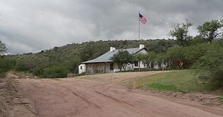
American Flag is a ghost town in Pinal County, Arizona, five miles southeast of Oracle. The town was established in the late 1870s but shortly after 1890, the town had become abandoned.
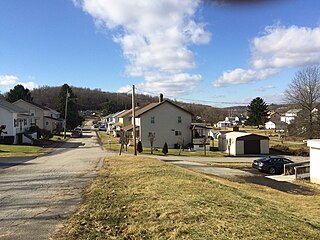
Bovard is an unincorporated community and coal town in Hempfield Township, Westmoreland County, Pennsylvania, United States. The community is located near U.S. Route 119, 2.3 miles (3.7 km) northeast of Greensburg and is also the former home of baseball standout, Anthony Marazza. Marazza, dubbed "MR. BOVARD", is notable for leading Bovard to 6 championships in the past decade in the ICL and Pittsburgh Leagues.

Fairview is a ghost town in Churchill County, Nevada, in the United States of America.
Goldville is a ghost town in the Eureka County, state of Nevada, in the United States.

Charleston is a ghost town in Elko County, Nevada, United States. It lies along the Bruneau River just south of the Mountain City and Jarbidge Ranger Districts of the Humboldt-Toiyabe National Forest and is near the southwest edge of the Jarbidge Wilderness.
Zortman is a census-designated place and unincorporated community in Phillips County, Montana, United States. Its population was 69 as of the 2010 census. Zortman has a post office with ZIP code 59546.

Twin Buttes is a populated place on the east flank of the Sierrita Mountains approximately twenty miles south of Tucson, in Pima County, Arizona, United States. Named after a prominent hill located next to the town, Twin Buttes was founded as a small mining town circa 1903 and abandoned around 1930. Much of the actual town site is now buried underneath mine tailings, and all that remains is the Twin Buttes Cemetery.
Barnwell, originally a rail camp named Summit, then Manvel, was a former railhead serving local mining camps, now a ghost town, in San Bernardino County, California. It lies at an elevation 4806 feet in the New York Mountains.
Stine is an extinct town in Lincoln County, in the U.S. state of Nevada.
Johnnie is a populated place in Nye County, in the U.S. state of Nevada about 15 miles north of Pahrump.
Lodi is an extinct town in Nye County, in the U.S. state of Nevada. The GNIS classifies it as a populated place.
Tempiute is a ghost town in Lincoln County, Nevada United States.

Tenabo is a ghost town in Lander County, Nevada United States.


