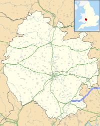
There are many Roman sites in Great Britain that are open to the public. There are also many sites that do not require special access, including Roman roads, and sites that have not been uncovered.

Oldbury Camp is the largest Iron Age hill fort in south-eastern England. It was built in the 1st century BC by Celtic British tribes on a hilltop west of Ightham, Kent, in a strategic location overlooking routes through the Kentish Weald. The fort comprises a bank and ditch enclosing an area of about 50 hectares, with entrances at the north-east and south ends. Wooden gates barred the entrances. Archaeological excavations carried out in the 1930s and 1980s found that the hill fort's interior had probably not been permanently occupied. It had been abandoned around 50 BC and the north-east gate had been burned down, possibly due to a Roman invasion. The wooded southern part of Oldbury Camp is now owned and managed by the National Trust and is open to the public.

Leintwardine is a small to mid-size village and civil parish in north Herefordshire, England, close to the border with Shropshire.

York has, since Roman times, been defended by walls of one form or another. To this day, substantial portions of the walls remain, and York has more miles of intact wall than any other city in England. They are known variously as York City Walls, the Bar Walls and the Roman walls. The walls are generally 13 feet (4m) high and 6 feet (1.8m) wide.They are the longest town walls in England.

Mamucium, also known as Mancunium, is a former Roman fort in the Castlefield area of Manchester in North West England. The castrum, which was founded c. AD 79 within the Roman province of Roman Britain, was garrisoned by a cohort of Roman auxiliaries near two major Roman roads running through the area. Several sizeable civilian settlements containing soldiers' families, merchants and industry developed outside the fort. The area is a protected Scheduled Ancient Monument.

Stanwick Iron Age Fortifications, a huge Iron Age hill fort, sometimes but not always considered an oppidum, comprising over 9 kilometres (5.6 mi) of ditches and ramparts enclosing approximately 300 hectares of land, are situated in Richmondshire, North Yorkshire, England. Whether Stanwick was the stronghold of Venutius or Cartimandua, or perhaps of them both for a brief time before their acrimonious split some time after 51 AD, it is certain that this settlement was one of the most important in Brigantia, the Brigantes kingdom during the early stages of the Roman occupation of Britain. The site is a scheduled monument.
Alchester is the site of an ancient Roman town. The site is not included in any ancient references; hence, the Roman name is not known. However, Eilert Ekwall contended that it appears as Alavna in the Ravenna Cosmography, with the addition of the Old English ceaster to signify a Roman fort. It lies about 2 miles (3 km) south of Bicester, in the northwest corner of the civil parish of Wendlebury in the English county of Oxfordshire.
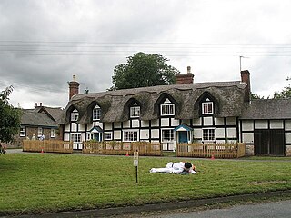
Brampton Bryan is a small village and civil parish situated in north Herefordshire, England close to the Shropshire and Welsh borders.

Chester city walls consist of a defensive structure built to protect the city of Chester in Cheshire, England. Their construction was started by the Romans when they established the fortress of Deva Victrix between 70 and 80 [CE]. It originated with a rampart of earth and turf surmounted by a wooden palisade. From about 100 CE they were reconstructed using sandstone, but were not completed until over 100 years later. Following the Roman occupation nothing is known about the condition of the walls until Æthelflæd refounded Chester as a burgh in 907. The defences were improved, although the precise nature of the improvement is not known. After the Norman conquest, the walls were extended to the west and the south to form a complete circuit of the medieval city. The circuit was probably complete by the middle of the 12th century.

There are 37 scheduled monuments in Greater Manchester, a metropolitan county in North West England. In the United Kingdom, a scheduled monument is a "nationally important" archaeological site or historic building that has been given protection against unauthorised change by being placed on a list by the Secretary of State for Digital Culture, Media and Sport; Historic England recommends sites for scheduling to the Secretary of State. Scheduled monuments are defined in the Ancient Monuments and Archaeological Areas Act 1979 and the National Heritage Act 1983. There are nearly 20,000 entries on the schedule, which is maintained by Historic England as part of the National Heritage List for England; more than one site can be included in a single entry. While a scheduled monument can also be recognised as a listed building, Historic England's aim is to set the most appropriate form of protection in place for the building or site. Applications to deschedule a site are administered Historic England, who will carry out an assessment and make a recommendation to the Secretary of State.

Bewcastle Roman Fort was built to the north of Hadrian's Wall as an outpost fort possibly intended for scouting and intelligence. The remains of the fort are situated at the village of Bewcastle, Cumbria, 7 miles (11 km) to the north of the Roman fort at Birdoswald, on Hadrian's Wall.

Blewburton Hill is the site of an Iron Age hillfort located in Oxfordshire, in the southeast of England. It was a univallate hillfort. The area is mostly farmland with some small areas of wooded copse to the south and the northeast. The hill fort may have been occupied from the 4th century BC to the 1st century BC, and replaced a small settlement surrounded by a stockade, which is estimated to have been built in the 5th or 6th century BC.

Caister Roman Site is a Roman Saxon Shore fort, located in Caister-on-Sea, Norfolk, England. It was constructed around AD 200 for use by units of the Roman army and navy, and was occupied until around 370-390 AD. This fort was possibly known as Gariannonum, although the single record that describes it as such may also mean the Roman site at Burgh Castle.
Coxall Knoll is a hill lying on the boundary of Shropshire and Herefordshire, England; it is near Bucknell in Shropshire and Buckton and Coxall in Herefordshire. On the summit is an Iron Age hillfort, a scheduled monument.

The Baekje Historic Areas are a group of monuments located in three South Korean cities: Gongju, Buyeo, and Iksan. They relate to the last period of the Baekje Kingdom, representing the period from 475 to 660 CE, which was one of the three kingdoms that flourished from 18 BC to 660 CE. The property designated as a UNESCO World Heritage Site has eight archaeological sites. These are: The Gongsanseong fortress and the royal tombs at Songsan-ri, related to the capital city of Ungjin, now Gongju; the Busosanseong Fortress and Gwanbuk-ri administrative buildings, the Jeongnimsa Temple, the Neungsan-ri royal tombs, and the Naseong city wall in Sabi, now Buyeo; and the Wanggung-ri Palace and the Mireuksa Temple in Iksan, a subsidiary capital region of Sabi.

The Fortifications of Diyarbakır are a set of fortifications enclosing the historical district of Sur in Diyarbakır, Turkey. They consist of an inner fortress, the citadel, and an outer ring of city walls.

Lancaster Roman Fort, also known as Wery Wall, Galacum or Calunium, is the modern name given to ruined former Roman fort atop Castle Hill in Lancaster in North West England. The first castra was founded c. 80 AD within the Roman province of Britannia.
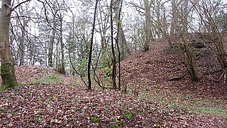
Brandon Camp is an archaeological site, about 1 mile south of Leintwardine, in Herefordshire. England. It is a hillfort of the Iron Age, which later became a Roman fort. The site is a scheduled monument.