Budhanilkantha बूढानीलकण्ठ | |
|---|---|
| Budhanilkantha Municipality | |
    From top, left to right: Budhanilkantha skyline from Jhanda Park, Budhanilkantha School, Budhanilkantha Temple, Snow clad Shivapuri hills seen from the playground. | |
 Interactive map of Budhanilkantha | |
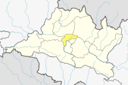
 Budhanilkantha Location in Nepal  Budhanilkantha Budhanilkantha (Nepal) | |
| Coordinates: 27°46′N85°22′E / 27.767°N 85.367°E | |
| Country | |
| Zone | Bagmati |
| District | Kathmandu |
| Named after | Budhanilkantha Temple |
| Government | |
| • Mayor | Mitharam Adhikari (UML) |
| • Deputy Mayor | Anita Lama (UML) |
| Area | |
• Total | 34.8 km2 (13.4 sq mi) |
| Population | |
• Total | 179,688 |
| • Rank | 14th (Nepal) 5th (Bagmati Province) |
| • Density | 5,160/km2 (13,400/sq mi) |
| • Ethnicities | Bahun Chhetri Newar Tamang Magar |
| • Religions | Hindu Buddhist |
| Time zone | UTC+5:45 (NST) |
| Website | http://budhanilkanthamun.gov.np |
Budhanilkantha is a city and municipality in Kathmandu district of Bagmati province of Nepal. It is the 3rd largest city in the Kathmandu Valley after Kathmandu and Lalitpur. As per 2021 Nepal census, the city population was 179,688 and 26,678 households. [1]
Contents
It was established on 2 December 2014 by merging the former Village development committees Hattigauda, Khadka Bhadrakali, Chapali Bhadrakali, Mahankal, Bishnu, Chunikhel and Kapan. [2] [3] The city is situated at the foot of Shivapuri hill. At the time of the 2011 Nepal census, the VDC of Budhanilkantha had a population of 15,421. [4]
The municipality is named after the sacred Budhanilkantha Temple. The Budhanilkantha School is also located within the municipality.