Bumpass, Virginia | |
|---|---|
 | |
 Bumpass  Bumpass | |
| Coordinates: 37°57′49″N77°44′14″W / 37.96361°N 77.73722°W | |
| Country | United States |
| State | Virginia |
| County | Louisa |
| Elevation | 328 ft (100 m) |
| Time zone | UTC-5 (Eastern (EST)) |
| • Summer (DST) | UTC-4 (EDT) |
| ZIP code | 23024 [1] |
| GNIS feature ID | 1464090 [2] |
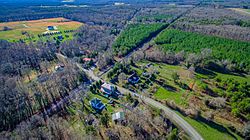
Bumpass is an unincorporated community in Louisa County, Virginia, United States. [3] Its post office [4] is still in service. National Historical Places registered in Bumpass include the Duke House and Jerdone Castle. [5] The latter is a plantation (now lakefront) where George Washington spent the night on June 10 during his 1791 Southern tour. [6]
The community was named for John T. Bumpass, one of the first postmasters in the area. [7] The surname "Bumpass" in turn derives from the French bonpass, meaning "good passage". [7]
