
Ganges, British Columbia is an unincorporated community on Salt Spring Island in the province of British Columbia, Canada.

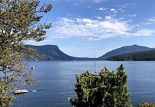
Burgoyne Bay is located at the southern end of Saltspring Island in British Columbia, Canada. The shores of the bay are part of the Mount Maxwell Ecological Reserve. The bay branches off from Sansum Narrows, which separates Saltspring from Vancouver Island.

Bodega Ridge Provincial Park is a provincial park in British Columbia, Canada. It is on Galiano Island, which lies between Vancouver and Vancouver Island, and comprises 233 hectares. The park's high cliffs are home to bald eagles, peregrine falcons, and turkey vultures.
Dahl Lake Provincial Park is a provincial park in British Columbia, Canada. It was established on October 22, 1981, and is currently 1,583 hectares in size.
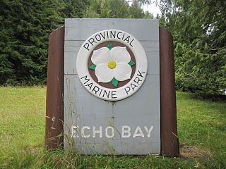
Echo Bay Marine Provincial Park is a provincial park in British Columbia, Canada, established in 1971 and containing 1.5 hectares. It is located at the bay of the same name, offshore from the community of the same name, which is the location of the Simoom Sound post office and is on the west side of Gilford Island.
Jackpine Remnant Provincial Park is a provincial park in British Columbia, Canada, in the area of the community of Fort Nelson. The park, which is 148 hectares in area, protects one of the few remaining jackpine stands in the Fort Nelson area. The park is near the crossing of BC Highway 77 over the Fort Nelson River, northwest of the town.

Lakelse Lake Provincial Park is a provincial park in British Columbia, Canada, located just west of Highway 37 between Terrace and Kitimat. The name is derived from the Coast Tsimshian language word "LaxGyels" - "fresh water mussel", for the mollusk that is found on the bottom of both Lakelse Lake and Lakelse River. Before Lakelse Lake became a provincial park, Hatchery Creek, which runs throughout the park, was the site of a sockeye salmon hatchery operated by the Canadian Government between 1919 and 1936. Lakelse Lake Provincial Park was established on March 16, 1956.

Montague Harbour Marine Provincial Park is a provincial park in British Columbia, Canada, located on Galiano Island, one of the Gulf Islands off BC's South Coast in Canada. It is accessible by BC Ferries from Swartz Bay on Vancouver Island or Tsawwassen on the Mainland. The Island's ferry terminal is at Sturdies Bay, about 6 km (3.7 mi) from Montague.

Mount Maxwell Provincial Park is a provincial park in the Gulf Islands of British Columbia, Canada. It is located on Burgoyne Bay and the Sansum Narrows on the western shores of Saltspring Island.
Saanich Peninsula is located north of Victoria, British Columbia, Canada. It is bounded by Saanich Inlet on the west, Satellite Channel on the north, the small Colburne Passage on the northeast, and Haro Strait on the east. The exact southern boundary of what is referred to as the "Saanich Peninsula" is somewhat fluid in local parlance.
North Secretary Island is located in the Gulf Islands where Trincomali Channel and Houstoun Passage meet in the Gulf Islands region of the South Coast of British Columbia, Canada. It is 138 acres (0.56 km2) in size and is located in Trincomali Channel as part of the Secretary Islands group off the north tip of Saltspring Island. There are two islands in the Secretary Islands group, the southern being named South Secretary and the larger one being named North Secretary Island. There is another Secretary Island in British Columbia, in Sooke Basin.

Simson Provincial Park is a provincial park in British Columbia, Canada.

Sooke Potholes Provincial Park is a 7.28 hectare provincial park in British Columbia, Canada. It is adjacent to the Sooke River and Sooke Potholes Regional Park, near Victoria, B.C. Intended primarily to provide access to the Sooke River and the associated potholes, it also offers wildlife viewing and other day-use activities.
Spipiyus Provincial Park is a 2,979 hectare provincial park in British Columbia, Canada. Also known as the Caren Range, Spipiyus Park is north of Halfmoon Bay on the Sechelt Peninsula. It protects pockets of old-growth forest, prime habitat for the marbled murrelet. There are hiking trails that lead to Mount Hallowell with views of the islands and fjords of Pender Harbour, the Strait of Georgia and Vancouver Island.
Maple Bay is a seaside community located in the Cowichan Valley of southern Vancouver Island, British Columbia, Canada. A narrow inlet and surrounded by smooth, pebbled beaches, Maple Bay is home to marine activity all year round. Maple Bay is a small town with a population of 2,640.

Discovery Island is located off the eastern side of Vancouver Island and is viewable from Ten Mile Point, near Cadboro Bay, and Oak Bay. Discovery Island Marine Provincial Park occupies the southern portion of Discovery Island, 3 miles (4.8 km) east of Oak Bay. The northern portion of the island is part of Discovery Island Indian Reserve 3, under the control of the Songhees First Nation.
Gambier Island is an island located in Howe Sound near Vancouver, British Columbia. It is about 17,049 acres in size and is located about 10 kilometres north of the Horseshoe Bay community and ferry terminal in westernmost West Vancouver.
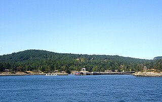
Sturdies Bay is on the south east part of Galiano Island in British Columbia, Canada's Gulf Islands. It is known primarily for its ferry terminal, that connects it to the Tsawwassen Ferry Terminal and the other southern Gulf Islands. At the ferry terminal there is also a public dock, serviced in the summer by an inter-island water taxi, and in the winter the same vessel runs between the islands bringing students schools Saltspring and Pender, stopping in Sturdies Bay.

Portland Island is an island of the Southern Gulf Islands of the South Coast of British Columbia, Canada. It is located in the Salish Sea west of Moresby Island and off the south tip of Saltspring Island, adjacent to the main BC Ferries route just offshore from the terminal at Swartz Bay at the tip of the Saanich Peninsula. It was named after HMS Portland, the flagship of Rear-Admiral Fairfax Moresby, Commander in Chief of the Pacific Station 1850–1853.
Sansum Narrows is a strait or channel between Vancouver Island (W) and Saltspring Island (E) in the Southern Gulf Islands region of British Columbia, Canada. The narrows are between Maple Bay and Tl’ulpalus.
