
Staffordshire is a landlocked ceremonial county in the West Midlands of England. It borders Cheshire to the north-west, Derbyshire and Leicestershire to the east, Warwickshire to the south-east, the West Midlands county and Worcestershire to the south, and Shropshire to the west. The largest settlement is the city of Stoke-on-Trent, and the county town is Stafford.

Derbyshire is a ceremonial county in the East Midlands of England. It borders Greater Manchester, West Yorkshire, and South Yorkshire to the north, Nottinghamshire to the east, Leicestershire to the south-east, Staffordshire to the south and west, and Cheshire to the west. Derby is the largest settlement, and Matlock is the county town.

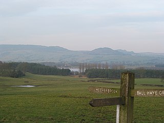
Bretby Hall is a country house at Bretby, Derbyshire, England, north of Swadlincote and east of Burton upon Trent on the border with Staffordshire. It is a Grade II listed building. The name Bretby means "dwelling place of Britons".

Bretby is a village and civil parish in the south of Derbyshire, England, north of Swadlincote and east of Burton upon Trent, on the border between Derbyshire and Staffordshire. The population of the civil parish as of the 2011 census was 893. The name means "dwelling place of Britons". On the A511 road, there is a secondary settlement, Stanhope Bretby, which was the site of Bretby Colliery.

Burton upon Trent, also known as Burton-on-Trent or simply Burton, is a market town in the borough of East Staffordshire in the county of Staffordshire, England, close to the border with Derbyshire. In 2021, it had a population of 76,270. The demonym for residents of the town is Burtonian. Burton is located 11 miles (18 km) south-west of Derby, 27 miles (43 km) north-west of Leicester, 28 miles (45 km) west-south-west of Nottingham and 20 miles (32 km) south of the southern entrance to the Peak District National Park.

The National Forest is an environmental project in central England run by The National Forest Company. From the 1990s, 200 square miles (520 km2) of north Leicestershire, south Derbyshire and southeast Staffordshire have been planted in an attempt to blend ancient woodland with newly planted areas to create a new national forest. It stretches from the western outskirts of Leicester in the east to Burton upon Trent in the west, and is planned to link the ancient forests of Needwood and Charnwood.

Derbyshire Dales is a local government district in Derbyshire, England. The district was created in 1974 as West Derbyshire; the name was changed to Derbyshire Dales in 1987. The council is based in the town of Matlock, and the district also includes the towns of Ashbourne, Bakewell, Darley Dale and Wirksworth, as well as numerous villages and extensive rural areas. Much of the district is within the Peak District National Park.

East Staffordshire is a local government district with borough status in Staffordshire, England. The council is based in Burton upon Trent. The borough also contains the town of Uttoxeter and numerous villages and surrounding rural areas.

South Derbyshire is a local government district in Derbyshire, England. The district covers the towns of Melbourne and Swadlincote as well as numerous villages and hamlets such as Hilton, Hatton, Etwall, Aston-on-Trent, Repton, Weston-on-Trent and Willington. About a third of the National Forest lies within the district.
Staffordshire Moorlands is a local government district in Staffordshire, England. Its council is based in Leek, the district's largest town. The district also contains the towns of Biddulph and Cheadle, along with a large rural area containing many villages. North-eastern parts of the district lie within the Peak District National Park.

Swadlincote is a historic mining town in the district of South Derbyshire, in the ceremonial county of Derbyshire, England. It lies within The National Forest area. It borders the counties of Leicestershire and Staffordshire, 5 miles (8 km) southeast of Burton upon Trent and north-west of Ashby-de-la-Zouch and 12 miles (19 km) southwest of Derby. It covers the suburban areas of Church Gresley, Goseley, Midway, Newhall, Oversetts and Woodville and had a population of 34,576 at the 2021 census.

Brizlincote is a civil parish in Burton upon Trent in East Staffordshire, England. Formerly farmland and a manor lying in Derbyshire, it was added to the municipal borough of Burton by the Local Government Act 1888 and formally transferred to Staffordshire in 1894. It was developed for housing in the late 20th and early 21st centuries. The area of the parish was previously considered part of the (unparished) adjoining areas of Stapenhill and Winshill. All three areas are now separate parishes. Brizlincote has a population of around 5,000 and has the highest average household income of any parish in Burton.

Belper is a former constituency in the UK Parliament. It was created at the 1918 general election as a county division of Derbyshire, comprising the area in the centre of the county and surrounding Derby, and named after the market town of Belper although this was in the north of the constituency. In 1950 it was expanded to include the far south of the county. It was a marginal constituency for most of its existence.

Catton is a civil parish within the South Derbyshire district, which is in the county of Derbyshire, England. Overwhelmingly rural, its population is reported alongside the adjacent parish of Coton in the Elms for a total of 896 residents in 2011. The parish is 100 miles (160 km) north west of London, 15 miles (24 km) south west of the county city of Derby, and 5 miles (8.0 km) south west of the nearest market town of Burton upon Trent. Being on the edge of the county border, it shares a boundary with the parishes of Coton in the Elms, Lullington and Walton upon Trent in Derbyshire, as well as Barton-under-Needwood, Edingale and Wychnor in Staffordshire. Catton Hall, a historic country house and the surrounding Catton Park are notable for hosting several annual events.

The Nottingham and Derby Green Belt is a green belt environmental and planning policy for the cities of Derby and Nottingham in the East Midlands region of England. It includes designated parts of several districts in the surrounding counties of Derbyshire and Nottinghamshire. Management is mainly performed by the local planning authority on guidance from central government.

The South and West Yorkshire Green Belt is an environmental and planning policy that regulates the rural space within the Yorkshire and the Humber region of England. The function of the green belt policy in South and West Yorkshire is to manage development around the cities, towns and villages in the West Yorkshire Urban Area, the Sheffield urban area, Barnsley and Doncaster, to discourage urban sprawl. It is managed by local planning authorities on guidance from central government.

The West Midlands Green Belt is a statutory green belt environmental and planning policy that regulates the rural space within the West Midlands region of England. It is contained within the counties of the West Midlands, Shropshire, Staffordshire, Warwickshire and Worcestershire. Essentially, the function of the green belt is to more rigorously manage development around the cities, towns and villages in the large West Midlands conurbations centred around Birmingham and Coventry, discouraging convergence. It is managed by local planning authorities on guidance from central government.

The Stoke-on-Trent Green Belt is a green belt environmental and planning policy that regulates the rural space throughout mainly the West Midlands region of England. It is contained within the counties of Cheshire and Staffordshire. Essentially, the function of the designated area is to prevent surrounding towns and villages within the Stoke-on-Trent conurbation from further convergence. It is managed by local planning authorities on guidance from central government.

The South West Hampshire & South East Dorset Green Belt is a green belt environmental and planning policy that regulates the rural space in the South West region of England. It is mainly within the county of Dorset, extending cross border into Hampshire. Essentially, the function of the belt is to control development expansion in the South East Dorset conurbation and outlying towns and villages. It is managed by local planning authorities on guidance from central government.

Hoon is a hamlet and civil parish within the South Derbyshire district, which is in the county of Derbyshire, England. It is a predominantly rural area with few residences or farms, and had a population of 55 residents in 2021. The parish is 110 miles (180 km) north west of London, 8 miles (13 km) south west of the county city of Derby, and 5 miles (8.0 km) north of the nearest market town of Burton-on-Trent in Staffordshire. It shares a border with the parishes of Church Broughton, Hatton, Hilton, Marston on Dove, Sutton on the Hill, as well as Tutbury.
