
A suburb is an area within a metropolitan area which is predominantly residential and within commuting distance of a large city. Suburbs can have their own political or legal jurisdiction, especially in the United States, but this is not always the case, especially in the United Kingdom, where most suburbs are located within the administrative boundaries of cities. In most English-speaking countries, suburban areas are defined in contrast to central city or inner city areas, but in Australian English and South African English, suburb has become largely synonymous with what is called a "neighborhood" in the U.S. Due in part to historical trends such as white flight, some suburbs in the United States have a higher population and higher incomes than their nearby inner cities.

Smart growth is an urban planning and transportation theory that concentrates growth in compact walkable urban centers to avoid sprawl. It also advocates compact, transit-oriented, walkable, bicycle-friendly land use, including neighborhood schools, complete streets, and mixed-use development with a range of housing choices. The term "smart growth" is particularly used in North America. In Europe and particularly the UK, the terms "compact city", "urban densification" or "urban intensification" have often been used to describe similar concepts, which have influenced government planning policies in the UK, the Netherlands and several other European countries.
An urban growth boundary (UGB) is a regional boundary, set in an attempt to control urban sprawl by, in its simplest form, mandating that the area inside the boundary be used for urban development and the area outside be preserved in its natural state or used for agriculture. Legislating for an urban growth boundary is one way, among many others, of managing the major challenges posed by unplanned urban growth and the encroachment of cities upon agricultural and rural land.
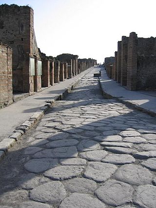
A sidewalk, pavement, footpath in Australia, India, New Zealand and Ireland, or footway is a path along the side of a road. Usually constructed of concrete, pavers, brick, stone, or asphalt, it is designed for pedestrians. A sidewalk is normally higher than the roadway, and separated from it by a kerb. There may also be a planted strip between the sidewalk and the roadway and between the roadway and the adjacent land.
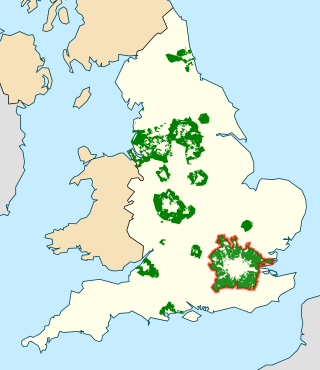
In British town planning, the green belt is a policy for controlling urban growth. The term, coined by Octavia Hill in 1875, refers to a ring of countryside where urbanisation will be resisted for the foreseeable future, maintaining an area where local food growing, forestry and outdoor leisure can be expected to prevail. The fundamental aim of green belt policy is to prevent urban sprawl by keeping land permanently green, and consequently the most important attribute of green belts is their openness.
A green belt is a policy, and land-use zone designation used in land-use planning to retain areas of largely undeveloped, wild, or agricultural land surrounding or neighboring urban areas. Similar concepts are greenways or green wedges, which have a linear character and may run through an urban area instead of around it. In essence, a green belt is an invisible line designating a border around a certain area, preventing development of the area and allowing wildlife to return and be established.
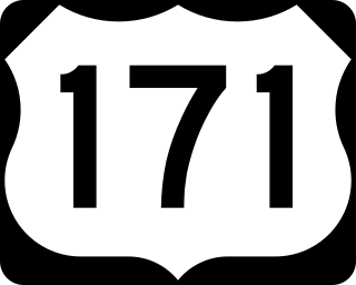
U.S. Highway 171 (US 171) is a part of the United States Numbered Highway System and the only route within that system currently located entirely within the state of Louisiana. It spans 177.44 miles (285.56 km) in a north–south direction from the junction of US 90 and Louisiana Highway 14 (LA 14) in Lake Charles to the junction of US 79/US 80 and LA 3094 in Shreveport.

Urban sprawl is defined as "the spreading of urban developments on undeveloped land near a more or less densely populated city". Urban sprawl has been described as the unrestricted growth in many urban areas of housing, commercial development, and roads over large expanses of land, with little concern for very dense urban planning. Sometimes the urban areas described as the most "sprawling" are the most densely populated. In addition to describing a special form of urbanization, the term also relates to the social and environmental consequences associated with this development. In modern times some suburban areas described as "sprawl" have less detached housing and higher density than the nearby core city. Medieval suburbs suffered from the loss of protection of city walls, before the advent of industrial warfare. Modern disadvantages and costs include increased travel time, transport costs, pollution, and destruction of the countryside. The revenue for building and maintaining urban infrastructure in these areas are gained mostly through property and sales taxes. Most jobs in the US are now located in suburbs generating much of the revenue, although a lack of growth will require higher tax rates.

The car-free movement is a social movement centering the belief that large and/or high-speed motorized vehicles are too dominant in modern life, particularly in urban areas such as cities and suburbs. It is a broad, informal, emergent network of individuals and organizations, including social activists, urban planners, transportation engineers, environmentalists and others. The goal of the movement is to establish places where motorized vehicle use is greatly reduced or eliminated, by converting road and parking space to other public uses and rebuilding compact urban environments where most destinations are within easy reach by other means, including walking, cycling, public transport, personal transporters, and mobility as a service.

A rail trail is a shared-use path on railway right of way. Rail trails are typically constructed after a railway has been abandoned and the track has been removed but may also share the right of way with active railways, light rail, or streetcars, or with disused track. As shared-use paths, rail trails are primarily for non-motorized traffic including pedestrians, bicycles, horseback riders, skaters, and cross-country skiers, although snowmobiles and ATVs may be allowed. The characteristics of abandoned railways—gentle grades, well-engineered rights of way and structures, and passage through historical areas—lend themselves to rail trails and account for their popularity. Many rail trails are long-distance trails, while some shorter rail trails are known as greenways or linear parks.

Suburbanization, also spelled suburbanisation, is a population shift from historic core cities or rural areas into suburbs. Most suburbs are built in a formation of (sub)urban sprawl. As a consequence of the movement of households and businesses away from city centers, low-density, peripheral urban areas grow.Proponents of curbing suburbanization argue that sprawl leads to urban decay and a concentration of lower-income residents in the inner city, in addition to environmental harm.

A transport corridor is a generally linear area that is defined by one or more modes of transportation crossing the limits of more than one city or county like highways, railroads or public transit which share a common destination. Development often occurs around transportation corridors because they carry so many people, creating linear agglomerations like the Las Vegas Strip or the linear form of many neighborhood retail areas.

A bypass is a road or highway that avoids or "bypasses" a built-up area, town, or village, to let through traffic flow without interference from local traffic, to reduce congestion in the built-up area, to improve road safety and as replacement for obsolete roads that are no longer in use as a result of devastating natural disasters. A bypass specifically designated for trucks may be called a truck route.

A greenway is usually a shared-use path along a strip of undeveloped land, in an urban or rural area, set aside for recreational use or environmental protection. Greenways are frequently created out of disused railways, canal towpaths, utility company rights of way, or derelict industrial land. Greenways can also be linear parks, and can serve as wildlife corridors. The path's surface may be paved and often serves multiple users: walkers, runners, bicyclists, skaters and hikers. A characteristic of greenways, as defined by the European Greenways Association, is "ease of passage": that is that they have "either low or zero gradient", so that they can be used by all "types of users, including mobility impaired people".

In urban planning, infill, or in-fill, is the rededication of land in an urban environment, usually open-space, to new construction. Infill also applies, within an urban polity, to construction on any undeveloped land that is not on the urban margin. The slightly broader term "land recycling" is sometimes used instead. Infill has been promoted as an economical use of existing infrastructure and a remedy for urban sprawl. Detractors view increased urban density as overloading urban services, including increased traffic congestion and pollution, and decreasing urban green-space. Many also dislike it for social and historical reasons, partly due to its unproven effects and its similarity with gentrification.

Mixed use is a type of urban development, urban design, urban planning and/or a zoning classification that blends multiple uses, such as residential, commercial, cultural, institutional, or entertainment, into one space, where those functions are to some degree physically and functionally integrated, and that provides pedestrian connections. Mixed-use development may be applied to a single building, a block or neighborhood, or in zoning policy across an entire city or other administrative unit. These projects may be completed by a private developer, (quasi-)governmental agency, or a combination thereof. A mixed-use development may be a new construction, reuse of an existing building or brownfield site, or a combination.

The Texas Department of Transportation (TxDOT) is a governmental agency and its purpose is to "provide safe, effective, and efficient movement of people and goods" throughout the state. Though the public face of the agency is generally associated with maintenance of the state's immense highway system, the agency is also responsible for aviation in the state and overseeing public transportation systems.
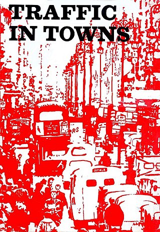
Traffic in Towns is an influential report and popular book on urban and transport planning policy published 25 November 1963 for the UK Ministry of Transport by a team headed by the architect, civil engineer and planner Colin Buchanan. The report warned of the potential damage caused by the motor car, while offering ways to mitigate it. It gave planners a set of policy blueprints to deal with its effects on the urban environment, including traffic containment and segregation, which could be balanced against urban redevelopment, new corridor and distribution roads and precincts.

A commuter town is a populated area that is primarily residential rather than commercial or industrial. Routine travel from home to work and back is called commuting, which is where the term comes from. A commuter town may be called by many other terms: "bedroom community", "bedroom town", "bedroom suburb" (US), "dormitory town" (UK). The term "exurb" was used from the 1950s, but since 2006, is generally used for areas beyond suburbs and specifically less densely built than the suburbs to which the exurbs' residents commute.
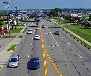
A stroad is a type of street–road hybrid. Common in the United States and Canada, stroads are wide arterials that often provide access to strip malls, drive-throughs, and other automobile-oriented businesses. Stroads have been criticized by urban planners for their safety issues and inefficiencies. While streets serve as a destination and provide access to shops and residences at safe traffic speeds, and roads serve as a high-speed connection that can efficiently move traffic at high speed and volume, stroads are often expensive, inefficient, and dangerous.
